Category Archives: Travelogs

On a wedding in Hadley…

rehearsalwalk

“Day before” wedding rehearsal.  (I’m sure there’s no “body-language hidden meaning…”)

*   *   *   *

Two weeks ago I got back from three weeks in Israel.  Then right away I had to make a dramatic transition:  From free-wheeling world traveler to “weird uncle of the bride.”

Town Hall and First Congregational ChurchWhich is being interpreted:  After my adventures in Tel Aviv – getting lost hiking to the train station, taking the wrong train (away from the airport) and going 26 hours without sleep – I had to begin preparing for an 1,100 mile road trip up to Hadley, Massachusetts.

There my “favorite niece from Utah” was getting married.

*   *   *   *

My latest adventure started after church on Sunday, June 16.  By the time I got out of church and gassed up, it was noon in PTC.  That afternoon I got as far as Knoxville TN.  I wanted to make it to Dandridge, but had a bit of a mixup trying to online-register for a Super 8 there.  (After pulling over during one of several traffic tie-ups on I-75, northwest of Atlanta…  Among other things, to check alternate routes via more scenic but slower back roads.)

To  make a long story short – and after yet another traffic slowdown coming into Chattanooga – I took a fallback position:  I picked up a delightfully-retro Travel Coupon booklet at a convenience store.  (Another bladder break and coffee.)   Then I “proceeded on,” taking more back roads around the south part of the city.  (The good news:  Now I know where the Social Security and county farm offices are in south Chattanooga, should the need ever arise…)

Lonnie Donegan.jpgNext day – Monday, June 17 – I made the Motel 6 in south Harrisonburg VA.  I had considered taking my time and getting to Hadley around noon on Wednesday, but by that Monday night I’d had my fill of motels.

So next morning I got up at 5:00 a.m. and left Harrisonburg in the dark.  I made the West Virginia line by 7:02, the Maryland line by 7:24 and Pennsylvania by 7:34.  Then – at the exit leading to Cumberland Gap Park – the “radio*” started playing “Cumberland Gap,” by the 1950’s Skiffle singer Lonnie Donegan(Best known for his hit single, “Does Your Chewing Gum Lose Its Flavor (On the Bedpost Overnight?”)  I figured it was sign from God…  (That “all is well.”)

From there the going was pretty good – until I got through Chambersburg PA.  There was a bad accident on I-81 north of Lebanon and yet another traffic tie-up.  Then a sign beside the interstate noted another lane closure at Mile Marker 117.  So I took more backroads to “bypass resistance;” state roads 443 and 61, over to Pottsville and back up to Interstate 81.  (Well past Mile Marker 117.)  I passed through some cute little Pennsylvania towns and stopped for gas – and another bladder break – in Schuylkill Haven.  There I also got a ready-made chicken salad sandwich on a kaiser roll.  Despite being made at a gas station, it was pretty dang good!
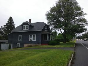
319bridgeI ended up making it to the rental house in Northampton MA – across the Connecticut River from Hadley – by 6:00 PM.  (At right.  As you can see, it was cloudy, overcast and subject to passing bands of rain, as it had been for most of the drive up.) 

To review that part of the trip on the way up:  It took me 54 hours to make about 1,100 miles.  Interstate 81 was – as usual – a pain, with clusters of tractor-trailers trying to pass each other like slow-moving turtles that blocked both lanes so well.

On the other hand, Interstate 88 east from Binghamton NY was much better.  It passed through beautiful rolling hills, and farmland – and not much traffic.  And the New York Thruway (I-90, around Albany and south over to Massachusetts) was a very pleasant surprise.

The Tuesday night I arrived, my brother and sister-in-law were over at “the Kelly’s” – the future in-laws – doing their early part of getting ready for the wedding.  So I puttered around the rental house, finding the washer and dryer – much needed – along with how to get my stair-stepping equipment easily into the basement.  Not to mention a place to store my kayak.

On that note, the early part of Wednesday (6/19) I spent two hours and 24 minutes kayaking on the Connecticut River.  (Which runs between Northampton and Hadley.)  I put in near Elwell State Park, which has a footbridge from the Northampton bank to an island in the middle of the river, then onto the Hadley side.  For that bout of kayaking there was SOME sun, but not much.

Later that Wednesday we all had dinner with the future in-laws.
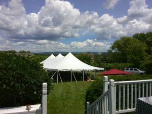
tentOn Thursday we got down to work.  The main wedding party started working on “favors.”  I helped most by staying out of the way.  (As in “Lead, follow or get the hell out of the way.”)  And by reading a first (1908) edition of Kipling’s “The Light That Failed.”

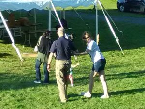
I made up for it on Friday by helping set up a tent-full of tables and chairs.  (As shown above left, completed.)  Then the wedding rehearsal finally started.  (A good bit after the scheduled 6:00 p.m. start time, but the happy couple was “not hung up on that deadline thing!”)  That’s when I took the photo of the father of the bride and bride-to-be, heading down the “aisle,” as shown at the top of the page.

Then came the final preparations the morning and early-afternoon of the wedding day, June 22.  Then came the count-down:  4:52 p.m. “It shan’t be long now!”  Then the Officiant getting some last-minute instructions, as shown by a photo in the notes below.

And finally – at or about 5:43 p.m. – it became official.  They were married!

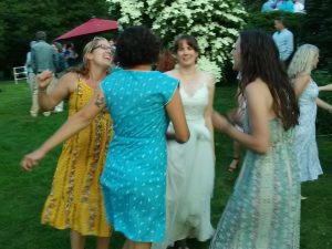
And then – It was TIME TO DANCE!

*   *   *   *

dancepic

*   *   *   *

I took the upper-photo image on June 21, 2019.

The Wikipedia caption for the Hadley MA image is “Town Hall and First Congregational Church.”

Re:  “The radio.”  I do have a radio in my car but mostly listen to Sirius Satellite Radio.

Re:  Lonnie Donegan, and his “Skiffle” style.  Wikipedia:  “With a washboardtea-chest bass and a cheap Spanish guitar, Donegan played folk and blues songs by artists such as Lead Belly and Woody Guthrie.  This proved popular,” beginning in 1954.  Later Donegan “went on to successes such as “Cumberland Gap” – later to be the sign from God, as noted – and “Does Your Chewing Gum Lose Its Flavour (On the Bedpost Overnight?), his biggest hit in the U.S…  He continued in the UK charts until 1962, before succumbing [sic] to The Beatles and beat music.” lastminuteinstructions
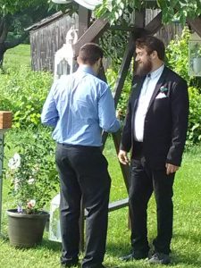
Re:  “Final preparations.”  They included the Wedding Officiant – to the right, with beard – getting last-minute instructions.
“Back from three weeks in Israel…”

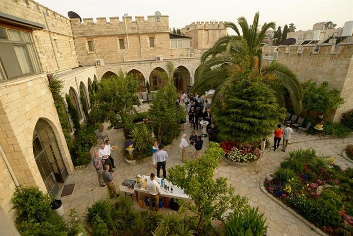
The night-dining area, St. George’s.  (28 shekels at the bar – lower left – gets you a Taybeh…)

*   *   *   *

I did my last post in this blog on May 3.  Since then I spent three weeks – 18 or 19 days – on a pilgrimage in Israel.  (Including traveling to and from.  I left the night of May 10 and got back the night of May 29.) 

And while I got back home on May 29, since then I’ve been preparing for a two-week road trip, up to Massachusetts, for my niece’s wedding, in June.  I’ve also posted My first full day in Jerusalem, in my companion blog.  (About the trials and tribulations of that first day of my pilgrimage, which included hearing a mysterious “explosion” at 4:08 on the morning of Sunday, May 12.) 

This post will focus on my last day in Israel.  (In Tel Aviv, where I got lost walking, took the wrong train, and later spent some 26 hours straight without sleep before finally getting home to the ATL.)

This pilgrimage was part of a course given by St. George’s College, Jerusalem, thePalestine of Jesus.”   And a side note:  For visits to many churches and all Muslim areas in Jerusalem, you’re expected to “dress modestly.” Ladies showing bare knees get brown frumpy skirts to cover the “limbs” from hip to below the ankle.

The Jerusalem experience was wonderful, overwhelming, intimidating and enlightening.  But like I said, let’s start with the most recent “cluster” (half a word) part.  It came on Wednesday, May 29, the day I spent 11 hours flying back home.  (And considering the time change, 26 hours straight without sleep before I got back home.)

The problem was: I got all cocky from the day before, when I’d made an easy connection from Jerusalem to Tel Aviv.  (On Monday the 28th.)  After parting ways with the other pilgrims in my church group, I made a fairly-easy two-mile trek from the College to the central bus station in Jerusalem.  (Lugging 30 pounds in a back-pack and large gym-bag to be checked at the airport.)  From the Tel Aviv bus station I hiked a “mere” mile, to my night’s lodging at “Yavne 26.”  (They list the street number last.)  On the way I managed a visit to the Haganah Museum, right around the corner from Yavne 26, at “Rothschild Boulevard 23.”

Later that evening I managed to hook up with eight or nine fellow pilgrims from Georgia. Unbeknownst to me they were staying at the Abraham Hostel in Tel Aviv, two or three blocks from my place on Yavne 26. They were headed to an extra added attraction, a side trip to Petra, in Jordon, that country’s “most-visited tourist attraction.” And here’s something I didn’t know. Google Maps has it as between 274 to 303 miles from Jerusalem to Petra, but there’s no direct route. From Tel Aviv they say it’s 297 miles, which explains why my fellow pilgrims traveling there had to end up in Tel Aviv for the evening of May 28.

I ended up finding the eight or nine fellow pilgrims at a restaurant around the corner from Abraham’s Hostel. I had to do that – search for them – because the guy at the front desk wouldn’t take a message, let alone make contact. So I checked the local eateries, and found them just across the street.

I ended up at the bar in the basement at Abraham’s, but my visit was cut short because I was all hyped up to get to Ben Gurion airport early enough to get through the vaunted Israeli airport security.  All the guides said you should get to the airport at least three hours ahead of time. Since my flight was at 9:55 a.m., I figured I should be at the airport by 6:55 a.m.

Another side note: Gentlemen who wear shorts – or otherwise show their knees at “many churches and all Muslim areas in the city” – are also given “skirts.”  (Like the two dumbasses in a photo I took but got “erased” some time after posting.)

So anyway, to get to the airport on time, I got up at 4:00 a.m. and started hiking back to the Haganah train station on Levinsky Street.  (Where I’d just hiked up the previous day.)  But I missed the intersection – “wool-gathering” I suppose – and had to double back.  As it turned out I hiked an hour – with the same 30 pounds of baggage – but got to the train station right about six a.m.

Then the real trouble started…

I got a ticket easily, but only after gashing my left forearm.  (I was rushing to “unpack” at yet another security check-point, just inside the train-station entrance.)  To make the lugging easier I’d tied together the upper arm straps of my pack with a knotted handkerchief, but after a sweaty hour’s walk it got “un-tieable.”  So to get the pack off I had to lift it up over my head, and in the process gashed my forearm.  And got blood all over the upper-leg portion of my jeans.  (I could just hear Israeli security:  “And where have you been to get all that blood all over you?”)

Then I got on the wrong train.  It was on Platform 3, like the ticket guy said, but it ended up going the wrong direction.  The train I got on – at the wrong time, it turned out – went to Lod.  That’s a beautiful city 9.3 miles southeast of Tel Aviv, but it’s not the Ben Gurion airport.

Once I found that out – after finding someone who spoke English – it seemed like forever to get back to the central station.  On the way a friendly uniformed Israeli suggested I take a taxi from the central station; about 65 shekels, or 22 dollars.  I was all set to do that, but getting off the train another Israeli – in blue jeans and flip-flops – fell down right behind me, missing the first step down.  I helped him up and asked if he was all right.  Then he asked if I was trying to get to the airport.  (He probably overheard my plaintive cries for directions somewhere along the way.)

He helped me get on the right train, the 7:09 going in the right direction, so I suppose there’s a lesson there.  Then while waiting for the 7:09 train, two lovely young Israelis in brown uniforms sat next to me while we waited.  (Incidentally, I’d done a lot of praying on the train to and from Lod.)  Then the 7:09 got delayed an extra six or seven minutes, so I got to enjoy their company even longer.  (Another note:  Tel Aviv in general was a nice change from Jerusalem, appreciating-the-opposite-sex-wise.  I.e., there were fewer women all covered up with burkas and such.)

That pleasant “accompaniment” wouldn’t have happened if I hadn’t gotten on the wrong train, going the wrong direction, so I suppose there’s a spiritual object lesson lesson there too…

The end result was that despite getting to the airport at 7:35 a.m. – instead of 6:55 like I should have – I got through the numerous layers of the “vaunted Israeli airport security” in plenty of time to get to Gate C-6.  (I had time to relax for 30 or 40 minutes, and finally have some breakfast:  Mango juice and a “lox” croissant.)  And to remember the time I’d just spent in the company of two lovely Israeli Female Soldiers (Not unlike the one shown below, from 1948.)

I’ll be writing more – lots more – on other lessons learned (and experiences experienced) from my pilgrimage to Israel.  But for now it’s enough to enjoy the comforts of home once again.  Here, on the functional equivalent of “my own back doorsteps,” I can – a la  John Steinbeck – finally come to think about all I’ve seen in the last three weeks, then “try to arrange some pattern of thought to accommodate the teeming crowds of my seeing and hearing.”  In other words, to make some sense of all I’ve seen, heard and experienced those last three weeks.

At least until my next pilgrimage, to the Camino Portugues in September…

*   *   *   *

A “Haganah female officer in 1948…”

*   *   *   *

The upper image is courtesy of St. George’s College Jerusalem Israel – Image Results.  See also Home | Saint George’s College Jerusalem for more on available courses and staff members.  The course in question was “The Palestine of Jesus.”  (See the link at “Home” page.)  Another note: This post is substantially similar to the one on my “spiritual” blog, DOR Scribe – Expand your horizons

Re: Taybeh.  See Taybeh Brewery – Wikipedia, on the “Palestinian brewery founded in 1994[, at] the West Bank village of Taybeh,” 22 miles north of Jerusalem.  “It produced its first beer in 1995 and has since developed a global following.  It is the first microbrewery in the Middle East.”  The other beer available to St. George pilgrims is “Maccabee,” brewed by Tempo Beer Industries “Maccabee (Hebrew: מכבי‎) is a 4.9% ABV pale lager that was first brewed in 1968.  It is distributed in Israel and is also marketed in the United States and Europe.”  I found Maccabee on draft at the LEONARDO MORIA CLASSIC HOTEL, Jerusalem 9 Georges St., a mere four-minute walk from St. George’s.

Re:  Cover-leg skirts.  Ladies are also cautioned not to have bare shoulders or visible cleavage.

Re:  “Vaunted airport security.”  The link is to What To Expect At Israel’s Airport Security. | Bemused Backpacker.  See also Leaving Tel Aviv: My Experience Through Airport Security, or Google “vaunted Israeli airport security.”  Also, I found out the next  morning – Thursday the 30th, at home – that Lod is actually pretty close to Ben Gurion airport.  It’s a little over two miles as the crow flies, but walking the route involves “restricted usage or private roads.”  See also Lod Airport massacre – Wikipedia, about the “terrorist attack [on] May 30, 1972, in which three members of the Japanese Red Army … attacked Lod Airport (now Ben Gurion International Airport) near Tel Aviv.”

Now they tell me!!!

Yet another note:  “Wadie Haddad, the primary organizer of the attack, was assassinated by Mossad in early 1978.”  (Those guys don’t fool around.)

Re:  “Pleasant accompaniment.”  In the sense of “something incidental or added for ornament, symmetry, etc.”  See Definition of Accompaniment at Dictionary.com.  The image is courtesy of Israeli Female Soldier – Image Results.

The Steinbeck reference is to the Penguin Books paperback version of Travels with Charley:  In search of America, detailing his 1960 road trip travelogue, at pages 108-109.  He described the feeling – “like constipation” – of being overwhelmed by his experiences, as in going to the “Uffizi in Florence [or] the Louvre in Paris.”  In yet another memorable passage he made an apt comparison:

Maybe understanding is only possible after.  Years ago when I used to work in the woods it was said of lumber men that they did their logging in the whorehouse and their sex in the woods.  So I have to find my way through the exploding production lines of the Middle West while sitting alone beside a lake in northern Michigan. [Emphasis added.] 

Re:  The Camino Portugués, also called the “Portuguese Way.”  It’s the collective name of the “Camino de Santiago pilgrimage routes starting in Portugal,” beginning in either Porto or Lisbon (My companions and I will be starting in Porto.)  As Wikipedia noted, the Portuguese Way is the “second most popular route after the French Way,” which my Utah brother and I hiked-and-biked in 2017.  See – from October and December, 2017 – “Hola! Buen Camino!” – Revisited, and “Buen Camino!” – The Good PartsA review of the posts shows that some of my pictures got  “screwed up…”  But they’re still good for reference and informational purposes.

The lower image is courtesy of Haganah – Wikipedia.  Caption:  “Haganah female officer in 1948.”  For more on the topic, Google “Israeli women soldiers brown uniform.”  That led me to sites like Pictures of Israeli Female Soldiers In and Out of Uniform, Israeli female soldiers are not afraid to reveal their assets, and 18 Pics Of Hot Israeli Army Girls IDF | Female Supermodel

Remembering the Okefenokee…

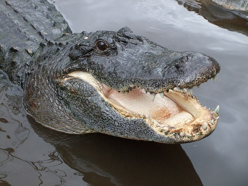
An “alligator mississippiensis,” prevalent in the Okefenokee Swamp – where I kayaked – twice

*   *   *   *

Okefenokeelocatormap.pngThis May I’ll be making a two-week pilgrimage to Jerusalem (As part of a local church group.)  Which makes this a great time to remember some past pilgrimages.  Like my two separate overnight-camping ventures into the Okefenokee Swamp (Shown at left.)

I wrote of those Okefenokee trips in several posts:  Operation Pogo – “Into the Okefenokee” (11/7/15), “Into the Okefenokee” – Part II (11/15/15), “Into the Okefenokee” – Part III (11/24/15), “There he goes again…” (5/30/16), and “There he goes again” – Revisited (5/31/17).

The original Operation Pogo noted that my fascination with the Okefenokee started – at age 10 or so, back in the 1960s – when I saw the movie Swamp Water, starring Walter Brennan:

The part I remember best was watching Walter Brennan getting bitten in the face by a snake.  In the scene, he kneels over and parts the bulrushes to get a drink. (Of  “swamp water,” while hiding from John Law in the Okefenokee.)  As Walter [kneels], the viewer can see a grinning cottonmouth off to his right.  (The viewer’s left.)  The grinning cottonmouth then proceeds to bite him “right on the cheek.”  I’ve been fascinated ever since…

Part of that fascination also came from the old Pogo comic strip.  (It ran from 1949 to 1975.)  It starred Pogo Possum, was set in the Okefenokee, and featured “social and political satire through the adventures of its anthropomorphic funny animal characters:”

Pogo is set in the Georgia section of the Okefenokee Swamp;  Fort Mudge and Waycross are occasionally mentioned.  The characters live, for the most part, in hollow trees amidst lushly rendered backdrops of North American wetlands, bayous, lagoons and backwoods.

Also, note that my original “Pogo” post was very long.  It clocked in at over 1,600 words in the main text, and over 2,000 words including the notes.  Since then I’ve cut down on blog-post wordage, mostly because the average reader has the attention span of a gerbil.  (You could Google “ideal number of words for a blog post.”  One site – Forbes – said that for one thing, “most people only read between 20% to 28% of a post” anyway…)

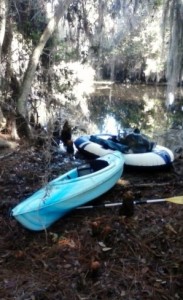
1445698042386Revisited” noted my second fun trip into the Okefenokee, from the west entrance into the Okefenokee east of Fargo, Georgia (In the “tagalong” combo at right;  a kayak with a rubber dinghy trailing behind.)  “Among other things I saw some fifty alligators during the first hour of paddling.”  After that I stopped counting…

I camped at the CANAL RUN shelter, “some nine miles in from the Foster State Park launch site.”  And … because it was so early in the season the canoe-only trails were much vegetated-over.  Which meant that many times I had to “butt-scootch” my kayak over a barely-sunken log, and sometimes had to stick my hand out, grab another log and finish pulling the kayak [over].  The last time I reached my left hand out I saw a patch of white.  It turned out to be yet another gator … “smiling” nicely at what he no doubt thought was a tasty new snack.

In case I’m being too subtle, that “tasty new snack” would have been my left hand.

And speaking of “pilgrimages” – and why I do things like camp overnight in the Okefenokee (twice) and fly to places like Jerusalem:  I addressed that topic in my companion blog.  See for example, On St. James, Steinbeck, and sluts (The “sluts” came from Robert Louis Stevenson.)

That post noted that on a true pilgrimage – usually by and through such things as “the raw experience of hunger, cold, lack of sleep” – we can quite often “find a sense of our fragility as mere human beings.”  (And to that might be added, mosquitoes, snakes and great numbers of alligators.)  The post added that a true pilgrimage can be “one of the most chastening, but also one of the most liberating” of personal experiences.

I certainly felt “chastened” at almost having my left hand chomped by a “smiling” gator.

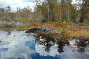
1445624973384And speaking of being chastened:  “One thing I learned is that – in the Okefenokee – there are precious few places to stop and take a break…  The shelters – for day use or overnight – are few and far between.  As a result, the ol’ keister got extremely sore by the end of the second day.  (Not to mention blisters on my palms…)”  That is, in this swamp there are few “shores” to speak of.  Just a “line of reeds that an alligator can mash down.”  And where a wandering kayaker – for example – steps off at his own peril, as shown above left.

Also, one time I was paddling through a very narrow canal when I saw a big bull gator – who eventually submerged. This was on the canoe trail to Monkey Lake.  As I paddled over the water where the gator had been, I could swear he came up and nudged the bottom of my kayak.  I figured it was an accident, at least the first time.  (But the second time?)

That added some spice to the trip.

Then there was the time I miscalculated my canoe-speed, and ended up paddling – late in the dark of night – through what seemed like miles of water lilies.  (Well after 8:00 p.m., as noted in Okefenokee … Part III.)  Which led me to think, as I paddled through the swamp in the dark:  “That Monet guy can take his stinkin’ water lilies andstick ‘em where the sun don’t shine.’”

That is, the canoe only trail to the Cedar Hammock Shelter is – or was – loaded with water lilies…

I discovered a nasty thing about water lilies.  They’re hard enough to paddle through during the day, when you can see what you’re doing…  [But] in a kayak – in the dark and in a hurry – your paddle tends to grab great wads of swamp weed.  Then the paddle tosses the soggy lily-entrails – wet and cold – all about your head and shoulders.

But such are the things that make for a great pilgrimage!  (At least in hindsight…)

*   *   *   *

SwampWaterPoster.jpg

Poster for the 1941 film, Swamp Water.

*   *   *   *

The upper image is courtesy of Alligator – Wikipedia.  The caption:  “American alligator (A. mississippiensis).”  For more on the upcoming two-week pilgrimage, see “On to Jerusalem!”!”

Pogo - Earth Day 1971 poster.jpgRe:  “Pogo,” running from 1949 to 1975.  Cartoonist Walt Kelly (1913–1973) fell ill in 1972, and was unable to continue the strip.  The strip continued for a short time with reprints, and cartoons from other artists.  But Kelly’s widow ultimately decided to discontinue the strip “because newspapers had shrunk the size of strips to the point where people could not easily read it.”  Also, one of the reasons I liked the strip was because – in hindsight – it seems rather prescient, as seen at left.

I took the photograph of the alligator basking on the “line of reeds.”  (From a safe distance.)

The lower image is courtesy of Swamp Water – Wikipedia.  That article noted the 1941 Jean Renoir film “starring Walter Brennan and Walter Huston, produced at 20th Century Fox, and based on the novel by Vereen Bell.  The film was shot on location at Okefenokee SwampWaycross, Georgia, USA.  This was Renoir’s first American film.  The movie was remade in 1952 as Lure of the Wilderness, directed by Jean Negulesco.”

Remembering the “Chilkoot &^%$# Trail!”

The “Chilkoot Trail” isn’t really a trail, it’s just “one big pile of &%#@ rocks after another!!!

*   *   *   *

Back in 2016, my brother, nephew and I hiked the Chilkoot Trail.  People call it “the meanest 33 miles in history,” and I found out why – the hard way.  After that adventure, my nephew – just out of the Army – headed back east to start the fall term at Penn State.  My brother and I went on to take two canoes “up” the Yukon River – paddling 440 miles in 12 days.

Once back home I posted “Naked lady on the Yukon,” on August 28, 2016.  (The events of that trip were still fresh in my mind, for one reason or another.)  I later posted Chilkoot &^%$# Trail! – Part 1 and Chilkoot &^%$# Trail! – Part 2, on September 7, 2016.

I guess I’ll have to revisit “Naked lady” in more depth later on. (Deep sigh.)  But for now it’s enough  to say:

I just got back from two weeks canoeing the Yukon River…  And the “mighty Yukon” is the last place on earth I would expect to see a [naked] lady sun bathing.  But one moment, out of nowhere, there she was…

You can see the full story in the 8/28/16 post.  But for the metaphorical lead picture above left, you’ll have to imagine no sand.  “(And no ‘Bikini Bottom,’ for that matter.)”

Which brings us back to the “Chilkoot &^%$# Trail!”

*   *   *   *

The “Chilkoot” starts in Dyea, Alaska.  And Dyea is pronounced “DIe-eeee,” maybe prophetically.  (Like, “that’s what you feel like doing once you get on the &$%# Trail!”)  It ends in Bennett, British Columbia.  That’s where you end up waiting, a long afternoon, with other hikers who’ve shared your ordeal. (Of four days or more.)  There’s only one train, at 3:15 in the afternoon, so all the footsore hikers get a chance to sit on something besides rocks, and pitch their tents to dry out.

Which brings up the fact that the number of hikers is strictly limited; you have to get a special permit to even start.  And they keep track of who gets where and when.

Like on the second afternoon – on the way to “Happy Camp,” seen in part at right.  That late afternoon I was “dragging tail” and the light started fading, so a nice lady ranger came out to help me, along with a nice husky young gent who carried my pack the rest of the way.*

That’s when I experienced the phantom pack phenomenon.  It’s not unlike the “phantom limb” sensation, but leaves you weaving and rolling like a drunken sailor.

That was one time I got to “if I could have cried I would.”  (Hey, I’m secure in my masculinity.)  

Another thing:  The nice lady ranger felt so bad for me she let us three stay in her private facility – the one above right – which meant we didn’t have to pitch our tents in the dark.  (She also gave us juice boxes, like “heaven on earth.”  I could have sworn they were raisin juice, but my older brother later said raisins are just dried-up grapes. It may have been the delirium, or the relief…)

Another excuse?  “Hiking the Chilkoot Trail is sheer torture for someone – like me – with only one good eye and and thus no depth perception.”  (For more detail see the February 2017 post, On that nail in my right eye.)  So my word of advice:  If you have only one good eye and no depth perception, take it slow and easy, and be ready to let the other hikers pass you by.

More good advice:  Anyone hiking the trail is advised that if they have to get airlifted out – like for a twisted ankle or such – the cost will be a cool $28,000.00.  Which brings up another point rangers make in the process of getting your permit to hike the trail:  Watch out for the bears!

A historical note:  The Chilkoot’s claim to fame started with the Klondike Gold Rush of 1896–99.  That “transformed the Chilkoot Trail into a mainstream transportation route to Canada’s interior.”  Also, the only other route to the gold fields was through White Pass.  (Up to 1899, when a railroad was built from Skagway to the Yukon.)   So which route was better?  Pioneer Mont Hawthorne said there wasn’t much difference:  “One’s hell.  The other’s damnation.”

13 Dead Horse GulchAnother side note:  White Pass was also called “Dead Horse Trail,” apparently renamed by Jack London:  “Nearly 3,000 pack animals died.  Drivers rushing over the pass had little concern for beasts.  Exhausted horses starved, were hurt on rough ground, became mired in mud and fell over cliffs.”
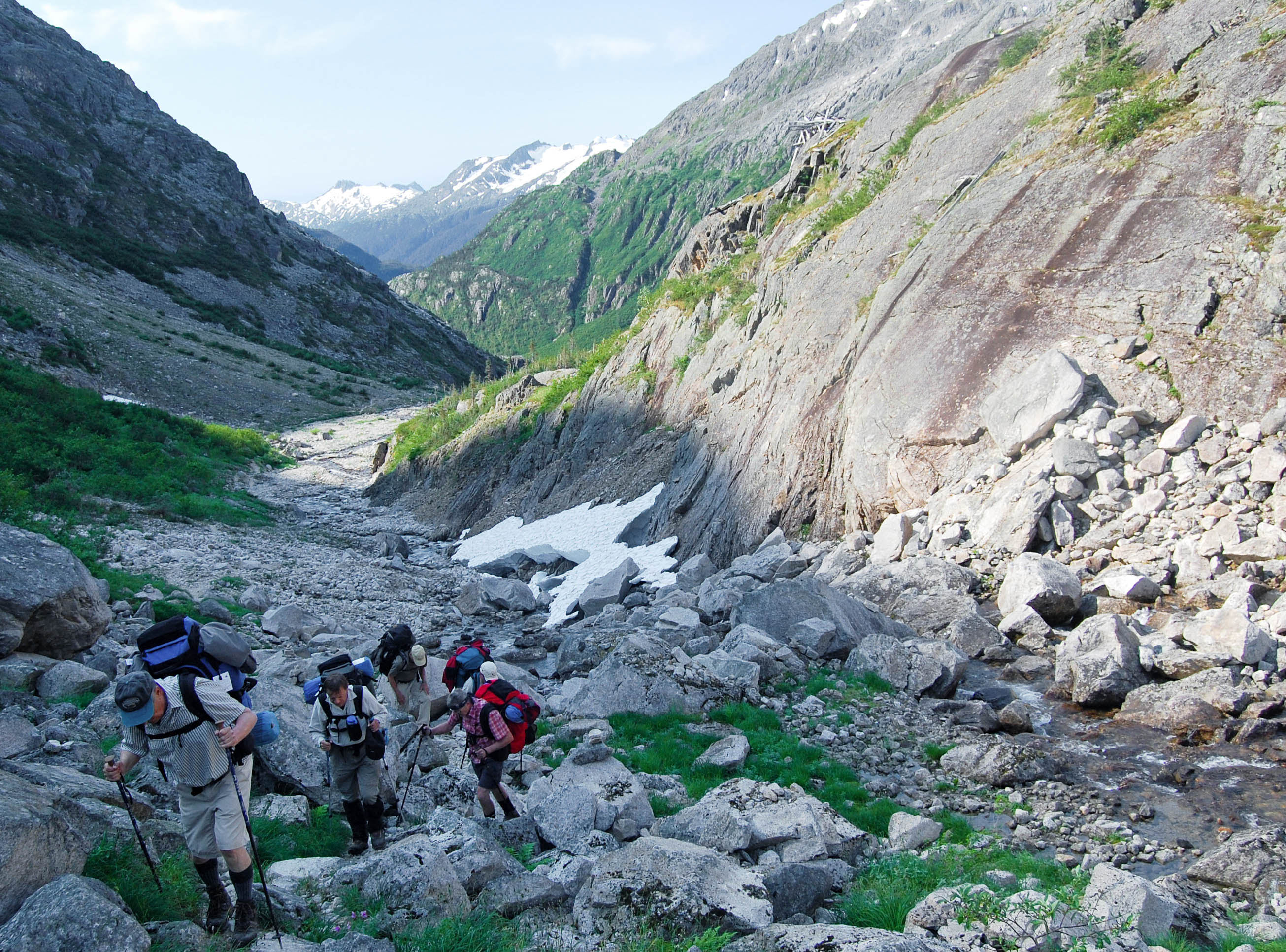
Which also gives you a feel for “hiking the Chilkoot.”

Which in turn brings up the question:  Why the hell would you do such a thing?

One answer can be seen in a post from my companion blog, On St. James, Steinbeck, and sluts.  It spoke in part of the “value of such pilgrimages in general.”  For example:

We were speaking of pilgrimages.  More to the point, of why an otherwise-relatively-sane 65-year-old [at the time] would either hike the Chilkoot Trail or spend 12 days canoeing 440 miles on the Yukon River.  That of course brings up St. James the Greater

And James is the Patron Saint of Pilgrims.  On that note, the post cited the book Passages of the Soul: Ritual Today. (James Roose-Evans.)  It said a pilgrimage – like a 12-day canoe trip on the Yukon or a “hike” on the Chilkoot &$%# Trail – “may be described as a ritual on the move.”

Further, the book said that through “the raw experience of hunger, cold, lack of sleep,” we can often find a sense of our fragility as mere human beings.  (And that’s especially true when the “majesty and permanence” of God’s creation included “all those &$%# rocks!”)

Finally, the book noted that such a pilgrimage – such ritual on the move – can be “one of the most chastening, but also one of the most liberating” of personal experiences.

I certainly felt “chastened” after we got back to Skagway from the Chilkoot Trail.  (Although the 10-of-12 beers that my nephew and I shared – of the two six-packs I bought – helped a lot too…)  But as I said in I pity the fool, “I pity the fool who doesn’t do pilgrimages and otherwise push the envelope, even at the advance stage of his life.”

Besides, my Chilkoot Trail experience made the Happy Camp “raisin juice” taste great!!!

*   *   *   *

To repeat, the Chilkoot Trail is just “one big pile of &%#@ rocks after another!!!

(And this is one of the smooth parts…)

*   *   *   *

The upper image is courtesy of Chilkoot Trail – Image Results.  From a post, “What the Chilkoot Trail Taught Me about Leadership – Pt. 6,” posted on , “b.”  A highlight:

We endured miserable weather throughout the day – cold, rainy and very windy…  At times, especially hiking up to and down from the summit I was quite frightened as I was afraid we would either be blown off the mountain or slip careening down the mountain.

I knew the feeling…  Also, this review-post borrowed liberally from On the Chilkoot &^%$# Trail! – Part 1 and Chilkoot &^%$# Trail! – Part 2.  

Re:  “Up” the Yukon River.  Like the Nile River, the Yukon flows north, which makes it unusual.

Re:  “Husky young gent who carried my pack the rest of the way.”  My brother and just-out-of-the-Army nephew also took turns carrying my pack part of the way to “Happy Camp.”  

Re:  “But as I said in I pity the fool…”  There followed a loose translation of Ralph Waldo Emerson‘s saying, “Whoso would be a man, must be a nonconformist.”

Re:  The book Passages of the Soul: Ritual Today.  The book also noted that a healthy sense of ritual “should pervade a healthy society, and that a big problem now is that we’ve abandoned many rituals that used to help us deal with big change and major trauma.”

Re:  The negative tone of this post.  My brother thought my post “Hola! Buen Camino!” – Revisited was also too negative; too “complaining” in general.  So I posted “Buen Camino!” – The Good Parts.  

Some people reading “Hola! Buen Camino” might think I had a lousy time in my five weeks hiking the Camino de Santiago in Spain.  For example, there was my comment on the first 10 days – after starting in Pamplona – being “pretty miserable.  My left foot constantly throbbed, until it blistered up and got tough…”  But there were lots of good things that happened during those 30 days on the Camino…

But “fun stuff doesn’t make for good drama.”  See What Elements Make for [Good Drama]?

If your drama doesn’t have a juicy, complex, emotional, heart-wrenching, personal, intelligent, connectable role for an actor – it’s dead in the water.  And as a side note, don’t be afraid to inject some comedy into your dramatic scenes.  Except for Schindler’s List, every single drama listed above has more than one moment of levity.  However, there is one thing that every good drama needs no matter what the story is.  It’s more than a trend – it’s the mandatory ingredient – CONFLICT.  Drama is based on conflict.  And not just any conflict, but one that is powerful, relatable, and complex enough to propel a story forward… 

And BTW:  That hike on the Camino de Santiago in Spain took place in the fall of 2017.

The lower image is courtesy of Chilkoot Trail – Image Results. See also Chilkoot Trail National Historic Site – Parks Canada: “The Chilkoot Trail is a 53 kilometre / 33 mile trip through history and one of North America’s most fabled treks.” The trail crosses the international boundary between the U.S. and Canada and is “co-operatively managed by Parks Canada and the US National Park Service.”

Last year the Meseta, next year “Porto…”

*   *   *   *

This time last year – October 4, 2017 – my Utah brother and I were hiking the Camino de Santiago in Spain.  Specifically, on this day in 2017 we managed to hike into León, for our second one-day break after 20 days of hiking. We got to the PENSION BLANCA B&B fairly early in the afternoon, and could then start relaxing.  Or at least easing our aching feet…

The good news was that once we reached León, we had to switch from hiking to bicycling. (We were running out of time.)  The bad news?  That change just led to “a different kind of hell.” (From Dorothy Parker’s famous quote, “What fresh hell is this?”  In our case, it only meant a change in where we got sore…)

Just the day before – October 3 – we hiked from Reliegos to Puente Villarente – shown above right – some 7.5 miles shy of León.  (See also the blurb on the hike from El Burgos Raneros to Mansilla de las Mulas.)  I know because I wrote in my journal, “We hiked 7.5 miles today.”  So again, we got to the PENSION BLANCA in León early in the afternoon, and started relaxing.

The other good news was that we were finally done with the Meseta part of the hike.  Which brings up the picture at the top of the page. [“Now defunct.”] The caption:  “Tom heading back to the Camino. Which gives an idea of the landscape we’ve been hiking through.” That hiking-through was on the Meseta Central plateau part of Spain – and it’s dry, dusty and hot. In fact, it’s the part that some people recommend Camino pilgrims skip.  (If they want to be all “wussified.”)

So the Meseta part of the hike presented its own “fresh hell,” its own set of fresh challenges.  But hey, that’s what a real pilgrimage is all about.   A “journey or search of moral or spiritual significance,” as shown at left.  Or in other words, “Finding yourself.”
Anyway, by October 4th we’d already hiked from Pamplona for 20 days, and ended up in León.  We’d hiked 250 miles.  And aside from taking a day off in León, we got our rented 15-speed mountain bikes.  With them we covered the remaining 200 miles to Santiago de Compostela in seven days.  Even though neither of us had ridden a bike in 40 or so years…

*   *   *   *

Before leaving for Spain – and the 450-mile hike-and-bike – I wrote about this pilgrimage-adventure in Training for the Camino and Going back “whence we came.”  (We started hiking from Pamplona on September 13 and got to Santiago October 12, 2017.)  Once I got back I did “Hola! Buen Camino!” – Revisited and “Buen Camino!” – The Good Parts (The latter because my brother thought “Camino – Revisited” was too negative.)   From the latter post I said this:

This is also a good time to mention that dinners on the Camino were universally delicious.  Most of the albergues featured a three-course special, including a salad, main course and choice of desserts.  Which may explain why – even though people said I looked thinner when I got back home – I actually weighed the same 160 pounds as when I left.

Also about this time – leading up to the Leon stayover – there was a mass shooting in Las Vegas.  Bill O’Reilly posted that that latest mass murder was “the price of freedom.”  I posted in response, “No Bill, putting up with dumbasses like you is the price of freedom.”

So much for a pilgrimage making you all kumbaya and hug-your-neighbor.  But we digress…

*   *   *   *

The start of the Meseta outside Burgos - el Camino de Santiago, Camino Frances, SpainThe point is that this time last year we were just finishing the dry, dusty Spanish Meseta part of our Camino hike.  But next year we plan something different.  We’ll go back for another hike, but this time on the Portuguese Camino, “a fantastic route for pilgrims looking for a more rural experience on the Camino de Santiago.”  And the “we” will include me, my brother and his wife.  Which means I’ll have to get my own lodging.  (So it’s time to start saving my pennies.)

I plan to fly into Lisbon, mostly because I’ve never been there but always wanted to visit.  The three of us will meet up in Porto; “gorgeous Porto with its colorful riverfront and home of Port wine.”  From there it’s a mere 161 miles to Santiago de Compostela, on a more-leisurely pace of ten miles a day, for 16 days or hiking.  (Who says you can’t can’t teach old dogs?)

*   *   *   *

Meanwhile, back in Leon, last year.  On October 5, on the day off, I found a McDonald’s restaurant, for a “little taste of home.”  And we practice-rode our rental 15-speed bikes.  I “didn’t fall down, and shifted gears without the chain coming off.”  But from there it wasn’t all smooth sailing.  On the ride out of Leon October 6, “my right handlebar took out – smashed the heck out of – the side-view mirror of some poor slob’s nice new car.”  In a second mishap:

I literally “ran my ass into a ditch…”  We were zooming downhill one afternoon.  I tried to adjust my left pant-leg, and the next thing I knew I was laying in a ditch, bleeding like a stuck pig.  And not just any ditch.  A nice deep ditch covered with thorns and brambles on the sides and bottom.  The “stuck pig” part came when my Ray-Bans gashed the bridge of my nose, causing it to bleed profusely…

See “Buen Camino!” – Revisited.  The point is:  We covered the remaining 200 miles to Santiago de Compostela in seven days, but not without some adventure (As illustrated at left, “An exciting experience that is typically a bold, sometimes risky, undertaking.”) 

Which can be what a pilgrimage is all about.

*   *   *   *

So anyway, this time last year we were just coming off the dry, dusty Meseta part of the Camino Frances, in our case from Pamplona to Santiago de Compostela.  And who knows, maybe this time next year we’ll be finishing up our hike from Porto to Santiago.  Or somewhere in the middle, or maybe just starting out.  Which leads to this thought:

I’m sure the Portuguese Camino will have its own challenges, it’s own way of helping me “find myself.”  But considering we’ll be starting in Porto, at least the start should be happy…

*   *   *   *

Rabelo boat, used to transport barrels of port down the River Douro,” to Porto . . .

*   *   *   *

The original post included an upper image with the caption, “My brother exploring some ‘ruinas’ on the Camino de Santiago, this time last year (10/4).” But for some reason this “platform for publishing” substitutes an actual image with a block stating – for example “image may contain sky, outdoor, nature,” which does me no good and is quite aggravating. When that happens I usually delete the useless “info box,” and note – as here – what used to be there…

So here’s what I wrote in the notes in the original post: “The upper image is my photo, taken with a ‘tablet’ rather than a camera.  A word of advice:  Take a real camera.  It adds very little weight, while the tablet seemed to take forever to set up, meaning you really had to think ahead to get a decent picture.” And for more on the platform, see WordPress.com – Wikipedia

Re “Now defunct.” See Is it now-defunct or now defunct? – Columbia Journalism Review. Which is an article I discovered while fixing the image screw-ups noted above. With this note:

The phrase “now defunct” is another journalism mannerism, a phrase not often spoken aloud. But we love it: It allows us to tell readers that this thing of which we are about to speak is no longer around.

Which leads to another photo that was in the original but is no more. I wrote of the image: “The image to the right of the paragraph beginning ‘This time last year’ is also my photo of the bridge for which Puente Villarente is named. ‘Puente’ means bridge and ‘Puente Villarente’ is four miles northwest of the ‘Mansilla de Las Mulas’ mentioned in El Burgos Raneros to Mansilla de las Mulas.  See also Camino Day 24: Puente Villarente to León 12km.  

So, in correcting the “defunct image” mishap I actually learned something new, about the term “now defunct.” Which why I like blogging, even if only for my own amusement. Meanwhile, the rest of the notes “hereinafter” are as they appeared in the original.

Re:  “Different kind of hell.”  The allusion – as noted – is to Dorothy Parker‘s famously saying – whenever the door rang in her apartment – “What fresh hell is this?”  It’s also the title of Parker’s 1989 biography by Marion Meade.  See Amazon.com: Dorothy Parker: What Fresh Hell Is This?  

Re:  “The part some people recommend.”  The actual title:  The Meseta – Walking the Camino de Santiago.  It says in part, “many people decide to skip this section of the Camino Frances entirely, which is a shame, because this part … has more to offer than meets the eye.”

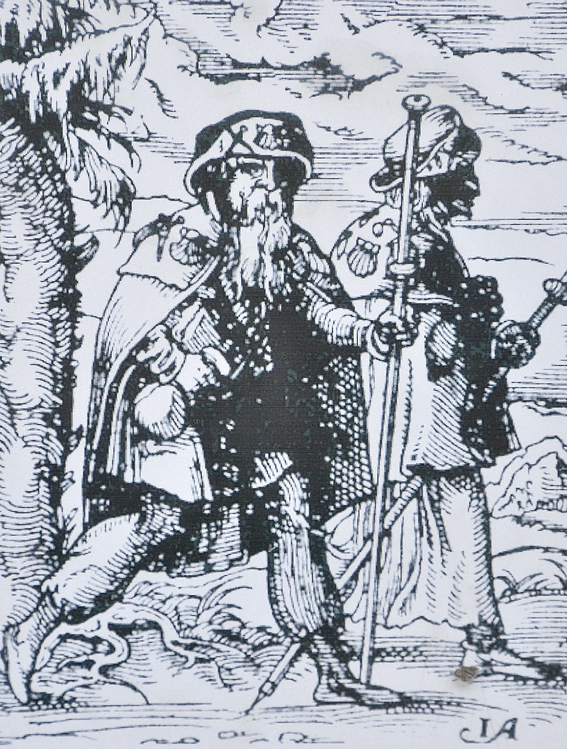
The pilgrim image is courtesy of the Camino link at Pilgrimage – Wikipedia.

A note about the Camino Frances, in our case from Pamplona to Santiago de Compostela.  My brother opted to start at Saint-Jean-Pied-de-Port, the northern end of the “French Way,” after flying into Paris.  I opted to fly into Madrid and take a train to Pamplona, where we met up.   

The lower image is courtesy of Port wine – Wikipedia.  The full caption:  “‘Rabelos,’ a type of boat traditionally used to transport barrels of port down the River Douro for storage and aging in caves at Vila Nova de Gaia near Porto.”  Also port wine is defined in pertinent part as…

… a Portuguese fortified wine produced with distilled grape spirits exclusively in the Douro Valley in the northern provinces of Portugal…  Fortified wine is a wine to which a distilled spirit, usually brandy, is added.  Many different styles of fortified wine have been developed, including PortSherryMadeiraMarsala … and the aromatised wine Vermouth.

So that part should be fun…

The “Rideau Adventure” – An Overview

1535276745593 (2)

I saw no naked lady on the Rideau

*   *   *   *

Editor’s note: I had to go back on August 3, 2020, to redo this post. As often happens, some photos – and especially my photos – from an old post get transformed into a box that says things like “image may contain: outdoor.” Or in my photo at the bottom of the page, “image may contain: one or more people, outdoor and nature.” I was able to fix that fairly easily, but for the photo above I had to settle for this tiny photo from the “add media” link in the dashboard.

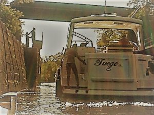
So what follows is the original post from September 10, 2018, with two differences in my photos at the top and bottom of the main text. And by the way, the full caption to the photo above: “I saw no naked lady on the Rideau, but there was this fetching blonde at Smiths Falls Locks…”

*   *   *   *

Last Saturday evening – September 1st – I got back home from my “Rideau Adventure.”  (Which included passing through the Poonamalie lock station – at left and discussed further below.)  That adventure involved canoeing the Rideau Canal, from Kingston – on Lake Ontario – to Ottawa.
I previewed it in Next adventure: Paddling the Rideau “Canal.”  Also – from July 31 – “Naked Lady” – on the Rideau Canal?

In a nutshell, I didn’t see a naked lady on the banks of the Rideau.  I did see a fetching blonde in a power boat, explained in the notes below.  And incidentally, “Poonamalie” is the station just before the Smiths Falls three locks.  (We followed “Yvette’s” Fuego on the first two of three locks…)   

And now for the overview:  The guide books say it should take from six to ten days to make the trip.  They also say the prevailing winds are “generally” from the southwest, but to be “ready for anything.”  We ended up taking 11-and-a-half days – and 11 nights – but two of those nights we spent in relative luxury in a rustic cabin in Portland, Ontario (Nine days “actual canoeing.*”)

1534935865425That was after taking a wrong turn padding north from Colonel By Island on the morning of Wednesday, August 22.  That overnight campsite included a violent rainstorm and raccoons breaking into our plastic food containers and taking our supplies of breakfast bars, crackers and trail mix.  That in turn was preceded by us paddling through a veritable monsoon, on the afternoon of Tuesday, August 21.  That morning we made 10 miles, but in the afternoon – after leaving the Narrows (Lock 35) – we made four miles before stopping at ” Colonel By.”

But such is “the stuff of legends.”  And we digress…

Getting back to those prevailing winds.  For the first few days the prevailing winds were from the north, in our faces.  Plus we had to delay our start – by one day – because The Weather Channel predicted heavy thunderstorms on the afternoon of Friday, August 17.  That forecast wasn’t accurate, but the one for the afternoon of Tuesday, August 21, was accurate.

We got the predicted heavy rain.

Which is another way of saying the trip featured highlights and lowlights.  “Yvette” was a definite highlight.  The heavy rains of August 21-22 were lowlights, as was taking a wrong turn after leaving Colonel By Island.  But that was followed by deciding to take two nights off – resting and refitting – in beautiful Portland, Ontario – a definite highlight – on August 23 and 24.

Thereupon,” on leaving Portland our main goal was to get off “all those big-ass lakes.”  With their unpredictable winds and a constant threat of being swamped by inconsiderate big-boat drivers.  Speaking of that, on the afternoon of August 24, we were in the process of getting off Lower Rideau Lake(The last of the “big-ass lakes” in the Rideau system, which is actually further north than Upper Rideau Lake Big Rideau Lake – with Cow Island – lies in between.)  

We were heading for the Poonamalie lock station, and my brother was sitting in his canoe, minding his own business and checking our bearings on his big book of charts.  Some jerk in a big-ass boat came zooming out from the river to the north – where we were headed – making a huge wave and yelling out, “GET OFF THE F’ING CHANNEL!”  Which just goes to show that life is like a box of chocolates:  “You never know what you’re gonna get.”

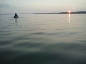
1534674220192Also speaking of that:  To avoid the often-contrary prevailing winds, we started getting up at 4:00 a.m.  Which leads to the picture at left, of one of the benefits of getting up at 4:00 a.m. and stumbling around in the dark while breaking camp.  Aside from the water being much smoother – which was especially important on those “big-ass lakes” during the first half of the trip – you also get to see some beautiful sunrises.  (As seen at left.)

So all in all we spent 11-and-a-half days on the trip, but that included two nights in a nice cabin in Portland Ontario.  And aside from primitive camping the first two nights – “dig a hole and squat” – most of the rest of the nights we camped at the lock stations themselves.  They featured nice level lawns, hot and cold running water in the nearby “washrooms,” and every once in a while a nearby pub or restaurant with hot food and cold beer.

Which led to my conclusion that this Rideau trip was “more of a Camino than the Camino.”  That is, last September and October – on Spain’s 450 miles of the Camino de Santiago* – my brother and I kept meeting up with flocks of fellow pilgrims, all or most greeting us with “Buen Camino.”  In other words, the Rideau trip was more of a pilgrimage, in the truest sense.  That is, a “journey or search of moral or spiritual significance.”  Or consider the words of John Steinbeck in Travels with CharleySpeaking of long-distance driving – at least in 1962 – he wrote:

If one has driven a car over many years [one] does not have to think about what to do.  Nearly all the driving technique is deeply buried in the machine-like unconscious.  This being so, a large area of the conscious mind is left free for thinking…  [T]here is left, particularly on very long trips, a large area for day-dreaming or even, God help us, for thought.

Unfortunately, there was precious little of that on the Camino.  (Or for that matter, on any modern long-distance driving trip, what with Sirius, GPS, iPod Shuffles or the new “Sandisks,” not to mention “books on CD,” none of which were available in 1962.)  On the other hand, there was plenty of time – paddling up the Rideau river system – for “God help us, thought.

In my case, on the Rideau I spent plenty of time – along with Steinbeck – thinking about the past:  “And how about the areas of regrets?  If only I had done so-and-so, or had not said such-and-such – my God, the damn thing might not have happened.”

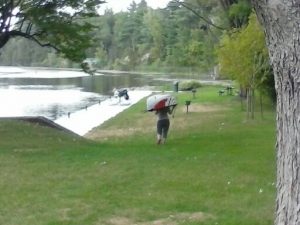
Which is another way of saying there weren’t that many other canoeists or kayakers on the Rideau.  In fact I can only remember one, the lady kayaker shown below, portaging – carrying her kayak – at the Burritts Rapids lock station.  Whereas my brother and I paid extra to take our canoes through the locks, this younger lady chose to do it the “other way.”  She’d carry her kayak on one trip – from one end of the lock station to the other – then go back and get all her gear, stacked what seemed to a mile high on her backpack.

The point being – in case I’m being too subtle – that the dearth of fellow paddlers meant there was plenty of time “for day-dreaming or even, God help us, for thought.”

Which seems to be what makes a pilgrimage a pilgrimage(Though it helped to find the Lock 17 Bistro, a short walk from Burritts Rapids, where we camped the night of Sunday, August 26.)

*   *   *   *

1535303307094

A lady kayaker at Burritts Rapids

*   *   *   *

The upper image:  My photo from our passage through the first two of three locks at Smiths Falls, Ontario.  I wrote that we got to the lock at 8:30 and they didn’t open til 9:00 a.m., so my brother walked to a close-by convenience store and got some REAL coffee and a chocolate-chip cookie.  Then the lady in question – I’d like to think her name was Yvette – “and her old-guy SO” – whatever that meant – “went off into the Rideau.”  I also journaled: “The point being:  This trip has been mainly pleasant.  Early stops, lots of breaks, a two-night stay in Portland…”  (Portland Ontario that is.)

Re:  My not seeing “a naked lady strolling the banks of the Rideau Canal.”  The reference goes back to the August 2016 post, “Naked lady on the Yukon.”  (Where the “mighty Yukon River” was the last place on earth I expected to see a lady sun bathing, “In the altogether” as it were.) 

Re:  Portland, Ontario:  “The Landing on Big Rideau Lake, which is now the community of Portland, lies at the heart of the Rideau Canal System and is central to the history of the canal and to the early development of Canada.  Portland is on Highway 15, midway between Ottawa and Kingston, Ontario.”  See also Portland, Ontario – Wikipedia.

Re:  Distances on the canal system.  Using the figures from Rideau Canal – Distances between Lockstations, it is 125.6 miles from the Lasalle Causeway in Kingston to Ottawa proper and the last several lock stations leading to the Ottawa River.  But we stopped at Hartwells lock station, 4.9 miles short of the Ottawa River, for reasons including there was no apparent take-out available, at which my brother could park his car and trailer, and we could unload the canoes.  Moreover, we put in at the small but better-suited “Elliott Avenue Parkett” – at the water’s end of John Counter Boulevard – some two miles north of the Lasalle Causeway.  Thus we arguably covered some 118.7 miles on the trip.  On that note, in an email post-mortem dated September 4, my brother noted this:   

…to set the record straight, the entire Rideau is 125 nm (nautical miles), of which we did 120 nm.  That works out to 138 statute miles.  And, we started Saturday, August 18]. around 11 am and finished at about the same time on Wed[nesday, August 29]., 11 days total, two of which were, going backwards to Portland and a day spent in Portland.  So 9 days total actually canoeing. 

Re:  “Our’ 450 miles of the Camino de Santiago.”  For more on that pilgrimage see “Hola! Buen Camino!” – Revisited and/or “Buen Camino!” – The Good Parts.

Another note:  For the next canoe trip I’m getting a bigger tent and a cot.  (No more sleeping on the ground for me.)  But that trip won’t happen until at least 2020, as next summer my brother, his wife and I plan to hike the Portuguese Camino.  That hike will involve a “mere” 150 miles, from Porto to Santiago de Compostela.  This route is said to be a “fantastic route for pilgrims looking for a more rural experience on the Camino de Santiago.”

The quotes from Travels with Charley are from the 1962 Penguin Books edition, at pages 94-95.

The lower image:  My photo of a lady kayaker, portaging – carrying her kayak – at the Burritt’s Rapids lock station. My brother and I paid extra to take our canoes through the locks – resulting in the previous picture of “Yvette,” bending and stretching, but this lady chose to do it the “other way…”  (“Oh  to be young again!”  Or not, once was enough…)

*   *   *   *

Also of note:  In Geezer’s guide to supplements – Part II, I wrote of supplements for “men my age,” that is, 67.  One of the recommended supplements was Selenium:  “No other single nutrient appears to prevent cancer more effectively…  It basically forces cancer cells to self-destruct.”  The good news was that “Nature’s selenium supplement is the Brazil Nut, which measures 100 mcg per nut.   So you get your daily dose by eating two Brazil nuts.”  But that presented a problem in accounting:

I bought a 9.5 ounce container at the local Fresh Market for $12.95 on July 15.  I’ll update this post when they’re gone – at the rate of two or three a day – but … it’ll be awhile.

For the record, I had my last two Brazil nuts from that batch on September 7, 2018, less than a week after I got back from the aforementioned Rideau Adventure.  I took the supplement from July 15 to August 17, for a total of 63 days.  I didn’t take the supplement while on the Rideau, from the 18th to August 30, when I left for home.  I then took it from August 31 to September 7, eight more days, or 71 total.  Thus the cost of this supplement rounds up to about 19 cents a day.     

“Naked Lady” – on the Rideau Canal?

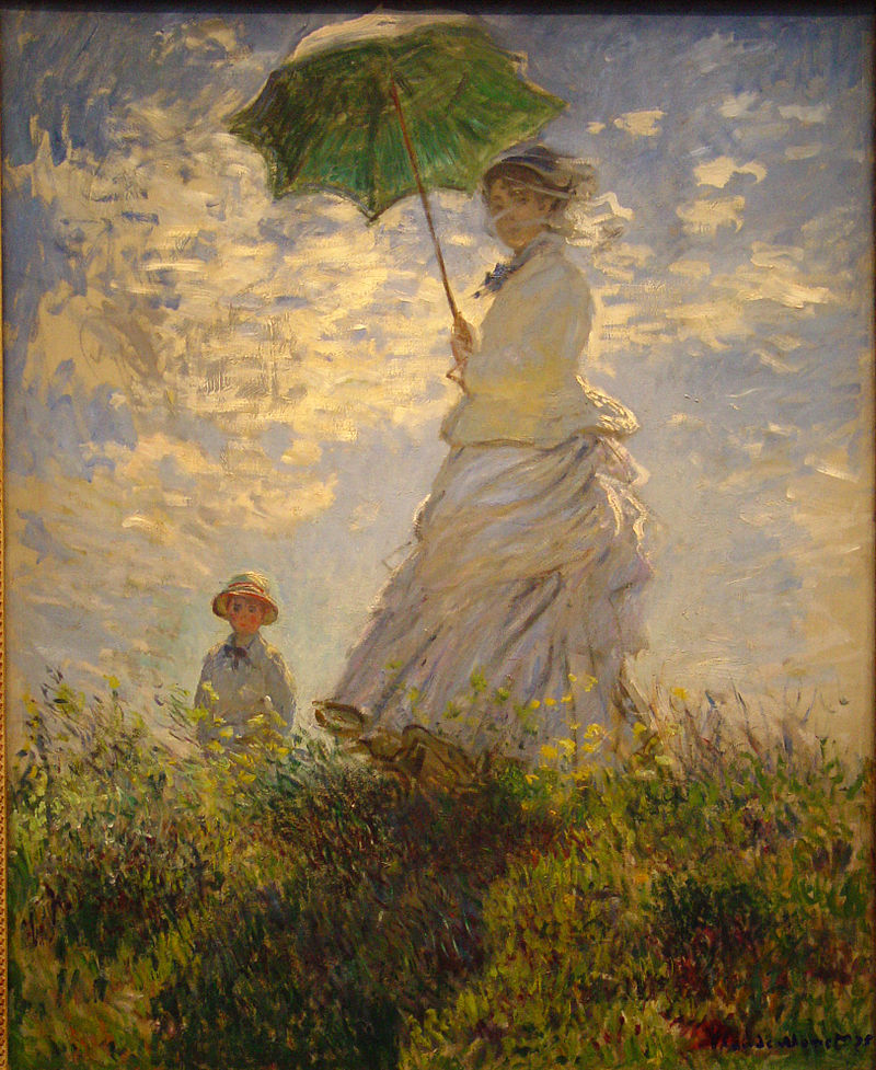
I’m more likely to see a “Lady with a Parasol,” strolling the banks of the Rideau Canal

*   *   *   *

As noted in Paddling the Rideau Canal:  This August my Utah-brother and I will be canoeing – some six to 10 days – up the Rideau Canal, from Kingston to Ottawa, Ontario.

Which brings up the fact that two years ago this August, we spent two weeks canoeing the Mighty Yukon River(Also in Canada.)  We paddled 440 miles – from Whitehorse  to Dawson City – in 12 days.  (Not counting the one day  we took off from paddling – Sunday, August 14 – in beautiful Carmacks, Yukon Territory.  The idea was to rest, refit and enjoy an ice-cold Yukon Gold.)

One result of that trip was a post on August 28, 2016, “Naked lady on the Yukon.”  As noted in the post, the Yukon River was “the last place on earth I would expect to see a lady sun bathing.”  (In the altogether, as it were.)  But I could probably say the same thing about the Rideau Canal.

You can read the full story in the Naked lady post, but here’s a short version:

It was Friday, August 12.  We were a day away from Carmacks, and had been on the river five days already…  About 4:00 my brother was way ahead of me, when he went around a right-hand bend and looked like he was heading to shore, for a break.  There followed one lo-o-o-o-o-o-o-ng right-hand curve in the Yukon, that seemed to last forever.  It was getting late and we were looking for the “good camp” listed in the guidebook.  When I finally got to the end of the long right-hand curve, I could see something, way off, a half-mile or so ahead.

That “something way off” turned out to be one of two canoeists (one canoe), who’d passed us at the north end of Lake Laberge (The other person “in the shadows” was her husband, methinks).  So anyway, the point is:  There – where we’d wanted to camp – lay a lovely young lady, face down aside her “grounded” canoe – in her birthday suit – “for all the world to see.”

Which brings up the strong current in the Yukon River.  It ranges from four to seven miles an hour, which is one reason you can cover 440 miles in 12 paddling days.  That averages out to over 36 miles a day, which is usually good.  However, when there’s something you don’t expect but would like to linger over, that presents a problem:  “By the time I recognized the naked lady as a naked lady, the current was already pushing me farther down-river.”

Again, you can read a fuller version of this tantalizing tale in “Naked lady on the Yukon.”  That’s along with references to a hike we did on that same trip, four days on the Chilkoot Trail.  (The “meanest 33 miles in history,” as seen at right.)  But for now, let’s get back to the upcoming Rideau trip…
For starters, only 12 of the 125 miles are actual “canal.”  The rest are woodland rivers and lakes, including Big Rideau Lake, 20 miles long and over three miles wide.  But this water route has one thing the Yukon River didn’t:  Plenty of places to stop for the night and shower, along with a goodly number of bed and breakfasts along the way.

So here let me try a bit of prognostication – or guesswork – for the first two days of canoeing.

Our plan is to average 15 miles a day, and thus cover the 125 miles in eight days.  (That’s not counting the total 677 miles of shoreline along the way, full of nooks and crannies we may choose to explore.)  And according to Google Maps, it’s roughly 17 miles from the Doug Fluhrer Park in Kingston, to the Rideau Rendezvous Bed and Breakfast, also listed as Kingston.  Or it’s a mere 14.5 miles if we start out at the Belle Island (Cataraqui Park) location.

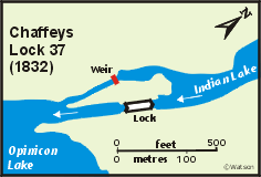
Chaffeys LockThen – if we make the Rendezvous that first day – the next “pleasurable” stop up could be Chaffeys Lock (37).  That was the location of Chaffey’s Rapids, “333 yards (304 m) in length, descending about 13 feet … where Indian Lake flowed into Opinicon Lake.”

And as such it used to mean a 1,500-yard portage, which would have required unloading both our canoes, carrying them and all our baggage those 1,500 yards, then packing up and setting out again.

Of course if you really want to you can still do that.  However, we’ll pay the small fee…

But once again there are some comfy lodgings there too.  (For a full list see Rideau Campgrounds, Cottages & Lodges – rideau-info.com.)  And according to the Rideau Canal map in Wikipedia, it’s 28 miles from the starting point in Kingston to Chaffey’s Lock.  Which should be a do-able enough starting-out pace for two old guys, aged 67 and 72.  Now, whether we see a young lady sunbathing In the altogether those first two days is another question entirely… 

*   *   *   *

bowdlerized version of what I saw one day on the Yukon River

*   *   *   *

The upper image is courtesy of the Wikipedia article on sun bathing.  The full caption:  “‘La promenade’ (1875) by Claude Monet.  At that time in the West, the upper social class used parasols, long sleeves and hats to avoid sun tanning effects.”  (More’s the pity.)  See also Woman with a Parasol – Madame Monet and Her Son – Wikipedia.

Re:  The Chilkoot Trail.  See my posts, On the Chilkoot &^%$# TrailPart 1 and Part 2.

The lower image is courtesy of Sun tanning – Wikipedia The caption:  “A woman sun tanning on a Portuguese beach.”

Next adventure: Paddling the Rideau “Canal”

A 1906 photograph of the Poonamalie Lock Station (32) on the Rideau Canal in Canada… 

*   *   *   *

Taking a break from Politics:  My next big adventure is coming up in August.

November 10, 2014 photo IMG_4329_zps7f7b5ddb.jpgMy Utah-brother and I will be paddling – some six to 10 days – up the Rideau Canal, from Kingston to Ottawa, Ontario.  (This is the same brother with whom I canoed 12 miles off the coast of Mississippi in 2014, as seen at right  And 440 miles on the Yukon River.  And hiked the Chilkoot Trail – “the meanest 33 miles in history” – and most recently hiked and biked 450 miles on the Camino de Santiago.)  

But don’t let the “canal” name fool you.  (Or the photo at the top of the page.)

This Rideau “Canal” is a water route of “mostly natural waters, made up of lakes and rivers.”  Of the 125 miles on this “canal,” only 12 – about 10% – are “manmade locks and canal cuts.”  The rest of the route consists of “natural waters,” as noted.  That includes Big Rideau Lake, some 20 miles long and over three miles wide.  (For comparison, Lake Laberge on the Yukon River – which we paddled in 2016 – is 31 miles long and up to three miles wide.)

The direct route from Kingston to Ottawa is 125 miles, but that includes over 677 miles of shoreline.  (Most choose that route because the prevailing winds are from the southwest.)  

Also, from Lake Ontario at Kingston the route rises 166 feet.  It rises to the “summit of Upper Rideau Lake,” from where it then descends 275 feet to the Ottawa River at Ottawa.

The canal system was built between 1826 and 1832, to help defend Canada by allowing boats to travel safely along the southern border.  I.e., Canadians could travel along their southern border – the border with the U.S. – “without having to travel along the St. Lawrence River, in gunshot range of the Americans.”  (And Donald Trump wasn’t even president…)  

The construction of the Rideau Canal was a preventive military measure undertaken after a report that during the War of 1812 the United States had intended to invade the British colony of Upper Canada via the St. Lawrence River, which would have severed the lifeline between Montreal and Kingston.

Then there’s this added note:  “It is the oldest continuously operated canal in North America.  Most of the locks are still operated by hand, using the same mechanisms that were used to operate the locks in 1832.”  (Speaking of “delightfully retro.”)

To give some perspective on how long such a canoe-trip can take, early voyageurs could cover the distance  in three days.  (But those were “very long days with lots of paddling.”)  And that would include portaging around the areas that have since been made locks and canal cuts.

Today the recommended pace is anywhere from six to 10 days, as noted.

And there are 26 lockstations to pass through.  Those you can either portage around – like the early voyageurs – or pay a fee.  They all have washrooms and potable water, and most offer camping.  (So it won’t be like canoeing 12 miles offshore, featuring eight days of primitive camping, on places like Half-moon Island, Ship Island, and “from time to time an occasional salt marsh.”) 

Other notes:  The name Rideau is French for “curtain,” and comes from the “curtain-like appearance of the Rideau River‘s twin waterfalls where they join the Ottawa River.”  And:

The canal also served a commercial purpose.  The Rideau Canal was easier to navigate than the St. Lawrence River because of the series of rapids between Montreal and Kingston.  As a result, the Rideau Canal became a busy commercial artery from Montreal to the Great Lakes.  However, by 1849, the rapids of the St. Lawrence had been tamed by a series of locks, and commercial shippers were quick to switch to this more direct route.

Thus it “remains in use today primarily for pleasure boating, with most of its original structures intact, operated by Parks Canada.”  But it’s not all fun and games, necessarily.

One Canal-guide noted three possible issues:  Wind, waves and big boats.  As for the first, while the prevailing wind is from the southwest, “be prepared for anything,” including a change in wind from the northeast.  Also, waves can be an issue on big lakes, “with large sections of open water unprotected by islands.”  And such large waves “can be an issue for a canoeist.”

The same is true of “big power boats (cruisers)” which also share the waterway.

One idea (the guide said):  Paddle close to shore.  It’s more interesting – with more wildlife and such – and keeps you further from the waves produced by big boats.  But if you encounter one – here I’m writing under the “memo to self” idea – the general rule is to turn into such waves, meeting them head on.  This “can actually be fun in a kayak (not as much fun in a canoe).”

I’ll be writing more on this adventure, if only in the form of a postmortem(But not in the literal sense.)  Meanwhile, here’s hoping we don’t have to use this little maneuver this August…

*   *   *   *

Image titled Canoe Step 14

*   *   *   *

The upper image is courtesy of Rideau Canal – Wikipedia.  Caption:  “Poonahmalee, on the Rideau River, near Smith Falls, Ontario – October 1906.”

Portions of the text were gleaned from “Watson’s paddling guide to the Rideau Canal” (PDF), by Ken W. Watson, First Printing 2012, Current Revision May 2018, at pages 9-10, 17-18.  The “wind, wave and big boat issues” are discussed on pages 13 and 14. 

Re:  “12 miles offshore.”  See Canoeing 12 miles off the coast of Mississippi, from 2016.  (It was a both a review of the 2014 canoe trip and a preview of last fall’s Camino de Santiago adventure.

 The “retro” image is courtesy of Delightfully Retro – Image Results.

The lower image is courtesy of How to Canoe (with Pictures) – wikiHow.

“Buen Camino!” – The Good Parts

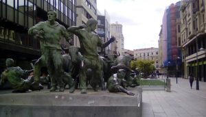
A Pamplona monument to running with the bulls.   (Something that is not on my bucket list!)

*   *   *   *

Some people reading “Hola! Buen Camino*” might think I had a lousy time in my five weeks hiking the Camino de Santiago in Spain.  For example, there was my comment on the first 10 days – after starting in Pamplona – being “pretty miserable.  My left foot constantly throbbed, until it blistered up and got tough.”  And that it took about 10 days for that to happen.

But there were lots of good things that happened during those 30 days on the Camino…

21743239_361474040953373_4085132213676039775_nThe good times started with Pamplona itself, where my part of the hike began.  I had drinks – two separate times – at the Café Iruña(Immortalized by Ernest Hemingway in The Sun Also Rises.)  And before the hike started my brother and I spent a day sight-seeing.  (During which I took my own photo of the “running of the bulls” monument, at left…)

Then too, at the end of the first day’s hike we stayed at the Albergue Jakue, in Puente la Reina.  That was September 13, when we made 15 miles but didn’t reach the albergue until about 8:00 p.m.  The good part:  “They had a $13 dinner special,* which included wine.  I GOT MY MONEY’S WORTH!”  To explain:  The wine came in a serve-your-own set of three spigots, not unlike those for draft beer.  (Except for the privilege of “pouring your own.”)  

As I recall, there was a red wine, a white wine, and a rosé (And I noted that I had a good portion of each.  As added in my journal, “Did I mention that I got my money’s worth on the wine?”)

Perhaps fittingly – or preemptively – during that first day we had hiked up and over the 750-meter high Alto del Perdon(Also known as the “The Mount of Forgiveness.”)  And as the link at left says:

It is a very windy place, and a long winding climb.  The path is not very steep but feels tiring…  Maybe the weight of unforgiven sins on our shoulders?  Once the top of the hill is reached, [the pilgrim-hiker] is welcomed by these statues representing pilgrims, braving the wind to continue their chosen path.  (Emphasis in original.)

For myself I was mostly glad that some enterprising lady had a “cafe movil,” basically a truck-pulled trailer offering cold drinks.  And it was interesting to go “‘horsing’ around with some of the cut-out statuary at ‘the Peak…'”  (The Peak of Forgiveness that is, as shown above right.) 

This is also a good time to mention that dinners on the Camino were universally delicious.  Most of the albergues featured a three-course special, including a salad, main course and choice of desserts.  Which may explain why – even though people said I “looked thinner” when I got back home – I actually weighed the same 160 pounds as when I left.

Then on September 14 we stayed at the Albergue de Capuchin, a pilgrim’s hostel run by monks in a monastery:  “Though ‘Spartan’ it has wifi … and a shower, w/ washer/dryer and a restaurant downstairs.”  That was in Estella, not to be confused with Estrella, “a lager beer, brewed in BarcelonaSpain.”  (With which I became well acquainted, while in Spain.)

Getting back to the hike, September 16 “was tough. 17.3 miles, from Los Arcos to Logrono. We’re both limping this fine Sunday morning.  I have an unpopped blister on the ball of my left foot…  I put a bandaid on it.  Then duct-taped a gauze pad on top of that.”  But along the way we had gotten some “jamone” sandwiches to go, and later ate them in a copse next to the “Ermita del Poyo,” or Hermitage of the Virgin of Poyo (As shown above left.)  

And incidentally, those “jamone” sandwiches became pretty much part of our daily routine.  Jamone is “basically a cured ham, thin sliced and dark hued, with cheese, on a half loaf of French bread,” as I wrote.  I suppose the bread was actually “Spanish,” but either way it was very chewy, as was the jamone itself.  Which led me to ponder at one point during the hike, “I wonder what people with dentures do for lunch in Spain, what with the chewy sandwiches?”

One answer?  They probably go hungry!

And speaking of routines, breakfast had a routine as well.  Fresh-squeezed orange juice – one feature I do miss about Spain – along with café con leche and tostadas(As in toast, or “more French/Spanish chewy bread, toasted and spread with butter and marmalade.”)  But however routine those early meals of the day, “dinners on the Camino were universally delicious.”

Unfortunately I’m approaching the limits of an ideal blog post – 1,000 words or less – so I’ll have to wrap it up.  And what better way to wrap up an emphasis on the good parts of the Camino than the photo at right:  A “scene along the way:  A shepherd and his ‘flocking’ sheep.”

I took that picture on September 17, the fifth day of hiking.  And aside from a quaint shepherd and his flock, you can also see “some fellow Peregrinos in the background, walking along the road.”  That particular day featured a lot of hiking on macadam and asphalt highways, but with more than two months’ hindsight, the picture above right made it all worthwhile.

Plus I discovered – in just checking my hand-written notebook – some more good parts of the Camino.  I wrote on September 15, “Two nice Spanish ladies helped us today.  One came from behind and zipped up my pack.”  (As in the side pockets that I’d left unzipped.)  Then, “Another [lady] pointed us back to where ‘we’d’ made a wrong turn.  We had to hike across a field.”

I remember that.  While the Camino is normally well-marked, there are times when you can get lost.  We’d taken what we thought was the right path, but then discovered there were no other hikers around.  That’s when the Spanish lady took the time to point out the error of our ways.

But now I’m getting really close to the 1,000-word maximum.  So I’ll wrap up with the picture below, from the first day off we took from hiking.  We reached Burgos – with a population of some 180,000 – on Friday evening, September 22.  (After 10 days hiking.)  After checking into our swanky hotel, we went out for a bite at the Cafe Dolar, an American-themed pizza parlor.

It was quite the Friday-night hot spot, and featured American-movie posters on the walls and ceilings, and some old-timey advertising posters and such.  I had such a good time that I went back Saturday afternoon, for a quick cerveza.  And to take the picture below.  (You can see my yellow-shirted arm to the left in the mirror.)  It was almost like being home…  (But better.)

*   *   *   *

*   *   *   *

The upper image is courtesy of Pamplona – Wikipedia.  Caption: “Monument to running of the bulls.”

“Note” also that an asterisk in the main text indicates a statement supported by a reference detailed further in this “notes” section.  Thus, as to “Some people reading ‘Hola! Buen Camino*,'” the full reference is to the post dated October 23, 2017, “Hola! Buen Camino!” – Revisited.  (As opposed to the “primitive” post I did while on the Camino itself, “Hola! Buen Camino,” dated October 3, 2017.)  

And as to the “$13 dinner special,” that would have been 13 euros. 

“Hola! Buen Camino!” – Revisited

My completed pilgrimage started at Pamplona, which you can see at the lower right of the map at Camino de Santiago 800 PROJECT: Map of the Routesilverarrow18.blogspot.com

*   *   *   *

Well, we did it.  My brother and I arrived in Santiago de Compostela on Thursday, October 12.  This was after hiking – and biking – the Camino de Santiago. (As was shown on a map at the top of the post page.)  as shown in the map above.  Along the way I occasionally listened to my iPod Shuffle – to help pass the time – and one of my favorite songs was It’s a Long Way to Tipperary.  Except in my mind I had to change the words to “It’s a long way to Santiago!”

*   *   *   *

I did my last post from Puente Villarente, in Spain – “about eight miles shy of León” – on October 3, 2017.  For reasons including that I only had my tablet, the post was extremely primitive.  But it did note that – upon reaching Leon – “we will have hiked 250 miles from Pamplona, in the 21 days since we left on September 13.*”  Here’s what I also noted:

The first 10 days hiking after leaving Pamplona were pretty miserable. My left foot constantly throbbed, until it blistered up and got tough. But the day off in Burgos helped a lot. And since then we’ve made good progress. Still, we had to implement a Plan B, which involves renting bikes in Leon and cycling the remaining 194 miles.

And speaking of Burgos: [Here I shared a picture of the city’s famous cathedral, with my “fellow traveler,” taken the morning of September 26, on the way out of town.  (Which took over an hour, hiking.) And to make a long story short, we covered the last 195 miles or so in seven days, riding mountain bikes, complete with panniers on the back.

In other words, in the first two weeks hiking we averaged 12  miles a day.  In the last seven days we averaged close to 28 miles a day. But in a way that was just a variety of Dorothy Parker‘s “different kind of hell.*” (We just got way too sore again, but in different parts of the body.)

You can get a better idea from a map at Camino de Santiago 800 PROJECT: Map of the Routesilverarrow18.blogspot.com. It took ten days to hike from Pamplona to Burgos, where we took our first day off.  It took another 10 days to reach Leon, where we took our second day off and picked up our pre-ordered bikes. Then in that long section from Leon to Burgos – of the total 450 miles – we covered 195 in seven days.

But not without mishap.  Neither one of us had ridden a bike in 40 or 50 years, so it wasn’t really surprising when my right handlebar took out – smashed the heck out of – the side-view mirror of some poor slob’s nice new car.*  In the second mishap I literally “ran my ass into a ditch…”

We were zooming downhill one afternoon.  I tried to adjust my left pantleg, and the next thing I knew I was laying in a ditch, bleeding like a stuck pig.  And not just any ditch.  A nice deep ditch covered with thorns and brambles on the sides and bottom.  The “stuck pig” part came when my Ray-Bans gashed the bridge of my nose, causing it to bleed profusely…

The third major mishap came a mere six kilometers from Santiago, when my rear tire when flat.

We finally got a new tube on and inflated, but then had a time getting the chain back on the derailleur.  I finally flagged down a passing Spanish cyclist.  He helped get that straight, but then – after he peddled on his merry way – we found out there were no rear brakes, which posed a problem.  We knew much of the remaining six kilometers was downhill, and also that if applied too forcefully, using front-only brakes can cause a cyclist to go “ass over teakettle.”

So my brother had us switch bikes, and we both glided – carefully and gingerly – into Santiago.

I’ll be writing on more of these adventures, including the several times I – or we – got Lost in Spain. But after five weeks in Spain – the last part of which included a nine-hour bus ride from Santiago to Madrid, and a 10-hour flight from Madrid to Atlanta – I can only say, with feeling:

There’s No Place Like Home!!

*   *   *   *

The upper image was courtesy of Camino de Santiago 800 PROJECT: Map of the Routesilverarrow18.blogspot.com.  

The “Tipperary” image was courtesy of It’s a Long Way to Tipperary – Wikipedia.

“Note” also that an asterisk in the main text indicates a statement supported by a reference detailed further in this “notes” section.  Thus as to the asterisk next to the passage “the 21 days since we left on September 13:”  We actually reached Leon on October 4. 

Re: Fellow traveller.  Here referring to a person who is “intellectually sympathetic” – in this case, to the crazy idea of spending thousands of dollars and five weeks to hike in a foreign country – as opposed to the term as used in U.S. politics in the 1940s and 1950s.  At that time and place the term was a “pejorative term for a person who was philosophically sympathetic to Communism, yet was not a formal, ‘card-carrying member‘ of the American Communist Party.” 

Young Dorothy Parker.jpgRe:  “Different kind of hell.”  The allusion is to Dorothy Parker‘s famously saying – whenever the door rang in her apartment – “What fresh hell is this?”  That’s also the title of Parker’s 1989 biography by Marion Meade.  See Amazon.com: Dorothy Parker: What Fresh Hell Is This?  

Re:  “Some poor slob’s nice new car.”  City streets in Spain are generally very narrow and difficult to maneuver. 

The “bicycle in a ditch” image was courtesy of Cyclist falls into ditch at opening of new safer bike path …telegraph.co.uk.

The lower image was courtesy http://f3nation.com/wp-content/uploads/2014/07/no-place-like-home.jpg.  See also No Place Like Home – Wikipedia, which noted that – aside from the famous line in the movie Wizard of Oz – the phrase may also refer to “the last line of the 1822 song ‘Home! Sweet Home!,’ words by John Howard Payne and music by Sir Henry Bishop; the source of inspiration for the other references here: ‘Be it ever so humble, there’s no place like home,’” and/or “‘(There’s No Place Like) Home for the Holidays,’ a 1954 Christmas song most famously sung by Perry Como.”  For a “live” version, see also There’s No Place Like Home – YouTube.