* * * *

* * * *
Welcome to the “Georgia Wasp…”
This blog is modeled on the Carolina Israelite. That was an old-time newspaper – more like a personal newsletter – written and published by Harry Golden. Back in the 1950s, people called Harry a “voice of sanity amid the braying of jackals.” (For his work on the Israelite.)
That’s now my goal as well. To be a “voice of sanity amid the braying of jackals.”
For more on the blog-name connection, see the notes below.
In the meantime:
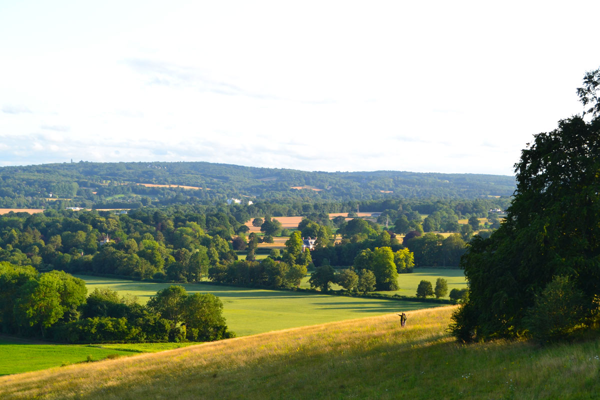
May 30, 2026 – I got back from that trip to Ireland last Thursday, May 21. (The one I’ve been previewing in the last four posts.) The trip kind of worked out as planned, but of course there were glitches, mostly having to do with how narrow the roads are in most of the country.
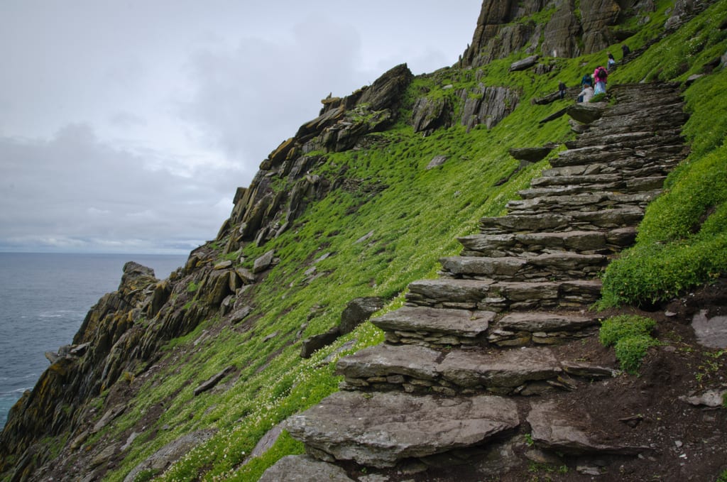
For another thing I didn’t get to do that boat trip out to Skellig Michael, with a chance to climb up to the top as planned. (On those tricky, slick hewn-out-of rock stairs.) The island’s pier is very small and at seven miles out in the Atlantic the little 12-passenger boat is prone to pitching up and down once it gets to the dock. Meaning the ride gets canceled if the winds go above 20 mph. Wednesday, May 13, featured sustained winds of 28 mph, with gusts above 40 mph.
So, here’s a brief summary of what did happen. We picked up a rental car after three days in Dublin, then drove 1,300 miles in 11 days, with only three mishaps. I smashed one side-view mirror and drove off the road once – into a mini-ditch – when I my attention wandered a split-second. (My travel partner side-swiped a car in a crowded, congested city with especially narrow streets, and is working “even as we speak” on the extra-added travel insurance claim.)
Other than that, the trip was fun. I especially enjoyed the pubs, including the seventh floor of the Guinness Storehouse in Dublin on our last night in Ireland. We had just driven in from Belfast after seeing the Mountains of Mourne (kind of) and trekking the Giant’s Causeway, of which lots more later. We got to the outskirts of Dublin around 4:00, but the in-city traffic was atrocious. We’d booked a 4:45 tour of the Storehouse but got there ten minutes late. They let us in but we quick-headed straight for the seventh floor. There, with your tickets, you each get one free pint of Guiness. I ended up with the better part of three pints, two of which were the Hop House 13 version I especially liked. (My “travel bud” didn’t drink much of her pint, and a fellow visitor dropped off his unused ticket, bless his heart!) But we’re getting ahead of ourselves.
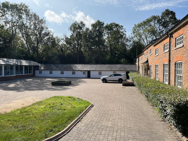
Let’s turn back to those two nights in Belfast, on May 18 and 19, just before that last night in Dublin on the 20th. In Belfast we stayed at Edenderry Town House, 171 Tennent Street. (A working-class neighborhood with a nice Stadium Bar within walking distance, unless it was raining.) Which leads to another note. I had packed my laptop and hauled it all over Ireland, but the only time I got to use it was on May 19. Here are some notes on what I wrote that evening:
I’m writing this on Tuesday, May 19, 2026, in the downstairs kitchen at 171 Tennent Road in Belfast… We wanted ground-floor rooms for the trip but kept getting 1st floor, which means second floor back home, and so there were lots of stairs to climb. Tomorrow, we head down to Dublin, by way of some church mound and the Mountains of Mourne. (And once we get there a tour of the Guiness facility.) From there an early night, then getting up no later than 7:00, returning the car, and heading to the airport – and home. So, impressions? Lots of narrow, really narrow roads. The traffic lights are strange too. Often in sets of three, one left, one maybe straight and one red, but to us foreign Yankees it takes time to decipher.
As for driving the unexpectedly narrow roads, before getting to Ireland I figured I’d mostly be a passenger, but I eventually did get the hang of driving in the left lane myself. (With some help from the rental Hyundai Kona‘s GPS, Google Maps on a phone and sometimes on-site, spur-of-the-moment passenger-navigator corrections or overrides.) That made for some interesting experiences in crowded cities with really narrow streets and cars going every which way.
(As for that Skellig Michael adventure, for days we kept checking the forecast, up to and including the afternoon of May 12, and it kept coming back with 27 and 28 mph winds. Finally, on the late afternoon of the 12th, at our place in Killarney, I got the official notice. Trip cancelled, full refund but it may take up to 10 days to register on the credit card site.)
Meanwhile, back to the downstairs kitchen at 171 Tennent Road in Belfast. I wrote on the laptop that I’d just checked the dryer for our last load of laundry before getting back home. “The clothes are still really wet. And some gruffy-looking young lodger is banging around the kitchen making what looks like a hamburger? But then he left. Hope he didn’t see my ‘gruffy’ comment I’d just typed out. ‘Nary a word was spoken.'” Meaning it was an awkward moment or two.
Which is also being interpreted: During our stay in Belfast, we saw only three other guests in the townhouse. Two looked like traveling electrical workers and the one other was the subdued, skinny bearded student who pretty much kept his own counsel. Then I added:
So anyway, other impressions. We’ve been going hard. This is the first time I’ve been able to use this unexpectedly heavy laptop, and I haven’t been able to get anywhere near my usual exercise quotas. And by the way, not only is the dryer exceedingly slow, but the door handle is in pieces making it hard to open the aforesaid door. I’m hoping we don’t get stuck with a big wad of damp clothes, locked in the dryer, after not being able to open the door.
After noting that I’d been eating way too much, and drinking too much beer – “Guinness, whatever” – I wrote that at 6:02 p.m. I checked the dryer. again. “Most of the quick-dry stuff is fairly dry, but things including my jeans and the fluffy warm, sheepskin-lined shirt that has been such a blessing are still damp; one might even say wet.” (The weather hovered in the mid-50s, and the sun rarely shone, but it didn’t feel really cold unless that wind was blowing hard, which happened often at the various cliffs we visited.) Then I wrote that I planned to do some yoga before dinner, “and maybe some ab crunches,” but that the upstairs Room 2 was “really tiny. Still, it was nice to be in one place two straight nights.” (And it was.) Then I noted the day’s highlight:
Today we booked an hour-long Black Taxi Belfast Tour at noon, but there was a mix-up in where to meet. We finally ended up at a Leonardo hotel – not the one in Jerusalem – but ten minutes late and the guy had a 1:00 o’clock booking. Meaning we got a 50-minute tour. Interesting but depressing, much in-depth stuff on The Troubles starting in 1969 and continuing with flare-ups even to this day. They have a wall separating the Catholic from the Protestant sides. The British built it and called it The Peace Wall, not unlike the Wall of Separation we saw in Bethlehem. (Of all places.)
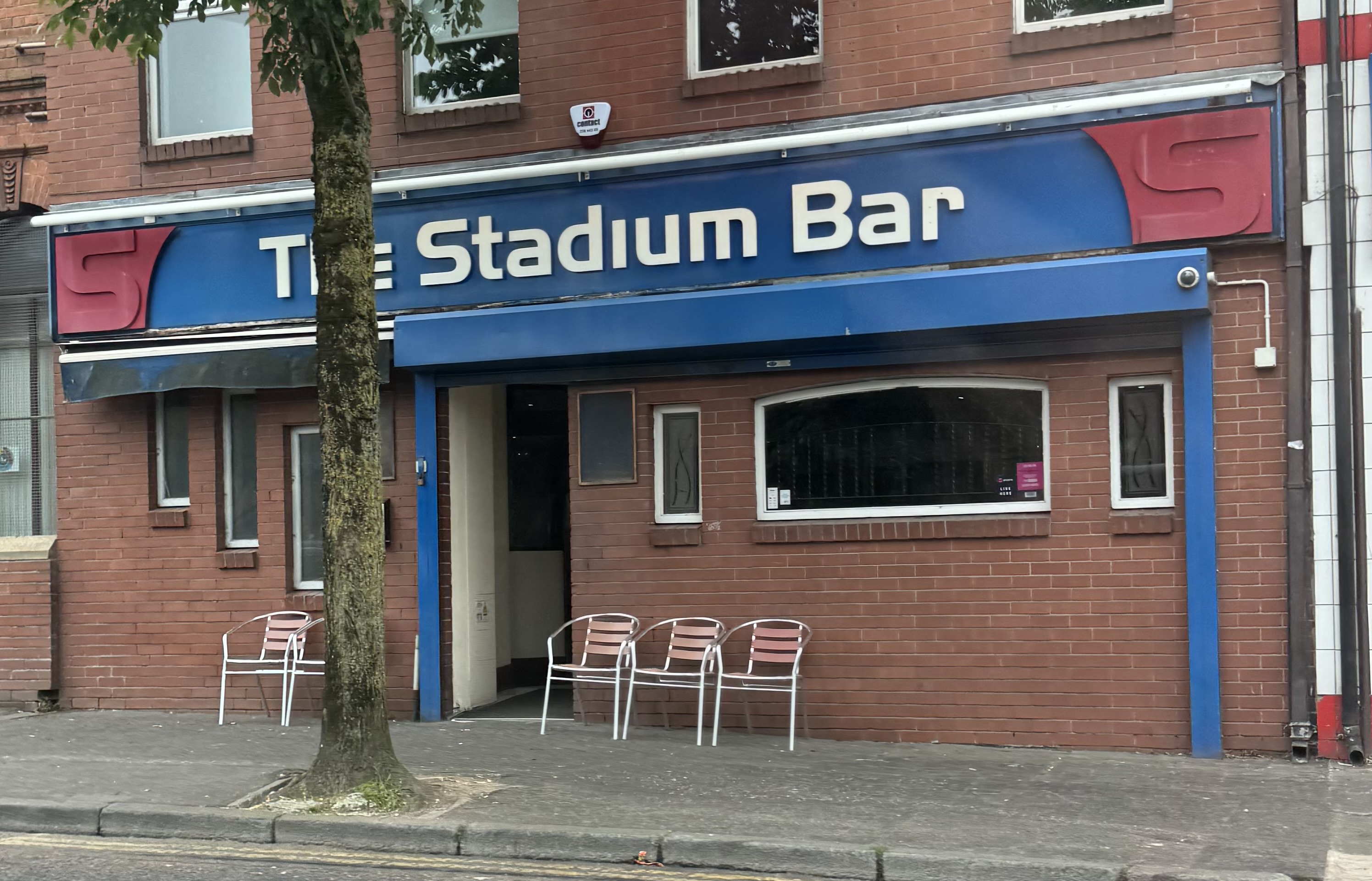
See the Notes for more on the Leonardo Hotel in Jerusalem and “the Wall” in Bethlehem, but there was a big positive in staying in one place for two straight nights. I got to visit The Stadium Bar in Belfast a couple times, enough to be welcomed as an almost-local. (In that “a vibrant spot perfect for catching up with friends over a game. Known for its casual atmosphere, it’s a popular choice among locals for its friendly vibe and top-notch music.”) And it was.
One final note. We actually did get to see the Rock of Cashel [and] O’Connor’s Pub in Doolin, in County Clare, but that’s a story for a later time. (As to what actually happened.) Meanwhile, here’s to remembering that “vibrant spot perfect for catching up with friends.”
* * * *
* * * *
The upper photo is courtesy of Images, “seventh floor guinness distillery dublin ireland.” With a page that included “Guinness Storehouse Gravity Bar: A Stunning Panoramic View – Dublin, the vibrant capital city of Ireland, is known for its rich history, friendly locals and of course, Guinness. Nestled in the heart of Dublin is the Guinness Storehouse, a must-visit destination for beer enthusiasts and travelers alike. While the entire Guinness Storehouse tour is an immersive experience, there is one spot that stands above the rest – the Gravity Bar.“
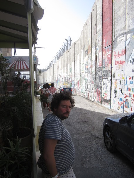
For more on the Leonardo in Jerusalem, see 2020’s This time last year – in Jerusalem! (On the Leonardo Hotel, Saint George Street 9, “catty-corner from St. George’s College.”) As for Bethlehem‘s Wall of Separation, also known as the “Israeli West Bank barrier,” see “Walls of Separation” in my companion blog. (“And in a bit of sarcasm – or irony – we stopped at the ‘Walled Off Hotel.’”
I took some photos of both the “Walled Off” and the Wall of Separation that runs right by it, and right through the City of Jesus’ birth. Doing that I caught the expression of the Palestinian in the foreground of the photo above left, and later commented, “That look about says it all.”
(To see a larger image of “that look about says it all,” click on the post link above.)
The lower photo is courtesy of “stadium bar belfast Images.”
* * * *
Re: The Israelite. Harry Golden grew up in the Jewish ghetto of New York City, but eventually moved to Charlotte, North Carolina. Thus the “Carolina Israelite.” I on the other hand am a “classic 74-year-old “WASP” – White Anglo-Saxon Protestant – and live in north Georgia. Thus the “Georgia Wasp.”
Anyway, in North Carolina Harry wrote and published the “israelite” from the 1940s through the 1960s. He was a “cigar-smoking, bourbon-loving raconteur.” (He told good stories.) That also means if he was around today, the “Israelite would be done as a blog.” But what made Harry special was his positive outlook on life. As he got older but didn’t turn sour, like many do today. He still got a kick out of life. For more on the blog-name connection, see “Wasp” and/or The blog.
* * * *