Monthly Archives: June 2024

Leaving Cheylard, on to St. Etienne…

*   *   *   *

undefined
We three had a good time – packs offscrambling around this “ruined chateau” in Luc…

*   *   *   *

The last post said this post would have more on the hike to St. Etienne, “with various trials and tribulations we went through getting there,” so here goes. We left Cheylard-l’Évêque and headed to Saint-Étienne-de-Lugdarès. The hike ended up totaling 12 miles or more, but that included an extra 4.9 miles off the Trail. (One way, per Google Maps, and I believe it.)

Before leaving Tom checked his guidebook and saw there were no “coffee cups” along the way. (John Brierley‘s guidebook for Caminos de Santiago uses a small pink coffee cup to signify an open cafe along the way.) So before leaving Cheylard’s Refuge du Moure we took up the hostess’s offer for packed lunches at eight Euros apiece.

From there the day started off well.

In the morning we passed through beautiful horse country, heading to Luc. Lots of wide green fields and pastoral grazing herds, but we could also see steep hills on the horizon. “We have to climb up and over that?” Also lots of that slippery-rock trail like we’d seen so much so far. Watch each step, “Careful! Don’t step there!” Lots of potential knee-wrenching, ankle-twisting careful foot-placing. (One reason for us being lucky to make a mile and a half an hour.) But the sky was a deep blue and the wind down around those green pastures wasn’t too bad.

Then we entered FORET DE MERCOIRE, Mercoire Forest, where we passed much of the day. “Primeval, Pacific-coast type rain forest.” That was my take on it, but the website added some interesting notes. “Relax in the peace and quiet of this huge and enchanting forest … where the river sources of Moure de la Gardille (1503m), Allier, Langouyrou and Chassezac all begin.” Along with this, “In the 18th century, Mercoire Forest is where many people fell victim to the Beast of Gévaudan.” (Of which more at our destination, Saint-Étienne-de-Lugdarès.)

The guidebook showed the GR-70 turning south at Luc, near the end of what is normally a day’s hiking quota. But Tom couldn’t find suitable lodging there, so once we got to Luc we had to keep heading east, off the Trail. That added the extra 4.9 miles, which doesn’t sound like much but makes a big difference at the end of a long day lugging a 20-pound pack.

But first we stopped at Château de Luc – shown above – for a break. We explored the castle ruins at some length before proceeding on. The tower had some great views of the surrounding countryside. Then after clambering around a bit we got back on the Trail, down through Luc. There we lucked on to a mom-and-pop gite, where I enjoyed another Bière blonde La Stevenson. (Like the one back in Brugeyrolles the evening of our first day off.) But unfortunately, the place had no restrooms. I tried to pass through some wooly curtain-like things at a door marked privé, but the lady yelled “No, no!” And that wasn’t the end of the story…

Back on the Trail, or rather off the Trail for that extra 4.9 miles. The place Tom reserved for the night was right across from Eglise St Etienne and – according to Google Maps – the hike should take an hour and 48 minutes. (Assuming you don’t stop.) But first you have to cross over D906, a busy main highway, then get on D19 (Luc Village), then head northwest and cross a bridge over the Allier River. (Separating Lozere from Ardeche.) Then you head back southeast, down past where you started, to where Le ruisseau Masméjean flows east from the Allier.

At first it was a nice change walking on paved highway. Lots of paved highway. But somewhere along there I remembered hearing the human foot is not designed to walk on asphalt or such hard surfaces – and I came to believe it. Then too something I’d eaten started “disagreeing.” I was in agony for a while, until I finally called ahead to Tom for a short break. Then came a steep scramble down into the trees that lined the road. (Beside the babbling ruisseau.) I remember a log and lots of bramble bushes, maybe poison ivy? My shins and calves ended up covered with itchy scratches, but they healed up in a day or two. Anyway, once it was all over – “let the reader understand” – I scrambled back up to the highway feeling lighter and better.

From that point it wasn’t too far to our lodging. “We got here at the crack of 4:40 p.m.” At the B&B – right across from Église Saint-Étienne – we got two separate rooms, one for the guys and one for Carol,. (Not a tiny room, beds jammed together like the night before.) The hosts said they had good internet but we never did figure out the password. Lots of “gaudy stylized letters and numbers.” At dinner the hostess explained the town was birthplace of the original Papillon, and that the famous – or infamous – “Beast of Gevaudan” claimed his first victim there. 

From there – Sunday, the 24rh – we faced a long hike to La Bastide-Puylaurent. (A name including the “puy” that means another volcanic hill.) But first we had to get back to the Stevenson Trail itself, in Luc, and didn’t relish paying for the same real estate twice. (Hiking back that extra 4.9 miles, adding significantly to the day’s total.) Which we mentioned to the nice lady hostess, who proceeded to volunteer her husband to drive us back to Luc. Which he did, after we stowed our packs in the rear and jammed into the small French sedan. Only to find out Carol had left her phone back at the lodging, which would have been a much bigger pain if we’d discovered that while hiking back to Luc. But the husband was pretty mellow and things worked out.

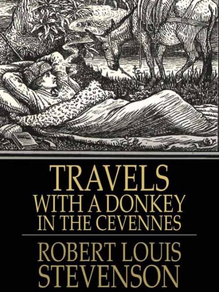
A side note: A mile and a half east of Bastide – where we were headed – is the Trappist monastery Notre-Dame-des-Neiges (Our Lady of the Snows), “visited by Robert Louis Stevenson … and described in his book Travels with a Donkey in the Cévennes.”

We didn’t visit the monastery but the place we stayed at had good internet – internet we could actually get on – plus a great dinner. “Only one choice, but what a choice!” But that’s a story for next time, along with more interesting incidents. (But no “gang aft aglay” for a change.)

In the meantime I just ran across this photo from that “Camping Above the Clouds,” which gives a better idea of how beautiful and spiritually freeing it was. More adventures to come…

*   *   *   *

photo camping.jpg
That place “camping above the clouds,” the night before we got to Langogne…

*   *   *   *

The upper image is courtesy of Château de Luc – Wikipedia.

For this post I referred to Gearing up for the Stevenson Trail in France, from May 27, 2023, and The Stevenson Trail – from Le Puy to La Bastide-Puylaurent, from September 3, 2023, a week before I flew out, September 10. (Arriving in Paris on the 11th.” Also, Dreams, maps and reality – hiking in France, 2023, from October 28, 2023, after we all got back from the trip.

The French ruisseau translates to brook or small stream. I couldn’t find a translation for Masméjean.

The full “Mercoire” link is FORET DE MERCOIRE – CHEYLARD-L’EVEQUE | Lozère Tourism.

“Paying for the same real estate.” See Not me. I don’t like to pay for the same real estate twice, on General Patton’s not wanting to “to fall back and regroup” during the Battle of the Bulge.

Re: Distance from Luc to Bastide. The straight-south route- along the highway – is a bit over four and a half miles. The official GR-70 route turns southeast at Laveyrune, then east to Notre-Dame des Neiges, then back west to Bastide, for a total of 9.8 miles. (Which figures into the next post.)

The lower image is courtesy of Camping | Camping Au-Delà des Nuages | Rauret, a place I earlier identified as “Arquejols.” (I covered our stay there in From Monistair to “East of Langogne.) That is, we stayed there the third night out, the night before we got to “east of Langogne” and our first day of from hiking, after four days. But I just found this link while writing up my book on the 2023 journey. The website leads with this: “Living in Harmony with Nature. Lovers of Mother Nature, we offer a service aligned with our values: All our infrastructures are made from local wood.” (They also offered a nice seven Euro bottle of Tarnac IGP Cevennes Blanc 2021 Wine.

*   *   *   *

Back on the Trail – but no “sluts?”

*   *   *   *

A French breakfast at Refuge du Moure, in Cheylard-l’Évêque. (That’s coffee in the bowl…)

*   *   *   *

June 16, 2024 – The last post on my ’23 GR 70 hike in France talked of our first day off. (After four days’ shakedown hiking, from Le Puy en Velay to a tiny hamlet 40 minutes east of Langogne.) And of a wonderful, lazy afternoon off, snuggling under a comforter, sipping hot tea and processing lessons from the first four days. And enjoying a cold Bière La Stevenson that night, before a switch to sharing two big bottles of wine, part of a communal dinner with four other pilgrims. (And wondering how readable my notes would be next morning.) 

Next morning we set out again, “back on the Trail.” Our destination – that Friday, September 22 – was Cheylard-l’Évêque. Stevenson himself had a tough time getting there. He arrived only after a miserable night camping and running across two “impudent sly sluts.”

Both are described his chapter, “Upper Gevaudan – A Camp in the Dark,” on his hike from Langogne to Cheylard. (Bordering “the Forest of Mercoire.”) He left Langogne on Tuesday, September 24,* 1878. But back then there was no direct route and it was “two o’clock in the afternoon before I got my journal written up and my knapsack repaired.” (He started way late.) Besides, he’d been told it would take only an hour and a half to get there.

But he got lost, then rejoiced on reaching Sagne-Rousse. (Per Google Maps, 2.4 miles and 54 minutes from Cheylard, hiking.) He rejoiced at being no longer as lost; he had “a sure point of departure.” But then it started raining, hailing, and the wind kicked up. Two hours later – getting darker and darker – he “tack[ed] through” a bog. He finally found a village and saw some locals, with children, but when he went to ask for help, “children and cattle began to disperse.” Only two 12-year-old girls stayed behind. (Locals were “but little disposed to counsel a wayfarer,” and “one old devil simply retired into his house, and barricaded the door.”) That left one source:

As for these two girls, they were a pair of impudent sly sluts,* with not a thought but mischief. One put out her tongue at me, the other bade me follow the cows; and they both giggled and jogged each other’s elbows.

He ended up hiking on, with Modestine, and finally found another village but no one answered his knocks there either. Finally he had no choice but set up camp in the pitch-dark:

All the other houses in the village were both dark and silent; and though I knocked at here and there a door, my knocking was unanswered. It was a bad business; I gave up Fouzilhac with my curses.* The rain had stopped, and the wind, which still kept rising, began to dry my coat and trousers. ‘Very well,’ thought I, ‘water or no water, I must camp.’

So much for “pioneering as fun.” He spent a cold, wet and miserable night, but next morning woke up feeling much better. More to the point, at the end of “Camp in the Dark” Stevenson brought up “the infamous Beast of Gévaudan,” a man-eating ogre who prowled the area. And that night, cold and wet, Stevenson could sympathize with the Beast. And by the way, Gévaudan – home of the Beast – is 54 miles southeast of Le Puy. (Right where we were heading.)

As for us, it was a mere five hour, 8.66 mile hike. (According to Tom’s calculation, verified later by Carol’s step-counter.) But also for us it was the first of six straight days hiking. And – as on the day-off afternoon – the weather was cold. I started off with five layers, topped by the Gorton Fisherman rain jacket. (Which gave surprising warmth.) Then peeled off layers as the day warmed up and strapped them a-flapping on my pack.

As I said, we covered the miles in five hours (“not bad”) and arrived, early afternoon, at Refuge du Moure. But the place didn’t open until 5:00, so we had to sit outside, packs against a wall, as other pilgrims came sauntering in as the afternoon wore on. At 5:00 we had to get in line and head up the outside stairs to get our room assignments. Like the Army? “Hurry up and wait,” with none of that first come, first served. (“Hey, we got here first!”)

As in many such places we had to leave our shoes by the entrance. (Where anybody could steal them?) And the room we got was small. “Small room, 4 beds. All together. Cozy! You go from privacy to no privacy in 24 hours.” And it was still cold. I wrote later, “My feet are cold!” Along with, “Interesting hike. For a time we thought we took the ‘off trail’ to Chaudeyrac.*” (A small town three miles west of Cheylard.) Stevenson had a similar problem, getting to Cheylard, but that was because of some quirk in the local magnetic fields that messed up his compass. Our confusion was due to a misleading sign. (“That’s our story and we’re sticking to it!”)

Anyway, Saturday morning I posted greetings from Cheylard and “L’Refuge.” I added that at breakfast I was “Carbing up for today’s 11.8-mile hike. They drink coffee from the big bowl. And note the cute little gingerbread donkey.” Later, while the others got ready I went into the community room, where a poster showed Stevenson’s path we’re following. (Mostly.) But “without the donkey. We are our own donkeys, in my case with a 20-pound pack. Five pounds over the recommended 10 percent of body weight. But worth it, in cases of cold, wind and hail.”

Then we got back on the Trail again, or rather off the Trail. The guidebook map showed the Trail turning south at Luc, but Tom couldn’t find suitable lodging there. So we headed east the extra 4.9 miles to Saint-Étienne-de-Lugdarès. The B&B where we stayed was right across a mid-town plaza from the cathedral Église Saint-Étienne. (Not the one in Paris.) That night I posted:

St. Etienne was interesting. At dinner the nice hostess explained that the burg was birthplace of the original Papillon. Not the guy played by Steve McQueen, THE original. She added that the famous – or infamous – “Beast of Gevaudan” claimed his first victim here. The Beast is big in St. Etienne.

But the dining room had posters showing both “Papillons,” the better-known Steve McQueen version, from in his 1973 film, and also a poster of the real one, Henri Charrière.

I’ll be writing more on the hike to St. Etienne in the next post, with various trials and tribulations we went through getting there. But first a few loose ends on what Stevenson wrote of his trek to Cheylard. (Aside from the “sluts.”) First of all, in his time and as opposed to today: “There was no direct road to Cheylard, and it was no easy affair to make a passage in this uneven country and through this intermittent labyrinth of tracks.” (These days the path is well-marked.)

As for “Fouzilhic,” he called it “three houses on a hillside, near a wood of birches.” Then of his approaching Cheylard, “the destination I had hunted for so long… Candidly it seemed little worthy of all this searching… What went ye out to see? thought I to myself.” (Referring to Matthew 11:7.) Later he wrote, “Why any one should desire to visit either Luc or Cheylard is more than my much-inventing spirit can suppose.” But he may have just been in a bad mood.

In a better mood he wrote about why he put up with such “bunts and blunders” that are such a big part of adventuring. That is, voluntarily taking part in an “unusual, exciting, and possibly dangerous activity, such as a trip or experience.” (Even, for me, at the ripe old age of 72.)

“For my part, I travel not to go anywhere, but to go. I travel for travel’s sake. The great affair is to move; to feel the needs and hitches of our life more nearly; to come down off this feather-bed of civilization, and find the globe granite underfoot and strewn with cutting flints.” (Emphasis added.)

Which is as good an explanation as any, I suppose. And by the way, that guidebook I got in Le Puy has that quote on the inside front cover, and since 1878 thousands of pilgrims have followed Stevenson’s advice – and his Trail. As for me, and as we used to say while hiking The Way of St. Francis in 2022, “It sure beats playing bingo at the Senior Center!”

*   *   *   *

As noted, “the Beast” is big in Saint-Étienne-de-Lugdarès

 *   *   *   *

The upper image is courtesy of myself. A picture I took with my tablet and posted on Facebook, as is the bottom photo, noted below.

Also, for this post I referred to Gearing up for the Stevenson Trail in France, from May 27, 2023, and The Stevenson Trail – from Le Puy to La Bastide-Puylaurent, from September 3, 2023, a week before I flew out, September 10. (Arriving in Paris on the 11th.” Also, Dreams, maps and reality – hiking in France, 2023, from October 28, 2023, after we all got back from the trip.

Re: Forest of Mercoire. See also Forest of Our Past, Forest of Our Future: Managing the Woods, for good descriptions and pictures of a typical day on a GR-70 hike in the area.

Stevenson “left Langogne on Tuesday, September 24, 1878,” The Wikipedia article Travels with a Donkey in the Cévennes said he left on Monday, September 24. Both Stevenson’s book and Yearly Calendar 1878 – United States say September 24 was a Tuesday.

The word “slut” had a different meaning today than it did in 1878. Today it refers to a sexually promiscuous woman, but back then and for much of its history it referred to “dirty, slovenly woman,” or a kitchen maid or “scullery drudge.” (“Compare slattern, also English dialectal slummock ‘a dirty, untidy, or slovenly person.'”) See slut | Etymology of slut by etymonline, and Slut – Wikipedia. But none of those fit Stevenson’s use. I think he meant “Two pre-pubescent girls more interested in gaggling and jogging each other’s elbows than helping out a stranger.”

On Stevenson’s feeling better after a miserable “camp in the dark.” Of that he wrote:

I had been after an adventure all my life, a pure dispassionate adventure, such as befell early and heroic voyagers; and thus to be found by morning in a random nook in Gevaudan – not knowing north from south, as strange to my surroundings as the first man upon the earth…

And speaking of Chaudeyrac, as in, “For a time we thought we took the ‘off trail’ to Chaudeyrac”. It’s a “commune in the Lozère department in southern France. The small villages of Fouzillic and Fouzillac, 300 m from each other, are located on the territory of the commune. The villages are mentioned by Robert Louis Stevenson in ‘Travels with a Donkey in the Cévennes.'” And a note on that last: Stevenson passed through two small villages 330 yards apart with similar names, Fouzillic and Fouzillac, but he referred to them as Fouzilhic and Fouzilhac. “He was there on September 24-25, 1878.” (From the Wikipedia article on Chaudeyrac.) The map on page 24 of that guidebook I got in Le Puy shows Chaudyrac as “off the path” after the near-90-degree turn, shortly after “Fouzilhac.” And yes that’s how the guidebook spells it. Also, Fouzilhac is the small town he “gave up … with my curses.

Re: “Bunts and blunders.” Referring to a quote from Practical Mysticism, by Evelyn Underhill:

Hearing now and again the mysterious piping of the Shepherd, you realize your own perpetual forward movement . . . and so are able to handle life with a surer hand.  Do not suppose from this that your new career is to be perpetually supported by agreeable spiritual contacts, or occupy itself in the mild contemplation of the great world through which you move.  True, it is said of the Shepherd that he carries the lambs in his bosom; but the sheep are expected to walk, and to put up with the bunts and blunders of the flock.  It is to vigor rather than comfort that you are called.  (E.A.)

Ariel Press (1914), at page 177. See also Evelyn Underhill – Wikipedia.

The bottom photo I took with my tablet and posted on Facebook. It was one of several large on-the-wall images of “the Beast” in the hallway of the B&B where we stayed.

*   *   *   *

“Acadia” – and a hike up Cadillac Mountain…

*   *   *   *

A view of Bar Harbor, Maine – in the left distance – from the top of Cadillac Mountain…

*   *   *   *

June 5, 2024 – Next post I’ll get back to last September’s (2023) hike on the Stevenson Trail in France. But I just finished another hiking trip – up to Maine. It included Acadia National Park and several long hikes, including a grueling trek up to the tippy-top of Cadillac Mountain:

If Acadia is the king of the New England coast, then Cadillac Mountain is its crown. The highest peak on the Atlantic coast from New England to Florida at 1,530 feet, its summit rewards hikers with panoramic views of the park’s forested hills, mountains, and scattered islands, with the ocean stretching endlessly beyond. 

(See How to Hike Acadia National Park’s Cadillac Mountain.) But first I had to get there.

I live southwest of Atlanta, and my hiking-venture brother lives in Springfield Massachusetts. Tom’s wife Carol signed up for a “hospitality” seminar near Saco, Maine, and they invited me along. The five-day invite-along included a plan for some hiking at or near Acadia National Park, so I said, “Okay!” The kicker – the surprising or ironic twist – was that I had to be there no later than Monday, May 27, and my great-niece graduated high school on Friday, May 24.

Plus the proud parents were having a graduation party not slated to start until 1:00 Saturday afternoon. That meant instead of a relaxing three-day drive up, it would be more like two days. (From mid-afternoon Saturday to near the same time Monday.) And that was over Memorial Day weekend, so aside from expected heavy interstate traffic, I had to take the precaution of booking rooms for that Saturday and Sunday way ahead of time. But it worked out. Mostly…

I had to shuck and jive around the Atlanta Beltway. (“Notorious for heavy traffic and congestion.”) But once past the US-78 exit to Clarkston, the driving smoothed out. I’d booked a room in Lincolnton, NC, mostly because I always take US 321 instead of going by way of Charlotte. (I find that city’s traffic almost as bad as Atlanta’s.) From there up I-77 to I-81, through Virginia’s beautiful Blue Ridge mountain area, to the Hershey PA exit just past Harrisburg.

There’s an Arooga’s Grille House & Sports Bar at 7025 Allentown Boulevard. I’ve been there before, and it’s a nice place to relax after a long day’s drive. From there – on Monday – it was just a hoot and a holler‘s drive up to Springfield, and the chance to ride in someone else’s car. We three left the next morning (Tuesday, May 28) and ended up – 360 miles and nine hours later – at Bar Harbor Cottages. Actually in Salisbury Cove, six miles from downtown Bar Harbor.

Next morning we toured Acadia, looking for a place to start the hike up Cadillac Mountain.

Which brings up the difference between walking and “sauntering,” which I do. I’d heard that John Muir came up with the term, but recently found an earlier version, from Thoreau‘s book Walking. (First published as an essay in the Atlantic Monthly after his death in 1862.)

I have met with but one or two persons in the course of my life who … had a genius, so to speak, for sauntering, which word is beautifully derived “from idle people who roved about the country, in the Middle Ages, and asked charity, under pretense of going à la Sainte Terre,” to the Holy Land, till the children exclaimed, “There goes a ‘Sainte-Terrer,’” a Saunterer, a Holy-Lander… [But] the saunterer, in the good sense, is no more vagrant than the meandering river, which is all the while sedulously seeking the shortest course to the sea.

We definitely didn’t “saunter” up Cadillac, but here I feel a need to clarify terms. (Voltaire said, “If you wish to converse with me, first define your terms.”) Aside from Thoreau, most other people define sauntering as walking “in a slow, relaxed manner, without hurry or effort,” but that isn’t right either. At least not for me, and not as we trekked up Cadillac Mountain.

Back at home my normal walking pace is a mile in 24 minutes. But according to Dr. Cooper, that doesn’t earn me any aerobic credit at all. To make up for that I normally hike with at least two sets of ankle weights. (Ten pounds total.) Which is what I wore on the trek up Cadillac Mountain. Along with a ten-pound pack, with necessaries including but not limited to water, sunscreen, and a peanut-butter-and-jelly sandwich for energy.

But that’s enough about my weird exercise system. Back to this latest hiking adventure.

For Cadillac Mountain, we took the North Ridge Trail, starting at a small pull-off with “extremely limited” parking. I didn’t note the time we started, as I usually do on Camino hikes. (A reminder for next September.) But I wrote that it took three hours actual hiking time – keeping track of those almost-aerobic points – not counting rest breaks and a lot of standing stops on the way up. I also wrote that it was a “LONG, steep and rocky hike.” (With those 10 pounds of ankle weights and 10 pound pack.) And by the way, for training hikes in July and August I use the ankle weights plus a 20-pound weight vest. (Or pack.) Then on the Camino I ditch the ankle weights, and without them I feel like I’m “walking on air.” (Relatively speaking anyway.)

Anyway, the view once we got to the top was beautiful, but next day we took it a bit easier.

On Thursday, May 30, we visited Deer Isle – “mysterious, evocative and easy to get lost in” – and its main harbor, Stonington. I’d read about the “isle” – not island – in Steinbeck’s Travels with Charley. At first we were a bit disappointed, but eventually the day turned out well.

We did two hikes early, the first one out to Lookout Rock. (It’s technically near Brooksville, on another of the many islands clustering around “Deer.”) Then a second hike at Scott’s Landing Preserve, near the eastern end of the bridge to Deer Isle. Later that afternoon we spent a pleasant couple of hours at the Maine Center for Coastal Fisheries, on Atlantic Avenue jutting out into the harbor. (Aka, “Discovery Wharf.”) I’d call it highly recommended, with a lot of detail on Maine’s lobster industry. (Apparently troubled, something I didn’t know.*)

And now a word about our lodging. In Salisbury Cove we stayed at Bar Harbor Cottages and Suites. Then in Saco, officially Old Orchard Beach, Tom and I stayed at Elmwood Motor Court. This was after dropping Carol off Friday afternoon at 4:00, for her two-day Camino “hospitality” seminar. (Where you learn how to manage an albergue in Spain, the equivalent of auberges in France, “small hotels or public houses especially in villages or the countryside.”)

You see a lot of those tiny. two-room cabin-cottages in the area we visited. Cute, but a bit cheek by jowl for three “seniors.” (One bathroom.) The one in Salisbury Cove was “rustic,” with a screened in porch, complete with a wooden rocking chair. And the paint-work was a bit slap-dash. The “Elmwood” was perfect for two, though no porch rocking chair. On the other hand it was right across Saco Avenue from Birdies Grill & Tavern.

On Saturday Tom and I did two hikes, the first a “catch as catch can” on the Eastern Trail starting in Saco. But we found out early on that it wasn’t completed yet, so we turned to a second hike on the Scarborough Marsh Nature Trail. (Two hours and eight minutes of actual hiking time, not counting breaks including one for another PB&J lunch.)

Another note. The weather alternated between hot during the day and a lot chillier at night than what a 72-year-old from Georgia is used to. (In late May and early June.)

And finally, on Sunday before picking up Carol at 4:00, Tom and I visited the Portland Museum of Art. One nice thing? You can spend an hour or two inside, then go out for lunch and come back. I especially enjoyed the number of Impressionist paintings.

From that point a short walk with Carol on “her” nearby but fenced-off beach, then a long drive back to Massachusetts. (Punctuated by a late dinner at a Cracker Barrel.) Those were the highlights, but next post it’s time to get back to that hike on the Stevenson Trail in France. We’d just enjoyed our first day off, no hiking, at a cute hamlet east of Langogne, and were ready to head out again. For a short – mere seven miles – hike to Cheylard-l’Évêque. But the first of six straight days hiking, with a 20 pound pack – but no ankle weights! Stay tuned…

*   *   *   *

*   *   *   *

The upper image is courtesy of Cadillac Mountain Acadia National Park – Image Results. As for “Acadia” being in quotes, the name comes from Greek, with “the extended meanings of ‘refuge’ or ‘idyllic place.'” See Acadia – Wikipedia, adding the name – with an “r” added – comes from the Arcadia district in Greece. “Explorer Giovanni da Verrazzano is credited for originating the designation Acadia on his 16th-century map, where he applied the ancient Greek name “Arcadia” to the entire Atlantic coast north of Virginia.” The article also noted the Acadian diaspora to southern Louisiana, when French inhabitants were forcibly relocated: “People living in Acadia are called Acadians, which in Louisiana changed to Cajuns, the more common, rural American, name of Acadians.”

Re: Shucking and jiving. A term I learned more about doing this post. According to Urban Dictionary, it originally referred to “intentionally misleading words and actions that African-Americans would employ in order to deceive” the White Folk in power. In use by the 1920s if not earlier, it was a “tactic of both survival and resistance. A slave, for instance, could say eagerly, ‘Oh, yes, Master,’ and have no real intention to obey.” (And here I am, a retired old white man using the term to illustrate driving around the ATL.) According to Wikipedia it can refer to “joking and acting evasively in the presence of an authoritative figure,” and can involve “clever lies and impromptu storytelling, to one-up an opponent or avoid punishment.” All of which may be useful skills in the future, depending on the outcome of 2024’s presidential election. But my point here? “I love going down those ‘rabbit trails!'”

Re: Cooper’s definition of aerobics. In his system, to earn a single aerobic point you need to walk a mile in no more than 20 minutes. Being a self-described Sainte-Terrer,” I rely more on the World Health Organization’s definition. See Physical activity – World Health Organization (WHO), which says a man my age should do a maximum of 300 minutes of medium-intensity aerobic activity or at least 75 minutes of vigorous-intensity aerobics. At home I do the maximum and the “at least.” (180%.) The week of the Cadillac hike I had 740 minutes credit for medium aerobics, mostly hiking, adding in extra credit for the ankle weights. (It’s complicated, worked out through years of trial and error.)

Re: Maine’s troubled lobster industry. See for example, The Uncertain Future of Lobstering in Maine – Modern Farmer, and The Live Market: Maine’s lobster industry is at a turning point.

The lower image is courtesy of Robert Louis Stevenson Trail – Walking in France.

*   *   *   *