* * * *
* * * *
January 21, 2026 – The last post I did on my August ’25 hike on England’s Canterbury Trail ended up at the Days Inn Clacket Lane. (In the Roadchef Motorway Service Area, Westerham.)
I had hiked 13 miles that day, mostly on my own; my brother Tom had taken the train from Merstham up to London to meet his wife, Carol. (She was flying in from the States and would join us for the remaining 45 miles of the hike.) Once I checked in at the Day’s Inn that late afternoon, I reveled in the big room, clean-sheeted bed and nearby amenities. (Which included a close-at-hand market where later that night I got two cans of Gordon’s Special Dry London Gin&Tonic for a nightcap.) I enjoyed that wonderful, relaxing evening in paradise, but “little did I know that evening in paradise led to an oft-harrowing hike on the morrow.“
And on that Wednesday morning, August 20, “the morrow” was here.
My plan for the day was simple enough. All I had to do was hike on alone the 6.25 miles to a guest house “somewhere in Dunton Green, ‘a small village and civil parish in the Sevenoaks District of Kent… It lies in the valley of the River Darent, 3 miles (4.8 km) north of the town of Sevenoaks.’” There I’d meet up with Tom and Carol, taking the train down from London.
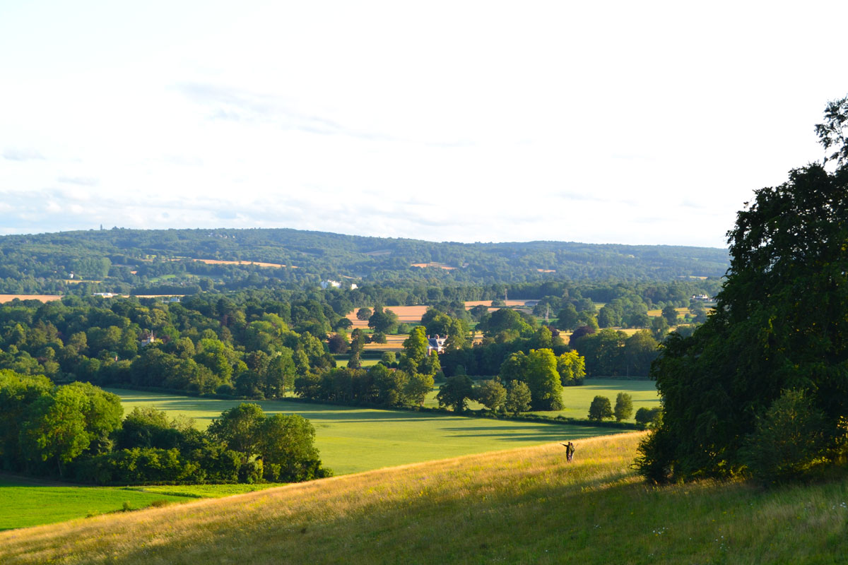
I left the Day’s Inn at 8:07 that August 20. The morning was foggy and overcast, and it took 32 minutes to hike up Clackett Lane, through the tunnel under the M25 “interstate,” then head east on Pilgrim’s Lane to Betsom’s Farm. I got there at 9:19 a.m. To that point Pilgrim’s Lane was a narrow one-lane road with tall thornbush hedge on both sides. There wasn’t a lot of traffic to dodge, but then I came to a T-stop. (At what I found out writing this was Lord Chatham’s Ride, Chevening.) There were no signs telling which way to go, but the Pilgrims’ Way Guidebook said I should turn left to reach Chevening Hill, “tallest point on the Pilgrim’s Way.” That sounded like a Canterbury Trail highlight, so I turned left and chugged on slowly uphill a good 10 minutes.
Which brings up the fact that earlier on the hike – back hiking St Swithun’s Way – I thought it might be better to follow the Google Map way to the next destination…
Hiking uphill I checked my Google Map locator. I didn’t have internet but the locator gave me an idea where I was headed. And I was headed the wrong way, away from where I was supposed to be going. So, after hiking uphill a good 15 minutes and seeing no end in sight, I turned and headed back downhill. Then I started looking for a road or path so I could turn east. Google indicated I should hike up Sundridge Road. But, “Remember that back in my Bishops Sutton to Alice’s Looking Glass post I noted that I found St. Swithun’s Way, the first part of the hike, ‘weighed in the balance and found wanting? Neither well marked nor well kept, overgrown in many places?” (As opposed to the North Downs Way, the second and longer part of the Canterbury Trail.)
Meaning: Back on St. Swithun’s Way I thought it might be better to take the Google Map way to the next destination; the heck with the guidebook. Then I started hiking Sundridge Road.
That Google Map way led to series of near-death experiences, in the form of cars zipping by at high speeds with little or no room on the side of the road. “More of the tall thornbush hedge on both sides,” as in hedging me in. I despaired of making it to Dunton Green in one piece, as numerous cars zipped by on my left and right, as I gingerly changed sides-of-the-road looking for the widest shoulder. But then, out of the blue and at about 12:15 this place appeared, the Eat‘N’Mess. (The full address is Unit 4 Turvins Farm Dairy, Sundridge Rd, Sevenoaks.)
Eat‘N’Mess excels in offering a diverse gluten-free menu without compromising on taste or quality. Known for its fantastic coffee and delectable baked goods, this cafe is a favorite brunch spot in Sevenoaks. The welcoming atmosphere and accommodating staff make it a delightful place to enjoy a meal.
And what a relief it was, nestled among a farm compound as it was. Among other things it had WiFi, meaning I could find out the other good news: “Google Maps says the Rose and Crown is only 23 minutes away.” And Yu’s Guest House was just a bit beyond that.
In time I left the Eat‘N’Mess refreshed and got back on Sundridge Road. I headed northeast until it hit Morant’s Court Road, right where it changed names from Starhill Road. I passed over the A21 and got to the Rose and Crown, then kept going until I saw Elands Veterinary Clinic. The spreadsheet said to go through the gate across the street and head up the unmarked road.
Coming in to Dunton Green, after nearly getting side-swiped by zooming cars on the off-the-pathway highway sections, I passed the Rose and Crown. On to the vet place, then through the wood gate. Two “houses,” one a carriage house that looked institutional, the other at the top of the hill, up a long winding lane. Yu’s email said not to bother the private house, which I took to be the first one. But the house at the top of the hill – when I finally got there – had a trampoline and all kinds of kid’s play stuff and other evidence of private ownership.
So I hiked back down the long winding unmarked lane, and since the carriage house still looked institutional I repaired to the Rose and Crown to await further developments. (To ponder the situation and use their WiFi to maybe get word from Tom.) While there I also used the WiFi to post on Facebook. I described a picture I sent back home, showing “my second pint of Estrella and Today’s Soup, carrot and squash. (Not bad, actually.) Life is good.”
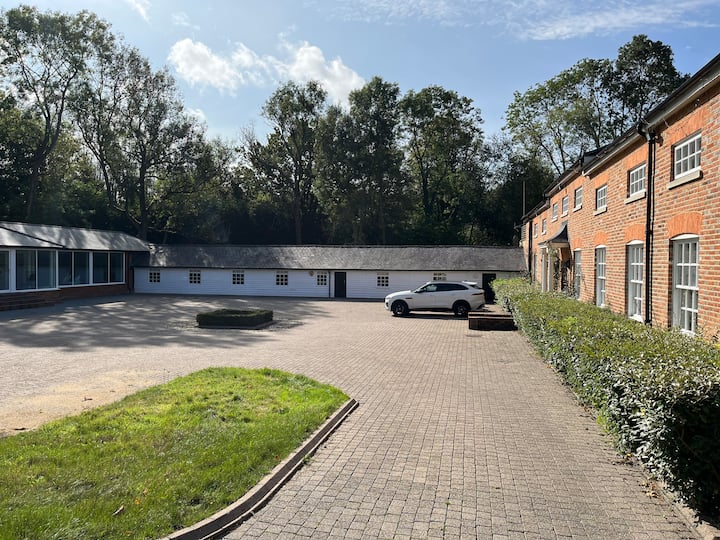
Feeling refreshed I headed back down Morant’s Court Road, and through the wooden gate. It turned out the carriage house was the place. It had three wings, three separate buildings. The instructions said, “The black door in the white building,” the one in the middle. So I tried the door and it opened. Once inside I saw a “big long place.” Two bedrooms along the front corridor and two couches and a day bed at one end of a long rec-room. Ping-pong and pool tables.
Later that day Tom and Carol arrived; we three were back together again. They checked out the apartment and Tom picked the day bed at the end of the rec-room. I got the private room close to the bathroom. (I’d gotten a couch or two in the last few days.) For dinner we hiked back up to the Rose and Crown. Next day we relaxed, did laundry and went to the grocery store down below the M26. Carol got adjusted from her jet lag, but mostly we just relaxed – and got mentally ready to resume the hike. On Friday, August 22, we’d hike ten and a half miles to The Tanyard, West Malling. Once we got there, we’d have five more hiking days to reach Canterbury.
* * * *
* * * *
The upper image is courtesy of “view From Chevening Hill” Uk – Image Results. (The “PW’s highest point” quote is on page 100 of the Pilgrims’ Way Guidebook.) The image came with a page headlined, “New tour on Chevening/Knockholt Walk.” It went on, “I’ve not tried it myself but delighted to relay the news that there is a useful detour on this North Downs stroll that means you don’t have to walk along Sundridge Road (although it is only a couple of hundred feet or so). So now you can follow a path behind Turvin Farm after Point 5 and rejoin the path back up the escarpment.“ I liked the part about not having to walk along Sundridge Road; I wish I’d known that at the time.
The lower image is courtesy of the Yu’s Guest House link. I have no idea what the other two buildings hold, though I think one of them may be the owner’s residence?
* * * *