Category Archives: Travelogs

“Naked lady on the Yukon…”

This is something like what I saw – unexpectedly – canoeing 440 miles on the mighty Yukon River

*   *   *   *

I just got back from two weeks canoeing the Yukon River.  (That’s also the caption for the Wiki-photo at left.)   And the “mighty Yukon” is the last place on earth I would expect to see a lady sun bathing.

But one moment, out of nowhere, there she was…

You can see the full story below.  I just wanted add – at least for now – that in the picture at the top of the page, for the Yukon setting, you will need to imagine no sand.  (And no “Bikini Bottom,” for that matter.)

Instead, imagine a bend in the Yukon River, a canoe turned over next to a “good campsite,” and a red blanket, on which lay the “naked lady.”  (And I think she was a blonde…)

But first, some background.

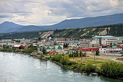
Downtown Whitehorse and Yukon River, June 2008My last post – “Many furriners” – noted it was last July 26 – a Tuesday – that my brother and I started the drive from Utah to Whitehorse, Yukon Territory.(Shown at right.)  Four days later – on Friday, July 29 – we met up with my nephew, fresh out of the Army.

From there we drove to Skagway, Alaska.  The following Monday – August 1 – we started a four-day hike on the Chilkoot Trail.  (The “meanest 33 miles in history.”)

And here’s a news flash.  There’s a reason they call it the “meanest 33 miles in history.”  I’ll be detailing that little jaunt in a later post.  (To be titled, “On the Chilkoot &$%# Trail!”)

But back to the Yukon River.  Once we three finished the “Chilkoot &$%# Trail,” my nephew flew back east – to Philadelphia – and from there to Penn State University, to begin fall classes.

That left two old geezers – my brother, 70, and me, just turned 65 – to paddle our canoes “up*” the Yukon River.  From Whitehorse  to Dawson City, that’s a distance of 440 miles, and we covered it in 12 days.  (Not counting the full day we took off on Sunday, August 14, in beautiful Carmacks, Yukon Territory, to rest and refit.)

Before we left I checked a web-post, Canoeing the Yukon River – Our Time Machine is a Canoe, written by Murray Lundberg.  Some years ago he did pretty much the same trip as ours, with his son Steven.  One big difference:  They started at the Lake Laberge Campground – instead of Whitehorse – “to cut down the still-water distance that we’d have to paddle.”

Which is another way of saying that paddling a canoe on Lake Laberge* – shown at left – is a real pain.

But that’s a story for another post.

Now back to the naked lady…

It was Friday, August 12.  We were a day away from Carmacks, and had been on the river five days already.  (And finally made it off “Lake &^%$# Laberge.”)  About 4:00 my brother was way ahead of me, when he went around a right-hand bend and looked like he was heading to shore, for a break.

There followed one lo-o-o-o-o-o-o-ng right-hand curve in the Yukon, one that seemed to last forever.  It was getting late and we were looking for the “good camp” listed in the guidebook.

When I finally got to the end of the long right-hand curve, I could see something, way off, a half-mile or so ahead.  (Where the river turned sharply to the left.)  I saw two small dots, near the bank – at what I later learned was the “good camp” we were looking for.  One of the dots was light and the other dark.  The lighter dot kept moving, to the left, downriver, and I figured it was my brother.  But I wasn’t sure which “dot” to paddle toward.

So I took the middle course, and as I got close to the bend in the river, I could see the dark dot was a green canoe, turned over.  (Which we never do.)  Then – I began to see – there was a red blanket next to the canoe, and something light on it.

That turned out to be the aforementioned naked lady – a reprise interpretation of which is shown at right – laying there in her birthday suit, face down, for all the world to see. (Or at least two passing canoeists.)  

Which brings up the current on the Yukon River.

Generally the current is pretty fast.  It ranges from over four miles an hour up to seven miles an hour in some places.  (Except on “Lake &^%$# Laberge.”)  That’s the kind of current that helps you paddle 440 miles in 12 days.  But it also means that when you see something totally unexpected, by the time you recognize it, the current is already moving you downriver.  (Creating a flash in the pan, so to speak.)   Which meant that by the time I recognized the naked lady as a naked lady, the current was already pushing me farther down-river.

Besides, my brother was already downriver, waiting.  (Having gotten an eyeful himself.)

As to the lady’s identity:  The last day on Lake Laberge we had landed – for a much-needed break – next to a couple in a tandem canoe.  They were from Turin, Italy, and later on in the trip we kept running into them, further downriver.  They pulled into Carmacks not too long after we did, on Saturday, August 13.  And when we finally got to Dawson City – a shade after 3:00 p.m. on Saturday, August 20 – they had gotten there a few hours before.

So it was my brother’s opinion – first expressed at Carmacks, on the 13th – that the “better half” of that nice Italian couple was the mystery lady, sunbathing au naturel on the banks of the Yukon.  (Besides which they took the one “good” camping spot on that stretch of the river.) Unfortunately, neither one spoke very good English, and there seems to be no diplomatic way to translate, “Was that your wife’s naked butt we saw back on Friday the 12th?”

But enough about the Naked Lady on the Yukon.

This is the first of several posts I plan to write about our other adventures this month.  And as noted before, those adventures started with our hike on the Chilkoot Trail.

To do that we first had to go to Skagway, Alaska.  And at the left is my picture of beautiful downtown Skagway, the day we got there, last July 30.

This was after checking out the Yukon River, in Whitehorse, after checking out of our hotel.  Then we drove the 110 miles or so to Skagway itself.  That’s where – among other things – we had to get a special permit to hike the Chilkoot &$%# Trail.”  (They won’t let just anybody on there!)

And among other other things, we also learned we’d lost an hour crossing into Canada.  That’s because there’s a special Alaska Time Zone, one hour earlier than the Pacific Time Zone they use in British Columbia and the Yukon Territory.

And there’s one more thing.  I took the photo at right, of one of the first things I saw at the visitor’s center in Skagway.  I thought at the time that it was unique to this part of Alaska.

However, after further review – for this post – I found out that’s not the case.  See for example Footprints on the toilet seats? – Reuters.  (“One Norwegian tourist in Malaysia said, ‘They can be very messy because people don’t seem to know how to use the toilets.  You find black spots, footprints on the toilet seats, and there’s water everywhere.'”) 

Or Footprints on the Toilet Seat: Guidebooks for Novice Travelers, noting Chinese tourists – for example – who behave “in ways the locals saw as inappropriate.”  On that note see also Travel pro-tips from the Chinese government: Don’t leave footprints on toilet seats [or] spit in hotel pools.  All of which is – I suppose – one reason they say Travel Broadens The Mind.

(And you might even see a naked lady along the way.)  But one thing both a good travel experience and a good pilgrimage will teach you:  “There’s No Place Like Home.”  (As shown below.)  

I’ll be writing more about my August adventures, including the next post:

*   *   *   *

Wizard of oz movie poster.jpg

As Dorothy said in The Wizard of Oz, “There’s no place like home!”

*   *   *   *

The upper image is courtesy of Sun tanning – Wikipedia, the free encyclopedia.  The caption:  “A woman sun tanning on a Portuguese beach.”

Re:  Paddling canoes “up” the Yukon River.  To most people, going “up” means to go north, while to go “down” means to go south.  (With “over” meaning east or west.)  But to go “down” a river means to go downstream.  And while many rivers flow “down” or south, the Yukon – like the Nile – flows north.  So while we were paddling “up” north, we were also paddling “down,” as in “downstream…” 

Re:  Lake Laberge.  Most people know the name as “Lake Labarge,” from the poem by Robert Service, The Cremation of Sam McGee.  In the poem, “the narrator winds up hauling the body [of Sam McGee] clear to the ‘marge [shore, edge] of Lake Lebarge.'”  So Service changed the name to “Labarge” to rhyme with “marge.”  (See artistic license – also known as “poetic license” – at Wikipedia.)  Also, the image of Lake Laberge is courtesy of lakelaberge.ca.

The lower image is courtesy of The Wizard of Oz – Wikipedia.  See also No Place Like Home – Wikipedia, which noted that – aside from the famous line in “Wizard of Oz” – the phrase may also refer to “the last line of the 1822 song ‘Home! Sweet Home!,’ (John Howard Payne and Sir Henry Bishop); the source of inspiration for the other references here: ‘Be it ever so humble, there’s no place like home,’” and/or “‘(There’s No Place Like) Home for the Holidays,’ a 1954 Christmas song most famously sung by Perry Como.”  For a “live” version, see also There’s No Place Like Home – YouTube.

Re: “So many dang furriners?”

*   *   *   *

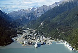
Aerial view of Skagway, Alaska.Last Tuesday – July 26 – my brother and I started the long drive north, from Utah to Skagway, Alaska.  (At left.)

From there our plan was to spend four days hiking the Chilkoot Trail.  (The “meanest 33 miles in history.”)

In fact, the Chilkoot is so mean that we had to invite my nephew – my brother’s son, just out of the Army – to go along with us.  (Just in case one or both old geezers sprained or broke something…)

Now, about “all those furriners…”

That’s pretty much the way I felt several times over the last few days.  (After we crossed over into Canada, on Wednesday, July 27.)  But it got especially bad at the free breakfast we had at the Super 8 in Fort Nelson, BC, on Friday morning, July 29.

I’ll have more on that later.  But first, some highlights from our trip north.

The first day out we made Great Falls, Montana.  We drove 560 miles, starting around 9:00 a.m.  My photo at right shows the sky to the east, just as we got to the Great Falls exit.

That means we had 120 miles to go, to get  the Canadian border. (Unless they’ve built a wall or something.)  And driving through eastern Idaho and Montana was a good reminder of how HUUUUGE this country is, and especially the west.

Meanwhile it looked like there was a fire to the west of Great Falls, as shown in my photo at left.  I figured there was a wild fire to the west of the city, which would explain the smoke we smelled driving up to exit 278.  And it turned out my hunch was right.  (As shown by the front page of the next day’s Great Falls Tribune, for July 27.)

It took about 30 minutes to go through Canadian customs, where Interstate 15 becomes Canada Highway 4.  That’s where we had to “Arretez-vous, ici.”  (“Stop here.”)

Which brings up some of the anomalies of traveling in Canada.

For one thing, aside from speaking French, Canada uses kilometers instead of miles.  So when the speed-limit sign says “Maximum 110,” you have to calculate kilometers to miles.  (Divide the number in half, then add 10 percent.)   So using that method – half of 110 is 55, plus 11 – and you figure out that means about 65 mph on your dashboard.

And that when the speed sign says “40,” that means you have to slow down about 25 mph.

Then too, at first blush the gas prices seemed unbelievable.  For example, we saw signs in Alberta that said “96.9.”  Unfortunately, that was the price for a liter, or one-fourth of a gallon. So multiply that by 4 and you get gas at $3.87.  (In British Columbia we paid over $5.00 a gallon.)

Another thing, driving through Alberta.  We saw acres and acres of fields like this:

At first I thought the yellow-flowered crop-fields might be “golden rod,” but it turns out they were fields of Canola.  (See “A Canadian success story.”)

Then too, they have a weird system for Americans to pay for gas up here.  You have to swipe your credit card, then go in to the office and sign something.  It sounds simple but in practice it can be easy to forget.  Which explains why my brother Tom drove off from the Shell station in Airdrie.  We ended up still making good time, despite having to backtrack a bit.  (And make a belated payment for the gas, on pain of seeing “rollers” in our rear-view mirror.)

That night we made it to Drayton Valley, Alberta.  (West and a tad-bit south of Edmonton. And Calgary was HUGE to pass through!)  The next night – Thursday – we made it to Fort Nelson, British Columbia.  In America-talk, Fort Nelson runs from Mile-marker 301 to 308.

And that would be on the famed Alaska Highway, which officially starts in Dawson Creek, British Columbia.  (As shown at left.)  We passed through Dawson Creek about 3:00 in the afternoon, on the way to Fort Nelson.  And at the border of British Columbia, that 3:00 became 2:00.

(Thanks to the change-over to Pacific Time.)  

The next day – Friday, July 29 – we made it Whitehorse, Yukon Territory.  That happened despite our worst expectations, and a slew of stoppages for highway construction along the way.

This was after three straight days of 12-or-more-hours-of-driving.  I got plenty of pictures, but for some reason they don’t transmogrify from my cell phone to my computer, the way they do back in America.  And in fact there was no cell-phone service at all.  Once you hit the Canadian border, you can forget about texting the folks back home.

And I found out that my American mobile hotspot doesn’t work in Canada either.  (Which may explain why the cell-phone pictures don’t transfer.)  I hoped that once we got to Skagway, in Alaska – which is technically in the U.S. – those problems would go away, but they didn’t.  Still no cell phone service, and still no mobile hotspot.

So anyway, we hit the city limits of Whitehorse at 7:00 p.m.  (Pacific Time, or 10:00 p.m. ATL Time.)  Saturday morning we checked out the Yukon River for the canoe part of this expedition. (That is one FAST current, estimated at about 7 miles per hour.) Then we drove to Skagway and got there early Saturday afternoon.  (To prep for the hike on the Chilkoot Trail, as seen at right, in winter.)

However, there was yet another mix-up about what the actual time was when we got here. When we crossed into British Columbia – Thursday – I started gearing up to Pacific Time.  (Three hours earlier than ATL time.)  But when we got to a “necessary” store in Skagway, the sign said, “Be back at 1:45,” and it was well past that.  That’s when I learned that Skagway is on “Alaska Time.”  Alaska Time is one hour earlier than Pacific Time, which meant that when it 3:10 when we arrived in Skagway, it was 7:10 back in Atlanta.

One final note:  We DID get to watch the 13-minute video on what to do when you meet up with a bear.  That was for the benefit of those hardy folk planning to hike the Chilkoot Trail.  My take on the video:  “Be sure and get behind the OTHER two guys in your hiking party!”

As noted before, stay tuned for “further bulletins as events warrant!”

I’ll let you know how the hike on the Chilkoot Trail turns out…

*   *   *   *

Calvin and Hobbes

*   *   *   *

The upper image is courtesy of Willie & Joe: Summary-1 – amyatishkin.  (And of course,Bill Mauldin.)

The lower image is courtesy Calvin and Hobbes Comic Strip, October 25, 1986.

On the Independent Voter

Emanuel Leutze (American, Schwäbisch Gmünd 1816–1868 Washington, D.C.) - Washington Crossing the Delaware - Google Art Project.jpg

Washington Crossing the Delaware” – which he managed to do without “rocking the boat…”

*   *   *   *  

In the last post, I noted that I was about to take a 10-day “family trip north:”

Three cars, carrying five adults and seven younger folk, ranging in age from 10 to 22.  Among other places, we’ll be visiting Valley Forge, the Liberty Bell and Philadelphia in general…  Last but not least we’ll see Hershey PA … “The Sweetest Place On Earth.”

I’m now writing two days after that family vacation ended, on Sunday, July 3d.

CB Terminology and Trucker SlangWhich means we all managed to get home – in our three-car convoy – on the eve of July 4th.

(It also meant that we had to drive home through FOJ-Weekend traffic, thought without the use of CB lingo, as shown at left.  We used cell phones…)

The three-car convoy lasted until Sunday, the 3d, when one of our three cars “peeled off” after a stop for gas – and fresh peaches – in Spartanburg SC.  The remaining two cars split up near Commerce GA, at Exit 149 on I-85.  (After dropping off a niece and her two kids.)

That left me alone, in my car, for the first time in 10 days.  But by the time I got back on the road – after getting some iced coffee – there was yet another traffic jam, further down I-85, closer to Atlanta.  (Thank you ATL.)  So I ended up getting home about 8:30 Sunday night.  And as noted, this was after a grueling two-day, thousand-mile-plus drive from Doylestown PA.

(A lot of those “grueling traffic jams” had to do with the fact that – in the America psyche – It’s Not Just Your Car, It’s Your Freedom.  But “too many dang cars” is a whole ‘nother topic entirely…)

Getting back to the grueling drive home:  Saturday we left our family reunion about 1:30, then got to drive down through Independence-Day-Weekend traffic.  (Especially heavy around Philadelphia, Wilmington, Baltimore, Washington D.C., and Richmond VA.)

That left us with 550 miles left to drive on Sunday.  (Two days ago.)  But the good news is that – even after all that “quality time” together – we’re all still speaking to each other.  (Mostly.)

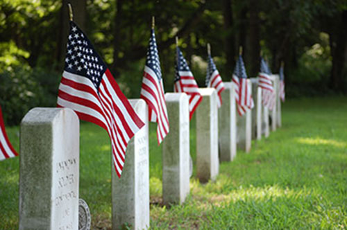
graves-imgTurning to more pleasant topics:  On Friday afternoon – July 1 –  we visited the Washington Crossing Historic Park. (The one on the Pennsylvania side, as seen at right.)  

Which of course makes this a perfect time and place to bring up Independence Day in the U.S.:

Independence Day is a day of family celebrations [with] a great deal of emphasis on the American tradition of political freedom…  Independence Day is a patriotic holiday for celebrating the positive aspects of the United States…  Above all, people in the United States express and give thanks for the freedom and liberties fought by the first generation of many of today’s Americans. (E.A.)

Which brings up the fact that – somewhere along the line – I intended to make this post more about the recent road trip than about Independence Day itself.

For example, I was going to mention what John Steinbeck wrote, about how “We don’t take a trip.  A trip takes us.”  (See also Quote by John Steinbeck.)  I also planned to cite a year-ago post – A Mid-summer Travelog – from my companion blog, along with “I pity the fool!”

The latter post was on Ralph Waldo Emerson – at left – and his saying, “Whoso would be a man, must be a nonconformist.”

Which raises two timely topics for this July 4th.

One topic is Independence Day itself.  The other is the growing number of Independent Voters in this country.  And according to Wikipedia, Independents are those voters who don’t align with either major political party, Republican or Democrat:

An independent is variously defined as a voter who votes for candidates and issues rather than on the basis of a political ideology or partisanship;  a voter who does not have long-standing loyalty to, or identification with, a political party;  a voter who does not usually vote for the same political party from election to election;  or a voter who self-describes as an independent.

And their numbers seem to be growing, which could be either good or bad.

For example, Wikipedia noted first that the definition itself is “controversial and fraught with implications.”  And that according to one theory, the growth of Independent Voters is a bad sign for the country.  (For reasons including but not limited to:  “independents may be more susceptible to the appeals of third-party candidates,” and that “the more independent voters, the more volatile elections and the political system will be.” Which could explain our present political situation…)

But personally I have my own theory.

My theory is that the American political system was designed to keep “moving back toward the middle.”  That is, once a party becomes dominant – for the moment – it tends to pay too much attention to what we might call its lunatic fringe.  Put another way, if one party dominates too long, it tends to move too far away from the middle.  (Left or right, as the case may be.)

5d5d8f10f87f013014e9001dd8b71c47

And so – traditionally – In response to being out of power, the other party has – generally speaking – tended to move back toward the middle of the spectrum.  It does so primarily to reach out to those voters in the middle.  (Those voters who decide elections.)

But that hasn’t happened lately.

One or both parties – it seems – have refused to compromise, and compromise is the keystone of a American democracy.  (See The Spirit of Compromise: Why Governing Demands It and Campaigning Undermines It, and/or The Spirit of Compromise.)

In other words, one or both parties have moved toward black and white thinking.  Psychologists call that splitting, or “the failure in a person’s thinking to bring together the dichotomy of both positive and negative qualities of the self and others into a cohesive, realistic whole:”

It is a common defense mechanism used by many people.  The individual tends to think in extremes (i.e., an individual’s actions and motivations are all good or all bad with no middle ground)…  Splitting creates instability in relationships because one person can be viewed as either personified virtue or personified vice…  [This] leads to chaotic and unstable relationship patterns, identity diffusion, and mood swings.

So one solution to today’s political-party black-and-white thinking – it seems to me – is the growth in the number of voters who identify themselves as Independents.  The problem there is that Independent or Moderate Voters are losing power in the process of one or both parties deciding on a particular candidate.  (As for President of the United States.)

Which brings up the biggest problem of being an Independent Voter.  That problem is:

“One must always choose the lesser of two weevils!”


*   *   *   *  

The upper image is courtesy of Washington Crossing the Delaware – Wikipedia, the free encyclopedia.

Washington Crossing the Delaware is an 1851 oil-on-canvas painting by the German American artist Emanuel Gottlieb Leutze.  It commemorates General George Washington’s crossing of the Delaware River on the night of December 25–26, 1776, during the American Revolutionary War.  That action was the first move in a surprise attack against the Hessianforces at Trenton, New Jersey, in the Battle of Trenton.

I also used the image and related information in my companion blog.  (See On Independence Day, 2016.)  There I noted that “Wikipedia listed inaccuracies” in the painting – by Leutze, working in Germany in 1850 – which included:  The American flag in the boat “did not exist at the time of Washington’s crossing;”  The boat was the wrong model, and much too small;  The painting showed “phantom light sources besides the upcoming sun,” while the crossing itself “took place in the dead of night;”  and finally: “Washington’s stance … would have been very hard to maintain in the stormy conditions of the crossing[, and] would have risked capsizing the boat.”  (See also artistic licence.)

“And speaking of rocking the boat, Washington and his fellow Founding Fathers did in fact rock the boat, according to the British during the Revolutionary War.  (In the sense of causing “trouble where none is welcome;  to disturb a situation that is otherwise stable and satisfactory.”)  See also John Paul Jones’ CLOSEST call, in my companion blog.  It included a British caricature of the man they called “the pirate Paul Jones.”  (To us of course he’s the Father of the American Navy.)”


Re:  Cars representing freedom.  For a different take, see The Car Once Symbolized Freedom… ← The Urban Country, which noted in part:  “Things have changed. We took it too far.”

The image of flags on gravestones is courtesy of Washington Crossing Historic Park – Official Site.  The caption and original image can be found under the “Soldier’s Graves” link:

From the parking area at the Thompson-Neely House, it’s a short walk across the Delaware Canal to the memorial cemetery where an unknown number of Continental soldiers who died during the December 1776 encampment in Bucks County are buried.

The article noted that no American soldiers were killed during the crossing or the First Battle of Trenton, but that “others did succumb to exposure, disease or previous injuries.”  The article also noted a second battle, on or about January 2, 1777, involving Lord Cornwallis:

General Lord Charles Cornwallis of the British Army had been looking forward to a trip home to England…  In fact, on December 27 he had sent his baggage aboard the HMS Bristol.  But after the disaster at Trenton, his leave was promptly cancelled and he was ordered to Princeton.  A very unhappy Cornwallis took command of the British forces there on January 1, 1777.  He had one clear mission: to find the American army and destroy it.

In this second Battle of Trenton, Washington held off the attacking British forces until the evening of January 2, then withdrew north from Trenton, which led to his victory in the Battle of Princeton, on January 3, 1777:  “Washington’s timely withdrawal set the stage for a successful engagement with the enemy at Princeton the following day.”

The full Quote by John Steinbeck on the uniqueness of individual journeys:

Once a journey is designed, equipped, and put in process, a new factor enters and takes over. A trip, a safari, an exploration, is an entity, different from all other journeys.  It has personality, temperament, individuality, uniqueness.  A journey is a person in itself;  no two are alike.  And all plans, safeguards, policing, and coercion are fruitless.  We find after years of struggle that we do not take a trip;  a trip takes us.  Tour masters, schedules, reservations, brass-bound and inevitable, dash themselves to wreckage on the personality of the trip.  Only when this is recognized can the blown-in-the glass bum relax and go along with it.  Only then do the frustrations fall away.  In this a journey is like marriage.  The certain way to be wrong is to think you control it.  (E.A.)

Re:  “Whoso would be a man, must be a nonconformist… I freely translated that to:  ““I pity the fool who doesn’t do pilgrimages and otherwise push the envelope, even at the advance stage of his life.”

I used the “lunatic fringe” cartoon in Is this “deja vu all over again?”  The cartoon itself is courtesy of Peanuts Comic Strip, April 26, 1961 on GoComics.com.  Wikipedia said the term was “popularized by Theodore Roosevelt, who wrote in 1913 that, ‘Every reform movement has a lunatic fringe.’”

The lower image is courtesy of pinterest.com.  See also Master and Commander: The Far Side of the World – YouTubeLesser of Two Evils – TV TropesReader Opinion: Clinton v Trump and “the lesser of two weevils, Master and Commander: A Movie Review – Maccabee Society, and/or Master and Commander: The Far Side of the World – Wikipedia.

“The Sweetest Place on Earth?”

Washington and Lafayette at Valley Forge.jpg

“Washington and Lafayette at Valley Forge,” during the long, cold winter of 1777-78…

*   *   *   *  

Right now I’m in between summer-vacation trips.

On Wednesday, June 1, I went back into the Okefenokee Swamp, on an overnight kayaking trip. (As detailed in “There he goes again…”)  Then on the weekend of Saturday, June 11, I drove up to North Carolina for a grandson’s high-school graduation  (I described that trip in On “latitude, attitude,” and other life changes, in my companion blog.)  

Next up is a family trip north:  Three cars, carrying five adults and seven younger folk, ranging in age from 10 to 22.  Among other places, we’ll be visiting Valley Forge, the Liberty Bell and Philadelphia in general.  (Seen at right, back in the 1910s.)  Last but not least we’ll see Hershey, PA … “The Sweetest Place On Earth.”

Which makes this the perfect time to do a review.

So here it is:  This time last year I posted On RABBIT – and “60 is the new 30,” Part I and Part II. (Both dated June 20, 2015.)  And on June 12, 2015, I posted “Great politicians sell hope.”

And by the way, that part about politicians selling hope seems especially appropriate in view of the 2016 presidential election now  underway.  (See also “More honored in the breach.”)

There were two key points of “Great politicians.”  (From two separate books I’d just read.)  One was that – generally speaking – the presidents who’ve occupied the White House have been – overall – decent, honorable and capable.  Then second was that “maybe the same applies to [today’s] politicians in general.  (Gasp!)”   Those points gave rise to a third thought:

Maybe today’s politicians seem especially nasty because many voters they’re trying to woo are just that way.  Maybe today’s politicians are simply a reflection of the nastiness that seems to have taken hold of a large part of our population.

All of which brought up the difference in those who can work with others to come up with viable solutions to our problems, as opposed to those who just “curse the darkness.”

In other words, the difference between doers and complainers.

On a more positive note, the two RABBIT posts – Part I and Part II – started off about John Updike and his “Rabbit” series.  (Five fiction-books on “the life of the middle-class everyman Harry ‘Rabbit’ Angstrom over the course of several decades, from young adulthood to death.”)  But then Part II turned to the topic of both nostalgia and more hope for the future.

The “nostalgia” went back to 1969, a time when you could go into a bar, pay 40 cents for a beer and leave a dime for the tip.  “And not get thrown out or insulted.”

The “more hope for the future” was about “60 is the new 30,” and “Why 60 Is The New 30:”

Increasingly, people over 60 feel more like 40, and now they have the science to back them up…   The new research argues that since life expectancy continues to rise, age 60 should not be considered old.  It’s more “middle age,” because for many, there’s a lot of living left to do after age 60, even embarking on second or third careers.

I added, “you might say of the Christie Brinkley image below:  ‘Now that’s turning 60!‘”

Did I mention that I turn 65 this summer, and have already gotten my Medicare card?  Which means that I too “have a lot of living left to do,” and now don’t have to worry – so much – about those danged medical bills.  For my part, later this summer – in August – my plans include hiking on the Chilkoot Trail.  (“The meanest 33 miles in history.”)  And taking a 16-day, 500-and-some-mile, canoe trip “down” the Yukon.  (See “There he goes again…”)

But first I’ll have some extended quality time with my seven great-nieces and great-nephews.

As noted, the trip will include a visit to Philadelphia, a city whose “importance and central location in the colonies made it a natural center for America’s revolutionaries.”  (Sounds interesting.)  In other words, a city known as the Birthplace of American Democracy.

Which arguably makes it “the sweetest place on earth.”  But just to make sure, I’ll check out Hershey, home of the “well-known Hershey Bar and Hershey’s Kisses.”

And maybe do some sampling of my own.  (It’s nice being “65 as the new 35.”)


Christie Brinkley: Still Stunning in a Swimsuit at 60!

What was that about the “sweetest place on earth?” 

*   *   *   *

The upper image is courtesy of Valley Forge – Wikipedia, the free encyclopedia.

The image of Philadelphia is courtesy of Wikipedia.  The caption:  “8th and Market Street, showing the Strawbridge and Clothier department store, [in the] 1910s.”

Re:  The places “we” will visit on the upcoming road trip.  See also Liberty Bell – Wikipedia, and Hershey, Pennsylvania – Wikipedia.  

Re: Doers and complainers.  The “Christadelphian” cited Justice Oliver Wendell Holmes, Jr., as saying, “The human race is divided into two classes – those who go ahead and do something, and those who sit still and inquire” – or complain – “Why wasn’t it done the other way?”  For more posts on the topic, just Google “doers and complainers.”

Re: The “Rabbit” series.  Those are Updike’s “novels Rabbit, Run; Rabbit Redux; Rabbit Is Rich; Rabbit at Rest; and the novella Rabbit Remembered.”

The lower image is courtesy of People magazine, people.com/people/article/0,,20780764,00.html.  I included the image in On RABBIT – and “60 is the new 30” – (Part II), with the caption:  “A good argument for ’60 is the new 30…’”

“There he goes again…”

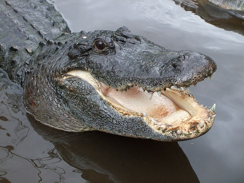
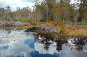
An “alligator mississippiensis,” prevalent in the Okefenokee Swamp – where I’ll soon be kayaking…

*   *   *   *

It’s that time of year.  Time to train for future adventures this summer, and finish some unfinished business from last fall.  The future adventures – this coming August – will include a four-day hike on the Chilkoot Trail.  (“The meanest 33 miles in history.”)  

And once that’s over,  my brother and I plan a 16-day, 500-and-some-mile, primitive-camping canoe trip “down” the Yukon.  (From Whitehorse, up through Lake Laberge – of ‘Sam McGee‘ fame – to Dawson City.  And the Yukon is a rare river that flows north, so technically we’ll be going “up…”)

1445624973384But first things first.  I finally wangled a permit to camp overnight at the Canal Run shelter in the Okefenokee.  Which means I’ll be finishing up something I started last fall.

Back in October 2015, I noted – in “Into the Okefenokee” – that I’d finally fulfilled a life-long dream.  “I took my little 8-foot kayak and paddled deep into the Okefenokee.”

In a few days I’ll be going back.

But last October there was a problem.  The only reservation I could get was for the Cedar Hammock shelter.  Unfortunately, that was a mere three miles from the main (east) entrance.

And that pretty much put the kibosh on my plan to “bisect the swamp.”  (See “Okefenokee” – Part II and Part III, where I noted a plan to come in on a later trip from the Stephen Foster State Park – Fargo – to the west.)  So this then will  be that “later trip,” upcoming…

But this time I have a reservation at the CANAL RUN shelter.  It is some nine miles in from the Foster State Park launch site.  And that means that if I can somehow reach the Coffee Bay day shelter on the first day, I will have indeed “bisected the Okefenokee.”

Of course there were naysayers – recently – when I announced my latest plan.  (With comments like:   Where did I want to be buried, and had I made out my “last will and testament?“)

SwampWaterPoster.jpgYet despite it’s fearsome reputation – as illustrated by the lurid movie poster at right – the Okefenokee itself is quite peaceful. (That is, if you can stick to canoe-only water trails and avoid the noisy and/or obnoxious air-boats that touristy-types love.) 

So I’m looking forward to my adventure, which will be the subject of a future post.  But first a few highlights, from the first trip:

…a word about permits.  Before you camp overnight in the Okefenokee, you need a permit.  (See Overnight Camping Permits – Okefenokee.)  That costs $15 a night.  (Of which $6 is non-refundable.  And none of it is refundable if you cancel less than a week before the reservation date.)   Then I also found out Recreation.gov tacks on a $6 “reservation fee.”  So for a grand total of $21, you may tent-camp in a swamp.

Another note:  When paddling a canoe or kayak In the Okefenokee, it’s a rare place where you can actually stop, get out and stretch your legs.   “(And give other body parts a break as well.)”   The shelters – day shelter or overnight – are few and far between.

1445624973384I.e., any “banks” you see will likely be nothing but mashed down reeds or bulrushes.  Beyond that, many of those banks of bulrushes will be already ocupado, by basking gators like the one at left.  But the good news is that you’ll be following in the footsteps of people like Robert Louis Stevenson.

As noted in Donkey travel – and sluts – in my companion blog – Stevenson was an – if not the – original modern travelogue writer.

For example, he wrote books like Travels with a Donkey in the Cévennes.  (Which laid the groundwork for John Steinbeck’s Travels with Charley.)  And a year or so before that, he wrote An Inland Voyage.  (About  a canoe trip through France and Belgium.)

Stevenson said he took pleasure in such arduous trips because he’d “been after an adventure all my life, a pure dispassionate adventure, such as befell early and heroic voyagers.”

And quite often that meant “not knowing north from south, as strange to my surroundings as the first man upon the earth.”  It also meant putting up with the occasional “astonishingly ignorant” fellow traveler.  (Or for that matter the two young country girls he came across, near an isolated French village; “impudent sly sluts, with not a thought but mischief. “)

But in the end, such a hard and difficult journey – or pilgrimage – is usually well worth the effort.  Anyway, that’s what I noted after my first trip into the Okefenokee, last October:

…despite the discomfort that seems to got along with such efforts, it felt good to finally visit the home of Pogo Possum.  To visit – even for such a short while – the “hollow trees amidst lushly rendered backdrops of North American wetlands, bayous, lagoons and backwoods.”

And speaking of Pogo Possum, here’s a bit of homespun wisdom to meditate…

*   *   *   *

Pogo - Earth Day 1971 poster.jpg


The upper image is courtesy of Alligator – Wikipedia, the free encyclopedia.  The caption:  “American alligator (A. mississippiensis).”  The next-down “gator picture” I took myself, in October.

The blog-post title alludes to “There you go again,” a phrase made famous by Ronald Reagan, and later used by politicians as diverse as Bill Clinton and Sarah Palin.  See Wikipedia.

For other past adventures, see 12 miles offshore and/or A late-fall mountain trek…

The lower “enemy is us” cartoon image is courtesy of Pogo (comic strip) – Wikipedia.  The caption:  “Pogo daily strip from Earth Day, 1971.”  In the alternative:  “A 1971 Earth Day comic strip written and illustrated by Walt Kelly, featuring Pogo and Porkypine [sic].”  Wikipedia described Porky Pine:

A porcupine, a misanthrope and cynic; prickly on the outside but with a heart of gold.  The deadpan Porky never smiles in the strip (except once, allegedly, when the lights were out).  Pogo’s best friend, equally honest, reflective and introverted, and with a keen eye both for goodness and for human foibles.  

I wondered why I liked him so much…

A late-fall mountain trek…

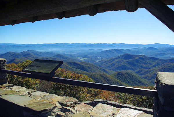
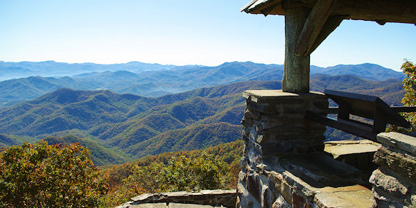
Wayah Bald Lookout Tower

The Wayah Bald Tower, a highlight from my recent trek on the Appalachian Trail


I’ve now officially hung it up for the winter.  “Which is being interpreted:”

“No more outdoor adventures … at least not ’til next spring.”  Which means the two adventures I had this (late) fall pretty does it for this year.

SwampWaterPoster.jpgTo explain:  Last October I fulfilled a life-long dream.  A two-day overnight kayak into the Okefenokee.  (As told in Operation Pogo.)

Then last November – 20 and 21 – I fulfilled another life-long dream: At least one overnight trek on the Appalachian Trail.

I touched on this dream in “A Walk in the Woods.”  (Parts I and II.)

Back in 1967 – when I was 16 – my next-older brother and I hatched the idea of hiking the Trail from Springer Mountain to Gettysburg, where our aunt and uncle lived.  (Some 623 miles…)  But for some reason my parents didn’t bust out laughing [or] slap their knees while wiping away tears of laughter…

Needless to say we didn’t make it.  Ever since then it’s bugged me that we didn’t make it.  And that’s why hiking the A.T. has been on my bucket list.  (Long before the term was coined.)

Among the highlights:  The temp dropped to 31 degrees that Friday night. (11/20.)  Another thing:  Hiking in the late fall – when the leaves have fallen – means the Trail is really slippery.

A related note:  Even now – three weeks later – my left big toenail is still purple-bruised.  (From the Saturday-afternoon slip-and-slide down toward Tellico Gap.)

I’ll get to the details later, but first a word about those “balds.”  There’s a lot of ’em on the A.T., but they’re not meant as an insult to the “follicly challenged.”

The term Bald in the Appalachians means a summit or crest, covered mostly by thick vegetation; “native grasses or shrubs occurring in areas where heavy forest growth would be expected.”

Grassy-bald-roan-mountain.jpgThus the towers at Wayah Bald and Wesser Bald.  (Of which more below.)  Then of course there’s Roan Mountain, seen from Grassy Ridge Bald, at right.

Getting back to the hike itself:  I originally planned to go from Winding Stair Gap to the Nantahala Outdoor Center, near Bryson City.

That’s a hike of about 27 miles.

Fortunately, I found an old high-school friend who lives in Franklin, North Carolina. (Right on the Trail.)  So in September I arranged to drive up to his place on Thursday afternoon, the 24th. From there he agreed to drop me off Friday morning, the 25th.  (And hopefully pick me up on Saturday afternoon, the 26th.)

Under that original plan I might have made 27 miles.  (If I’d been able to hike before the time change.  See Spring Forward – Fall Back.)  Unfortunately, that September try got rained out. Which meant by late November, I had an hour or two less hiking time per day.

Be that as it may…  I made new arrangements.  (Before the weather got too cold.)  My friend dropped me off at 8:35, Friday morning, November 20.  (At the parking lot at Winding Stair Gap, where the Trail crosses U.S. 64, known locally as Murphy Road.)

And now a word about hiking speed.  A good ambling-speed on level ground is a mile every 20 minutes.  (Three miles an hour.)  But a friend at church hikes the Trail regularly, and she says on a good day she and her husband can cover eight miles.  Other sources indicate a good speed – with full pack and up and down mountain trails – is about two miles an hour.

AT 022That’s what threw me off.  Like my paddling in the Okefenokee, I overestimated my ability to trek. (With less daylight, and slipping and sliding on fallen leaves.  Not to mention the recent rains that put much of the Trail under water, as seen at left…)

So anyway, that Friday afternoon I reached Wayah Bald about 4:40.  See also Wayah Bald Tower.

My slightly used handbook – published in 1994 – said there was a camping area a mile and a half further on.  But the sun was setting, it was getting cold and the ground was flat and grassy there.  So I pitched my tent.  (Expecting a ranger to come by and say “You can’t camp there!”) 

But then three young folk came by.  (A young man and two young ladies, all college age.)  We’d been passing each other all afternoon, and after stopping for a bit, they started to head off to the farther-up camping place.  But then they came back and camped on the other side of the tower.  (Which was some comfort.  You never know about those “Dueling banjos…”)

So anyway, I pitched my “Eureka” one-person tent just to the left of where the stone wall at the bottom of the picture turns down.  (As seen in the photo below right.)

Wayah Bald Lookout TowerI’d packed five layers of sweaters and down vests, plus Gore-tex gloves.  (Not to mention a small mouthwash bottle filled with rum.)  And like I said, that night it got down to 31 degrees or so.

I shivered some during the night, and could have used some extra padding for my side hip-bones.  Still, I got a fairly good night’s sleep.  (And there was a nice view of the lights of Franklin, shimmering in the distance, when I got up to answer nature’s call.)

Next morning it took a while to pack up.  It was so cold I had to keep warming my fingers to untie things, then tie them in or to the pack, etc.  But I eventually hit the trail at 8:21.

Like I said, my original plan was to reach the “NOC,” some 27 miles away.  But as I hiked along Saturday afternoon, I formulated a secondary objective: The Wesser Bald Lookout Tower.

But finally – as the sun got lower and lower on Saturday afternoon – I found a rare place with cell-phone reception.  (And they are pretty rare.)  I called my buddy and negotiated a pick-up at Tellico Gap.  (See Wayah Bald to Tellico Gap.)

Over the phone I read the directions – from the 1994 guidebook – to my friend.  They told of an 8-mile drive (for him), west from Highway 28.  Then a 4-mile gravel road up to Tellico Gap.

By some miracle he actually found the place, on the Trail, and with a place to park.  And he got there about 10 minutes before I did.  (Slipping and sliding downhill.)

Boy was I glad to finally sit down in his pickup truck!  

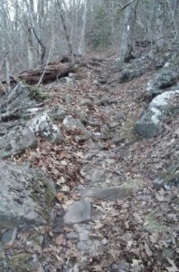
One lesson I learned was that hiking in the Trail in late fall means most of the leaves have fallen. That means much of the Trail is  covered by leaves.  The leaves in turn cover up many if not most of the rocks and tree roots that can trip you up.  (As shown below left.)

AT 037Then there’d been the recent rains, making parts of the trail more like streams than trail, as noted above.

Aside from all that, I deliberately chose to go slow, knowing one wrong move could mean a twisted knee or ankle.  (Which speaks to the wisdom of not traveling alone.)  And finally, my main objective was to see how fast I could travel comfortably.

As I alluded in “Okefenokee – Part II:”  Not only did my Utah brother propose a 16-day, 500-mile, “primitive-camping canoe trip down the Yukon River.”  Also for the Summer of 2016, he’s proposed a four-day hike along the Chilkoot Trail.  (In Alaska.)  So this overnight A.T. hike served as a kind of “shakedown cruise.”

Which leads to the specifics:  It was 5.9 miles from Winding Stair Gap to Wayah Gap.  (Before Wayah Bald.)  It was another 13.5 miles from Wayah Gap to Tellico Gap.  That made a grand total of 19.4 miles.  I covered that 19.4 miles in some 11 hours, 29 minutes of actual hiking.

That averaged out to 9.7 miles a day.  (Or 1.68 miles per hour, over rough ground.  It was actually 1.689895 miles per hour, but who’s counting?)  Still, despite my doing better than the eight-mile-a-day average noted above, it was a learning experience…

And a pretty humbling one at that.  But I’m glad I did it.  For one thing, that first beer and that nice soft bed Saturday night felt really, really good!

And incidentally, the word “trek” – as used in the headline and text – comes from Trekboer.  (A term later shortened to just “Boer.”  See also “kommando,” from Afrikaans as well.)

The point being:  The image below gives an accurate feel for some of the conditions on the A.T. – in late fall, this past November 2015.  (Though without the oxen, whips and wagons.)


The original Trekboers, “Passing Cradock Pass…”


Re: The Appalachian “balds.”  See Bald Mountains – Wikipedia, the free encyclopedia:

The Bald Mountains are a mountain range [bordering] Tennessee and North Carolina in the southeastern United States.  They are part of the Blue Ridge Mountain Province of the Southern Appalachian Mountains.  The range gets its name from the relatively frequent occurrence of grassy balds atop the more prominent summits.

See also Appalachian balds – Wikipedia.

Re: Hiking the whole Trail.  At 64, I realize I’ll probably never do that.  (Or want to, for that matter.) But my bucket list does include hiking at least one portion of the Trail in every state that it passes through.  (So far I’ve done Georgia and North Carolina.)

Re: “Dueling banjos.”  As the link noted, “If you ever see the film [Deliverance,]  you will never be able to enjoy banjos again.  Or go canoeing.  Or visit rural Georgia.  Or, you know, sleep.”  And I must admit to a certain trepidation even kayaking in the remote Okefenokee. Still, there is a certain dark humor in the trope illustrated at right…

The lower image is courtesy of the Boer link in the article, Trekboer – Wikipedia. The caption:  “Passing Cradock Pass, Outeniqua Mountains, by Charles Collier Michell.”  Note that “Boer is a Dutch and Afrikaans word for ‘farmer.'”

Re: “Kommando.”  Another word of Dutch/Afrikaans origin, later spelling-changed to Commando: “The word stems from the Afrikaans word kommando, which translates roughly to ‘mobile infantry regiment.’  This term originally referred to mounted infantry regiments, who fought against the British Army in the first and second Boer Wars.”


“Into the Okefenokee” – Part III

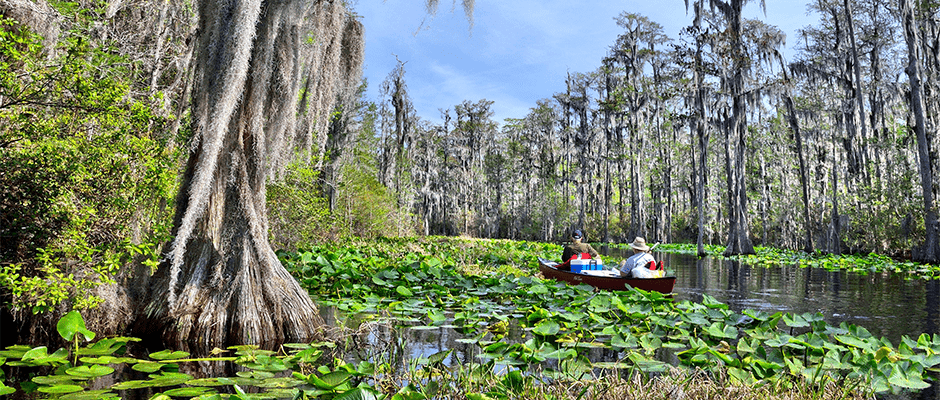
As noted in Part II, “water lilies” are lovely to look at but a pain to paddle through…   

*   *   *   *

This is the final installment of Operation Pogo – “Into the Okefenokee.”
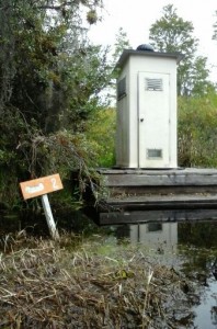
1444146412784For an overview, see Canoe Map.  I started from Refuge Headquarters, southwest of Folkston.  At Mile Marker 2 there’s a “Porta-potty.”
Another note:  This is the “short version.”  For the long version – in the manner of In-A-Gadda-Da-Vida – see the notes below.

And one more “by the way:” You’ll probably want to read the first two installments first.

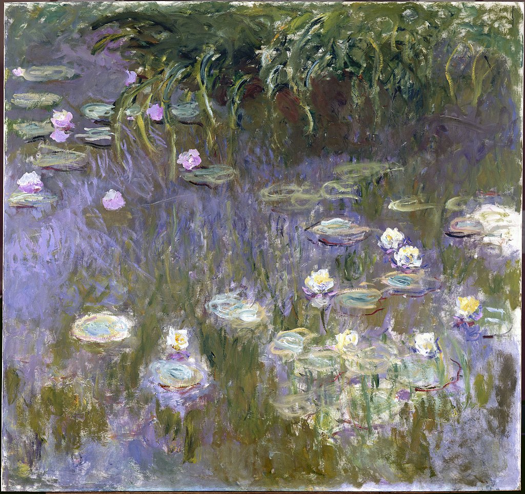
Part II ended with me thinking this, as I paddled through the swamp in the dark:  “That Monet guy can take his stinkin’ water lilies and ‘stick ‘em where the sun don’t shine.'”

But we digress!!!
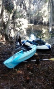
1445698042386I found myself paddling through the swamp late Friday night because my timing was off.  It was off because I thought my “tagalong combo” – at right – might get me charged twice.  So I tried to be sneaky, and ended up paddling in the dark…

To make another long story short, my two days’ paddling-MPH turned out to be a lot slower.  (A mile in 36 minutes, not 18 minutes.)  So Friday afternoon I turned back early…

I was able to get back after closing.  And get my rubber raft from the car, blow it up and pack it, then set off “into the sunset.”
oke 066

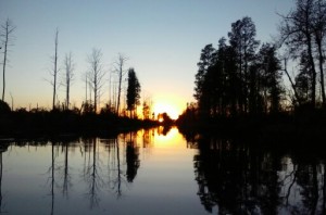
(On the Suwanee Canal, to get a photograph of a beautiful sunset.)

I didn’t get to the shelter until 8:30 or so, well after sunset.  Which brings up again that the “canoe only” trail from Suwanee Canal to Cedar Hammock is loaded with water lilies…

That’s when I discovered a nasty thing about water lilies.  They’re hard enough to paddle through during the day, when you can see what you’re doing…
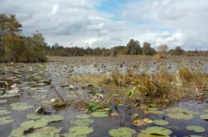
oke 055(The image at right is a picture I took of the canoe-only water trail to the Cedar Hammock shelter, during the day…)

I found out when you paddle through water lilies in a kayak – in the dark and in a hurry – your paddle tends to grab a great wad of swamp weed.  Then the paddle tosses the soggy lily-entrails – wet and cold – all about your head and shoulders.

But there were moments of beauty.

I had been after an adventure all my life, a pure dispassionate adventure, such as befell early and heroic voyagers … not knowing north from south, as strange to my surroundings as the first man upon the earth…  (E.A.)
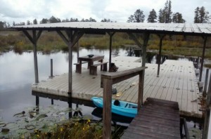
oke 057That’s Robert Louis Stevenson by the way, so I’m not the only one with such thoughts…  (See 12 miles offshore.)

I eventually did make the Cedar Hammock shelter.  (Seen at left in the daylight.)  But I didn’t bring my tent because there was no place on the platform to put in stakes.  And because I was in a hurry to pack.  And the forecast was for no rain.   And because I thought it’d be nice to camp “under the stars.”  I didn’t bring any bug spray because there hadn’t been any mosquitoes any of the times I’d been at or around there before.

Fortunately I ended up getting some sleep that night.  Mostly by covering myself completely with the sleeping bag.  And even though a week later I was still scratching mosquito bites, mostly on my ankles.  (Which was strange because they’d been covered by socks.) All the while I took some small pride in being in a place other people weren’t, and where few “normal” people dared tread.  (As the saying goes, Why Be Normal?)

Next morning – Saturday – I took my time getting going.  (In part because of the late night paddling, and I thought I had plenty of time.) Then I set off for the Canal Run shelter.  (See Part II, including the Permits link.)  On the way I found a rare spot to actually get out and stretch me legs.  (And give other body parts a break as well.) That’s where I took the tagalong picture above, on a rare stretch of rather squishy-underfoot hammock along the Suwanee Canal.
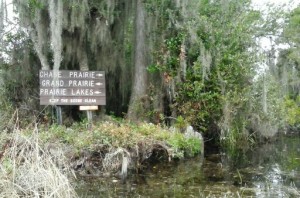
oke 038That was on the way to the “fork in the canal,” shown at left.  See also the Canoe Map.

From there I set out for the Coffee Bay day shelter.   (Which according to the dots on the map is three miles further west.)

The problem was that when I first got there, it was occupied.  By a raucous group of adult men and teen boys, out for a day-cruise.  So I set off for Mile Marker 6, got there and turned back.

My hope was that they’d be gone by the time I got back.  Which worked, up to a point.

Then came the best part of the trip.  I sat in my camp chair and enjoyed a sense of accomplishment.  Along with the one cold beer saved from the night before.  And a hearty lunch of pre-packed chicken.  Not long after that I nodded off for a short nap, there in the afternoon warmth. And that one brief shining moment of happiness even survived the morning after.  Or in this case the late afternoon after…  (Alluding to the 1972 Maureen McGovern song.)

Which is being interpreted:

They say that time heals all wounds.  And looking back, a month after my voyage into the Okefenokee, that seems true.  Which is another way of saying the paddle-back after the nap was rushed, to say the least.  But thanks to the healing power of time, the body parts that ached so much – that long Saturday afternoon of paddling – no longer seem so important. At the time I was frustrated, mostly because of the disconnect between how fast I thought I could go, and how fast I actually could go. But despite the discomfort that seems to got along with such efforts, it felt good to finally visit the home of Pogo Possum.  To visit – even for such a short while – the “hollow trees amidst lushly rendered backdrops of North American wetlands, bayous, lagoons and backwoods.”

And maybe – just maybe – I got from the trip just a hint of growth.  (From being merely a “misanthrope and cynic,” to develop a sense of “prickly on the outside but with a heart of gold.”)

As exemplified below.  And in closing, note that my Utah brother has a brilliant idea for further adventures next summer.  A 16-day, 400-plus-miles canoe trip down the Yukon River

*   *   *   *

Pogo - Earth Day 1971 poster.jpg

Pogo and his buddy “Porky Pine,” deep in the Okefenokee…

*   *   *   *

The upper image is courtesy of Water Lilies (Monet series) – Wikipedia.  The caption:  “Le Bassin des Nympheas, 1904, Denver Art Museum.”  See also Le Bassin des Nympheas (Water Lily Pond) by Claude Monet, which added:  “Monet treated the water’s surface like a mirror, reflecting the swaying fringe of foliage and the clouds moving across the sky.  The water spans the breadth of the composition.  Only the willows and reeds that appear at the top of the canvas moor the pond to its surrounding banks.”  (But they’re still a pain in the butt to paddle through…)

Re: short and long versions.  See also In-A-Gadda-Da-Vida by Iron Butterfly on iTunes:   “There was an under-three-minute single version, but clearly fans wanted the complete experience.  Flipping the record to its first side, though, is an underrated experience.”

I took the photographs of the “tagalong” boat combo, the sunset on the Suwanee Canal, the water lilies on the way to Cedar Hammock, and the Cedar Hammock shelter itself. 

The “trying to be normal” image is courtesy of: thecompellededucator.blogspot.com/2014/03 … “why be normal when you can be amazing.”  And of course Maya Angelou

The lower “enemy is us” cartoon image is courtesy of Pogo (comic strip) – Wikipedia.  The caption:  “Pogo daily strip from Earth Day, 1971.”  In the alternative:  “A 1971 Earth Day comic strip written and illustrated by Walt Kelly, featuring Pogo and Porkypine [sic].”  Wikipedia described Porky Pine:

A porcupine, a misanthrope and cynic; prickly on the outside but with a heart of gold.  The deadpan Porky never smiles in the strip (except once, allegedly, when the lights were out).  Pogo’s best friend, equally honest, reflective and introverted, and with a keen eye both for goodness and for human foibles.  

I wondered why I liked him so much…

*   *   *   *

 And now word about the subtle difference between water lilies and water hyacinths

Water hyacinths are formally known as Eichhornia crassipes, “an aquatic plant native to theAmazon basin,” and considered “a highly problematic invasive species outside its native range.” (Fancy language for a “pain in the butt.”)  Water lilies on the other hand are formally known as nymphaeaceae, a “family of flowering plants” living as “rhizomatous aquatic herbs in temperate and tropical climates around the world.”

 *   *   *   *

And finally, the “long version,” in the manner of In-A-Gadda-Da-Vida

Picking up with, “This is the third and last installment…”

This is the third and last installment of a tale that began with Operation Pogo – “Into the Okefenokee.”  It’s an account of my overnight camping trip, “deep” into the swamp.  (Last October 23-24.)  It included 11 hours of paddling over two days, lots of slithering alligators, and a “night operation.”  (Paddling to the Cedar Hammock shelter in the dark of night.)

1444146412784For an overview, see Canoe Map.  I started from Refuge Headquarters, southwest of Folkston.  The Cedar Hammock shelter-image is just below Mizell Prairie.  The image just below that is the “porta-potty” at Mile Marker 2, on the Suwanee Canal.  (Seen at right.)

On Friday afternoon, October 23, I paddled about half-way to Monkey Lake.  (Then turned back to Headquarters to pack my camping gear.)

Saturday afternoon I got as far as Mile Marker 6, just west of the Coffee Bay shelter.  And by the way, each black dot on the “trails” represents a mile.  (That and other factors mean the Canoe Map is “extremely small scale.”)

Another note:  This is the long version of this tome – in some ways not unlike the long version of In-A-Gadda-Da-Vida.  And one more “by the way:” You’ll probably want to read the first two installments first.

Part II of this venture ended with me “on the cusp.”

On the cusp of paddling a canoe-trail deep in the Okefenokee, in the dark, through a slough of water lilies.  (The “entrails” of which blapped me; noted below.)  

That’s what made me think this thought, paddling in the dark:  “That Monet guy can take his stinkin’ water lilies and ‘stick ‘em where the sun don’t shine.’”

But we digress!!!

1445698042386I found myself paddling through the swamp late Friday night because my timing was off.  My timing was off because I thought my “tagalong combo” – seen at right – might get me charged twice, for two “boats.”  So I tried to be sneaky, andthat’s how I ended up paddling in the dark…

There’s more on that later, but first let’s review that first morning in the swamp.  (After driving down from Cordele.)

I left my camping supplies behind at the main (east) entrance, to be picked up later.  Then I made a quick 3-mile preliminary paddle – sans rubber raft – to the Cedar Hammock Shelter.

Then I started out on the canoe trail to Monkey Lake.  That’s where I ran across the big bull gator – almost literally – as noted in Part I:

As I paddled over over the water where the gator had been, I could swear he came up and nudged the bottom of my kayak.  I figured it was an accident.  (But the second time?)  Thatadded some spice to the trip.

I figured I could make Monkey Lake easily that first day in the swamp.  For one thing, a helpful sign along the way said it was only 5.5 miles or so.  At the time I figured I could make that in a couple hours.  But that’s also when I found out that my paddling-MPH on an all-day trip was a lot different than my speed on a two-hour jaunt.

Again to make a long story short, that day and the next my paddling-MPH turned out to be a lot slower.  (A mile every 36 minutes, not every 18 minutes.)  The result was that Friday afternoon I had to turn back early from the paddle to Monkey Lake, and paddled back to the put-in place.

I was able to get back after closing.  (Per my sneaky plan.)  And I did get my rubber raft from the car, blow it up and pack it, then set off literally “into the sunset.”

oke 066(Along the Suwanee Canal entrance to the Refuge itself.)  And in the process I got to photograph a really beautiful sunset, seen at left.  But again, either my timing or my paddling was off.

I didn’t get to the shelter until 8:30 or so, well after sunset.  Which brings up again that the “canoe only” trail from Suwanee Canal to Cedar Hammock is loaded with water lilies…

When I left the east entrance put-in, I thought I had plenty of time.  (Laboring under the delusion that I could make three miles in 54 minutes; 18 minutes per mile.)   Sunset was supposed to be about 7:00 p.m., and “last light” about 7:30.  But it took a tad longer than I expected.  One of the reasons was those stinkin’ water lilies…

That is, in this venture I discovered a very nasty thing about water lilies.  They’re hard enough to paddle through during the day, when you can see what you’re doing…

oke 055(The image at right is a picture I took of the canoe-only water trail to the Cedar Hammock shelter, during the day…)

Then too, the strange thing is that while I was paddling on the way back from Monkey Lake, I visualized how much fun it might be to “conduct a night operation.”  (To paddle through the beautiful Okefenokee at night.)

Which brings up the old saying:  “Be careful what you wish for.”

Which is being interpreted:  I found out that if you’re both in a hurry – as I was – and can’t see what you’re doing, your paddle tends to gouge out great tendrils of “swamp weed.”

That’s what I call the stuff that grows down under the lilies.  (As opposed to “sea weed.”)

I found out that when you try to paddle through water lilies in a kayak – in the dark and in a hurry – your paddle tends to grab a great wad of swamp weed and toss it – soggy and cold – all about your head and shoulders.  (Not always.  Just enough to keep you off balance…)

Which made for a long hour of paddling, with the last mile or so  through a never-ending sea of water lilies.  But there were moments of beauty.  Every once in a while along the way I’d stop paddling.  (I am retired after all.)  Partly to rest my arms and shoulders.  Partly to get a break from being blapped by water-lily entrails.  But a big part of it was simply to stop and appreciate the ambience.  It really was beautiful, in the middle of the Okefenokee in the moonlight:

I had been after an adventure all my life, a pure dispassionate adventure, such as befell early and heroic voyagers … not knowing north from south, as strange to my surroundings as the first man upon the earth…

oke 057That’s Robert Louis Stevenson by the way, so I’m not the only one with such thoughts…  (See 12 miles offshore.)

I eventually did make the Cedar Hammock shelter.  (Seen at left in the daylight.  My kayak –sans “tagalong” – is near the bottom of the picture.)

That’s when I found out that I should have brought something for the mosquitoes.  I did bring a cooler with four beers and two sandwiches.  (Along with some “dry good” food.)  And that first beer tasted really great, in the process of unpacking.

Also, I brought a “night light,” a small flashlight that attaches to the bill of your camp.  But I didn’t bring my tent, or bug spray, or mosquito netting.

I didn’t bring the tent because there was no place on the platform to put in stakes.  And because I was in a hurry to pack.  And the forecast was for no rain.   And because I thought it’d be nice to camp “under the stars.”  I didn’t bring any bug spray because there hadn’t been any mosquitoes any of the times I’d been at or around there before.  (And besides, bobandrobin had said, “We didn’t need the bug spray today…”)

Fortunately I ended up getting some sleep that night.  Mostly by covering myself completely with the sleeping bag.  And even though a week later I was still scratching bites, mostly on my ankles.  (Which was strange because they’d been covered by socks.)

And again there was a great deal of beauty to appreciate.  I alternated between hiding under the sleeping bag and sitting in my camp chair, drinking a beer and slapping mosquitoes.  The first part of the night featured a full moon.  (Which came in handy when paddling through the water lilies.  And that full moon may have helped me not lose my way.)   And that first part of the night the full moon lit up the swamp rather prettily…

Later the moon went down.  And with no artificial light around, the stars sparkled just out of reach.

All the while I took some small pride in being some place other people weren’t, and where few “normal” people dared tread.  (As the saying goes, Why Be Normal?) The next morning – Saturday – I took my time getting up and going.  (In part because of the late night paddling, and because I thought I had plenty of time.)  In lieu of coffee I had a Coke Zero, and for breakfast a couple of granola bars.  I had a single-serve packet of chicken for lunch, later on.  And I’d saved one last beer, to enjoy with lunch.

Then I set off for the Canal Run shelter.  (See Part II, including the Permits, link.  And as per my plan to “bisect” the swamp later trip, via Foster State Park – Fargo.)  On the way I found a rare spot to actually get out of my kayak and stretch me legs.  (And give other body parts a break.) That’s where I took the tagalong picture above, on a rare stretch of rather squishy-underfoot hammock along the Suwanee Canal.

oke 038That was on the way to the “fork in the canal,” shown at left.  See also the Canoe Map.  The fork in the canals shown at right is just below and slightly to the right of the “porta-potty” image shown above.
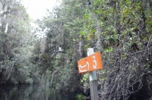
From there I set out for the Coffee Bay day shelter.   Which according to the dots on the map is three miles further west.

I ended up getting to Mile Marker 6, that apparently marks six miles from the start of the National Wildlife Refuge, not the put-in place with rental boats, cafe and gift shop.  (According to the dots on the map.)  Then I went back and enjoyed some much needed “leg-stretching.”

The problem was that when I first got to the day shelter, it was occupied.  By a group of adult men and teen boys, out for a day-cruise adventure.  So I set off for Mile Marker 6, got there and turned back, all in the hope that they’d be gone by that time.

The plan worked, up to a point.  I only had to dodge a couple of BB-gun shots by the ardent young sportsmen.  (Not to mention the usual teen-boy goofballing.)   But then the group departed in its three canoes, and the Okefenokee was quiet again.

Then came the best part of the trip.  I sat in my camp chair – packed in the rubber raft – and enjoyed a sense of accomplishment.  Along with the one cold beer saved from the night before.  And a hearty lunch of pre-packed chicken.

Not long after that I nodded off for a short nap, there in the afternoon warmth.  And that one brief shining moment of happiness even survived the morning after.  Or in this case the late afternoon after…  (Alluding to the 1972 Maureen McGovern song.)     Which is being interpreted:

I spent the rest of the afternoon and early evening rushing to get back to my car at the put-in place.  I made it time to leave before dark, but not to enjoy a much-anticipated burger, fries and cold drink at the cafe.  That came later, much later, as I drove my way back home.

They say that time heals all wounds.  And looking back, a month after my voyage into the Okefenokee, that seems true.  The body parts that ached so much – that long Saturday afternoon of paddling – no longer seem so important.

At the time I was frustrated, mostly because of the disconnect between how fast I thought I could go, and how fast I actually could go.  (Which BTW is a theme repeated on the just-completed, two-day Appalachian Trail hike.  The subject of my next blog-post.)

On the other hand, maybe that’s part of the process.   Maybe such disconnects come with the territory of fulfilling a life-long dream.  (See Part I.)

Despite the discomfort that came with the effort, it felt good to finally visit the home of Pogo Possum.  To visit – even for such a short while – the “hollow trees amidst lushly rendered backdrops of North American wetlands, bayous, lagoons and backwoods.”

And maybe – just maybe – I got from the trip just a hint of growth from being the “misanthropeand cynic,” and from there develop a sense of “prickly on the outside but with a heart of gold…”  And in closing, note that my Utah brother has a brilliant idea for further adventures next summer.  A 16-day, 400-plus-miles canoe trip down the Yukon River

*   *   *   *

“Into the Okefenokee” – Part II

*   *   *   *

And now, back to “Operation Pogo:”

1445624973384Operation Pogo was the first episode of my travel-venture “Into the Okefenokee.”  This is a followup.

(The saga will conclude in Part III.  And just a suggestion: You’ll probably want to read Part I first.)

As noted in Part I, I saw tons of alligator “cousins” – like the one basking at left.  (Usually on the ostensible shoreline, or slithering through the waters ahead of me.)

That first episode ended with me trying out one of those “free” campgrounds listed on Freecampsites.net, on Thursday October 22.  (Killebrew Park near Warwick.)

What I found seemed to be a modern-day equivalent of a Depression-era Hooverville:

I’m guessing [that] most people [who stay at such places] already have their Plan B…  Packing up and moving to the next-closest “free campground…”  The point is that after feeling distinctly uncomfortable at the idea of camping at Killebrew Park – even if there had been a space available – I had my own Plan B.

My Plan B was to drive up to nearby Georgia Veterans State Park that late Thursday afternoon.  (West of Cordele and just off I-75.) It’s a beautiful park – and campground – but then I went to register.  Fortunately I’d just renewed my “Friends of Georgia” ParkPass, and so was entitled to one free night of camping.  I then asked how much it would cost to tent-camp otherwise.  (For future reference.)  The best available discount rate was $28.00…

On the other hand, Expedia said there was a nearby Budget Lakeview Inn (Sycamore) for $38.00. That may not be everyone’s cup of teaBut – having camped less than a year ago on a soggy salt marsh 12 miles out in the Gulf of Mexico – that wouldn’t have been so bad to me.  (See 12 miles offshore, on the 8-day primitive-camping canoe trip last November 2014.)

Which brings up what I said in my first Mid-summer Travelog:

For the price you pay to camp these days – as Steinbeck did [in 1960] – you can get a nice Motel 6 with AC.  (And that’s tent camping.  For what you pay for an RV or travel trailer, you can stay at a lot of Motel 6’s.)

And just for the record, I’ve owned motor homes.  (Three in fact.)  So I know whereof I speak.

Which brings up the fact that on that Thursday night – October 22 – I discovered that my spandy-new 2015 Ford Escape offers plenty of room for sleeping.

But first a word about permits.  Before you camp overnight in the Okefenokee, you need a permit.  (See Overnight Camping Permits – Okefenokee.)  That costs $15 a night.  (Of which $6 is non-refundable.  And none of it is refundable if you cancel less than a week before the reservation date.)   Then I also found out Recreation.gov tacks on a $6 “reservation fee.”

So for a grand total of $21, you may tent-camp in a swamp.  Which brings up again:  “For the price you pay to camp these days – as Steinbeck did – you can get a nice Motel 6.”  (On the other hand, you might miss some of the gators, “slithering along.”) Meanwhile, back at Veterans State Park, Thursday night.  (After registering…)

I had my tent, but wanted to get an early start.  So I blew up my air mattress and spread it – and my sleeping bag – in the back of my Ford Escape.  (I’d folded down the seats and moved the kayak outside.)  By moving the front passenger seat up and folding it up toward the dashboard, I had plenty of room in case of jimmy legs.

(The latter term refers to the Seinfeld Money episode.  In it – and perhaps ironically – “Jack Klompus drives the car into a swamp and Jerry returns to Florida.”)

So anyway, I got a pretty good night’s sleep.  Next morning – Friday October 23 – I left Cordele and covered the 160 miles to the Folkston entrance in about three hours.  I took my time getting ready, in part because my reserved camping shelter was only three miles away.

That is, in the time frame I had there was only one camping platform available, Cedar Hammock.  The nice lady at the main (east) entrance assured me I “should be able to reach it before dark.”  I in turn thought her estimate was way off.

oke 031Remember that I’d made Mile-Marker Three – at right – in 54 minutes the first time I visited.  (See Part I.)
So this Friday, I thought I’d have plenty of time to paddle around that day, and might even make the Canal Run shelter and back. (See Permits, above.  That would allow me to “bisect” the swamp on a later trip, coming in from the Stephen C. Foster State Park – Fargo, to the west.  Or so I thought…)

But there was another reason I took my time getting ready that Friday morning.  I wasn’t sure my “tagalong combo” was completely kosher.  (The rubber raft I towed behind my kayak, to carry supplies, noted in Part I.)  For one thing, according to a “liberal” reading of the park rules, I might be charged twice, for the kayak and the rubber boat.

So I operated on the theory, It’s easier to ask forgiveness than permission.  I figured I’d leave the rubber boat – and supplies – in the car.  Then I’d paddle around happily during the day, and return to the entrance area a bit after closing time.  (6:00 p.m.)

It kind of worked out that way…  But my plan also ended up with me thinking that Monet guy could take his stinking water lilies and “stick ’em where the sun don’t shine.”

But we digress!!!

I’ll conclude this venture in Part III, which means another “To be continued…”  Meanwhile you can consider this as well:  My Utah brother has a brilliant idea for further adventures next summer.  A 16-day, 500-and-some-mile, primitive-camping canoe trip down the Yukon River.

From Whitehorse, up through Lake Laberge – of “Sam McGee” fame – to Dawson City.

But for now, enjoy this lovely painting by Monet, of water lilies.  (And you can thank your lucky stars that you don’t have to paddle your stinkin’ kayak through them…)

*   *   *   *

 “Water lilies:”  Lovely to look at, but a pain to paddle through…   

*   *   *   *

As in Part I, the upper movie-poster image is courtesy of Swamp Water – Wikipedia.

I took the photographs of the first alligator basking on the “shore” and Canoe-mile-marker Three.

Also re: Mile Marker Three.  It’s past the turn-off “canoe only” trail to the Cedar Hammock shelter.

Re: “travel-venture.”  See also Travelogue … at Dictionary.com.

The “floating gator” image is courtesy of Okefenokee Swamp – GA | Kayak Trip … Paddling.net.

Re: “Lake Laberge.”  In his 1907 poem “The Cremation of Sam McGee,” Robert W. Service spelled the name of the lake as “Lebarge.”  

The lower image is courtesy of Water Lilies (Monet series) – Wikipedia.

*   *   *   *

Operation Pogo – “Into the Okefenokee”

A contemporary view of the Okefenokee Swamp, made famous – or infamous- by a 1941 film… 

*   *   *   *

November 7, 2015 – I saw the movie Swamp Water back in the early 1960s.   (When I  was around 10 or 12.)  The part I remember best was watching Walter Brennan getting bitten in the face by a snake. In the scene, he kneels over and parts the bullrushes to get a drink. (Of  “swamp water,” while hiding from John Law in the Okefenokee.) 

As Walter does all that, the viewer can see a grinning cottonmouth off to his right. (The viewer’s left.) The grinning cottonmouth then proceeds to bite him “right on the cheek.”

I’ve been fascinated ever since…

Which is another way of saying that back on October 23, 2015, I fulfilled a life-long dream.

I took my little 8-foot kayak and paddled deep into the Okefenokee Swamp myself.  There I camped overnight, on the Cedar Hammock shelter. On the other hand, I didn’t see any snakes either… There’s more on the overnight camp-out later.  But first a word about that life-long dream. I’ve been fascinated by the Okefenokee as long as I remember.  (In much the same way as I am by New York City.  To me they’re both fascinating and scary…)

Part of it was the movie Swamp Water, but another part was the old Pogo comic strip.  It starred Pogo Possum, and was set in the Okefenokee Swamp.  It also featured “social and political satire through the adventures of its anthropomorphic funny animal characters:”

Pogo is set in the Georgia section of the Okefenokee Swamp;  Fort Mudge and Waycross are occasionally mentioned.  The characters live, for the most part, in hollow trees amidst lushly rendered backdrops of North American wetlands, bayous, lagoons and backwoods.

And characters in the strip included Albert Alligator. Which brings up a note:  I saw tons of Albert’s cousins – and other distant relatives as well.  I usually saw them basking on the “shore,” or slithering through the waters ahead of me. But one time I saw a big bull gator – who eventually submerged – in a very narrow canal. This was on the canoe trail to Monkey Lake. As I paddled over over the water where the gator had been, I could swear he came up and nudged the bottom of my kayak.  I figured it was an accident.  (But the second time?)

That added some spice to the trip.

And speaking of “shore.”  One thing I learned is that – in the Okefenokee – there are precious few places to stop and take a break from your canoe or kayak. The shelters – for day use or overnight – are few and far between.  As a result, the ol’ keister got extremely sore by the end of the second day.  (Not to mention blisters on my palms…)

065Which leads to the fact that the “shore where the gators bask” – noted above and as shown at left – was not really a shore(As that term is generally understood.) In the Okefenokee Swamp, such a shore is usually a line of reeds that an alligator can mash down.  (And where a human steps off at his own peril…)

But we were talking about that life-long dream.

I’ve lived in the Tampa Bay area most of my life.  (Before I ended up in “God’s Country.”)  So to go anywhere north, I always had to drive up I-75 or I-95.  Either way, as I got just past the Florida-Georgia line, there – off to the right or left, respectively – always lurked the Okefenokee. (Begging to be explored, both threatening and fascinating…  Much like New York City.) So when I finally got my chance, I took it.  (Albeit, well past my 64th birthday.)

To prepare for the trip – about two weeks before the October 23 overnight jaunt – I drove down for a short two-hour exploratory kayak.  (Verb, not noun.)  On that short jaunt I paddled out to Mile Marker 3.  Three miles west of the Suwannee Canal East Entrance to the Swamp. I covered that three miles in 54 minutes, a figure that would came back and haunt me later. Having done that, I took the plunge and made a reservation to camp overnight. That – I thought – would enable me to explore a lot more of this mystic swamp.

1445698042386But first a word about transport.

I originally planned to rent a canoe, from the local Okefenokee Adventures at the main entrance.  (11 miles southwest of Folkston.)   The cost would be $25 a day for the two days, and in the canoe I could carry all my gear in comfort.  (In one vessel.) Needless to say, you can’t pack much gear – beyond a cold drink and sandwich – in an eight-foot kayak.  But then I found myself “financially challenged,” for the time being at least…

The upshot was that – instead of renting a nice big canoe – I opted for a “tagalong combo.”  I paddled my small kayak and towed a small rubber “dinghy,” as shown at right. And incidentally, this site shown was one of the few places that I could get out and stretch my legs.  That’s another way of saying I found one stretch of hammock(s) along the Suwanee Canal, the ” principal waterway into the swamp.”  Aside from the shelters themselves – few and far between – that was pretty much it for getting a break from paddling.

And finally – for this episode anyway – here’s a word on tent camping.  (Before  we get to the swamp-camping part of the journey into the Okefenokee.) In Mid-summer Travelog (Part I), I wrote about tent camping as a less-expensive alternative to motels, while traveling on the road.  That was part of a discussion of Travels with Charley, the book on a road trip John Steinbeck took in 1960.  I noted some big differences between highway travel in 1960 and highway travel today. Like, in 1960, Steinbeck could camp for a dollar a night, if not free.

Once, early in his trip, Steinbeck stopped at a farm in New Hampshire for fresh eggs.  He then asked permission to “camp beside the stream and offered to pay.”  The farmer said there was no need to pay.  “The land’s not working.  But I would like to look at that rig you’ve got there.”  (At this time motor homes were still rare.)   The two men ended up at the table inside Steinbeck’s “rig,” discussing events of the day over “a good dollop of twenty-one-year-old applejack.”

Old Grand Dad.jpgAnother time – just before he drove into Chicago to meet his wife at the Ambassador East – Steinbeck was relaxing where he’d pulled over to make coffee.  (Beside a lake of clear, clean water.)  Then, “A young man in boots, corduroys” and a mackinaw came up; “Don’t you know this land is posted?  This is private property.”  Steinbeck ended up camping there, after a “bribe … with a cup of coffee.”  Coffee, that is, with a “dollop of Old Grand-Dad.”  (Which may bespeak an object lesson for traveling…)

Then on pages 95-103 of the Penguin Books edition, he wrote of the marvels of the then-new trend in personal housing.  (Mobile homes.)  More to the point, on page 98 he wrote this: “Since I did not require any facilities, sewer, water, or electricity, the price to me for stopping the night was one dollar.”

That seems to be no longer true.  Not in any meaningful way anyway.

In Travelog (Part I), I wrote that for what you pay to camp – as Steinbeck did – you can get a nice Motel 6, with air conditioning and no bugs.  (And that was for tent camping.)  But then I had to add this proviso, in a follow-up post, Mid-summer Travelog – Part III:

It is true that camping at a state park these days – even with online reservations – can cost almost as much a night at a Motel 6.  But after the trip I found a website, Freecampsites.net. (See also FreeCampgrounds.com.)  I haven’t actually tried one of these yet, but it does bode well for the future.  (And I suppose there’s some kind of object lesson in all this…)

Which is another way of saying that on the way down to the Okefenokee, I got a chance to try out one of those campgrounds on Freecampsites.net. The site I planned to check out was Killebrew Park – Warwick, GeorgiaWarwick is a cute little town of some 430 souls.  It’s at the south end of Lake Blackshear, and a mere 16 miles southwest of the Cordele ramp to Interstate 75. But Killebrew Park was a different story.  It was indeed at the south end of Lake Blackshear, and thus a possible site for future kayaking adventures.  Before even entering the campground I saw a large sign, “No campsites available.”  (Or Words to that Effect.) Then I drove into the campground itself, just to make sure.

http://1.bp.blogspot.com/-NEdTsiK6DRA/Tz3sF8_7X-I/AAAAAAAACO0/AjUYec-_ZGo/s1600/Bonnie+and+Clyde+1967.JPGWhat I saw reminded me of a scene from Bonnie and Clyde.  (As shown at right.)  That led to me to later Google the term Hoovervilles  – and possibly discover their modern-day equivalent:

The communal “Hoovervilles,” “Hobo Jungles” and “Shanty Towns” of the Great Depression evoked
the hippie communes that were springing up all over the country in 1967.  The nomadic, anti-establishment rebel  lives of Bonnie & Clyde struck a chord with young audiences of the 60s.

But the campground at Killebrew Park had a different feel to it.  The standard practice at most campsites is for a 14 Day Stay Limit.  So after driving through the place, I’m guessing at what most people do when staying at such places as Killebrew Park.  I’m guessing they already have their Plan B mapped out:  Packing up and moving to the next-closest “free campground.” Whether these free campgrounds are the modern equivalent of such “Hoovervilles” is beyond the scope of this post.  (Now just passing the preferred post-length of 1,600 words.)   Or possibly for another, later post.  The point is that after feeling distinctly uncomfortable at the idea of camping at Killebrew Park – even if there had been a space available – I had my own Plan B.

That and the overnight-camp in the Okefenokee will be covered in the next post…

*   *   *   *

SwampWaterPoster.jpg

“…a cottonmouth bites Walter Brennan ‘on the cheek.’”

*   *   *   *

The upper image is courtesy of Okefenokee National Wildlife Refuge – Image Results. From the article, National Wildlife Refuge System celebrates 114th birthday

Re: “John Law.”  See also Urban Dictionary: John Law, and not to be confused with John Law, the noted economist (1671-1729), the “Scottish economist who believed that money was only a means of exchange that did not constitute wealth in itself and that national wealth depended on trade.” 

The “Albert” image is courtesy of www.comicvine.com/four-color-105-albert-the-alligator-and-pogo.  Wikipedia described Albert as “Exuberant, dimwitted, irascible and egotistical…  The cigar-chomping Albert is as extroverted and garrulous as Pogo is modest and unassuming, and their many sequences together tend to underscore their balanced, contrasting chemistry —like a seasoned comedy team.”

Re: “God’s Country.”  See Introduction to Ashley Wilkes:   “I live in the ATL – also known as ‘God’s Country’ – and that’s the birthplace of Gone with the Wind.”

Quotes from “Travels with Charlie” are generally from the 1980 Penguin Books edition.  The “applejack” quote is on pages 27-28.  The “Granddad” quote is from pages 109-13.

*   *   *   *

And finally, as to possible other places to camp free, see RV Parking at Walmart | Walmart Atlas.   See also A Guide to Car-Camping – in Walmart Parking Lots and No Overnight Parking at Walmart | Walmart Atlas.  The upshot seems to be that you should be able to car-camp at some 80% of Walmarts around the country.  For another example – mobile home parks, as Steinbeck used – see Amenities & Rates – Arrowhead Campsites & Mobile Home Park.  That park – located in Ocala, Florida – offers an overnight tent-site rate of $17.00.