Monthly Archives: August 2026

From Herselt to Maastricht – and the end of the hike

*   *   *   *

We’ll pass through Flanders, the Dutch-speaking part of Belgium, “home of the poem…”

*   *   *   *

Welcome to the “Georgia Wasp…”

This blog is modeled on the Carolina Israelite. That was an old-time newspaper – more like a personal newsletter – written and published by Harry Golden. Back in the 1950s, people called Harry a “voice of sanity amid the braying of jackals.” (For his work on the Israelite.)

That’s now my goal as well. To be a “voice of sanity amid the braying of jackals.”

For more on the blog-name connection, see the notes below.

In the meantime:

August 14, 2026 – This is the last of three preview posts on my upcoming 140-mile hike on the GR-5 in Holland. As noted before, we’ll start at the Hook of Holland and end up in Maastricht, also in Holland. But in between we’ll spend 14 of the 23-day total going through Belgium. (With three days off to rest our feet, two of them in Belgium.) Or as my draft notes said:

Left off at Herselt, from there to Testelt and Diest, still in Belgium, where we’ll have our third day off. (Hey, I’m 75 and my brother is 81.) From there we hike to Huesden Zolder, Stokrooie, Vlaandern, Zutendaal, and finally Lanaken, our last day in Belgium.

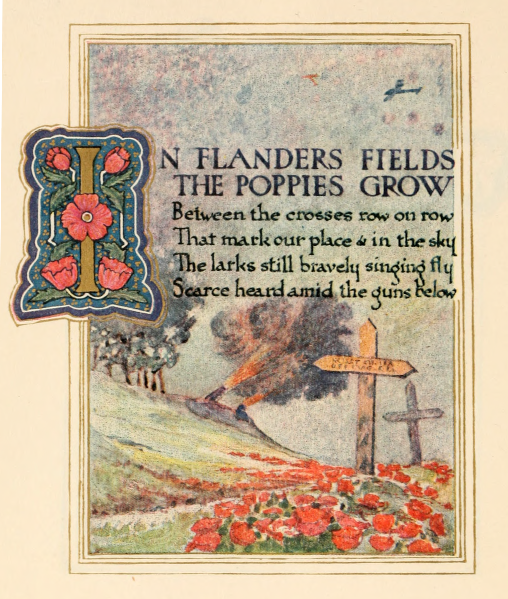
To continue the narrative: From Herselt we hike 9.4 miles to Testelt. It’s in a rural area of Flanders, an area that many people know Flanders from the World War One poem by Canadian physicain Lieutenant-Colonel John McCrae: “In Flanders Fields, the poppies blow between the crosses, row on row, that mark our place; and in the sky the larks, still bravely singing, fly scarce heard amid the guns below.” We may get a chance to pay our respects to the honored dead from that particular deady conflict in history – and if so I’ll report on that back home.

But back to Testelt. It’s known mainly for agricultural activities, including crop farming and livestock. It’s near the Albert Canal, “a significant waterway for industrial transport,” but the “quiet, pastoral setting contrasts with its proximity to larger urban centers like Antwerp.” The Demer river flows through town, “creating a scenic valley that has shaped the village’s agricultural landscape for centuries.” And there’s a Bierkroeg Den Hulst, a “cosy Belgian pub” that we may want to visit. (Bierkroeg translates to stein, beer mug or tankard.)

Next day we hike 9.2 miles to Diest, still in Belgium, where we’ll have our third day off.

The site Diest – Discovering Belgium has some suggestions, like Stuckens in Zoutstraat 5, famous for it’s pastries and sweets. (Not to worry; we’ll be burning calories.) See also Diest – Wikipedia, which notes the Grote Markt (Grand Square), to wit: A central square “surrounded by picturesque houses from the 16th to 18th Century.” From there we hike 12 miles to Heusden-Zolder, “nestled in the picturesque province of Limburg… Steeped in history and surrounded by beautiful natural landscapes, this hidden gem offers a delightful mix of cultural attractions and outdoor adventures.” (Those attractions include the iconic Circuit Zolder, a world-renowned racetrack, the site of numerous international events including Formula One races.)

Next day we hike eight miles to Stokrooie, also situated along the Albert Canal, “which bisects the village and significantly altered its landscape.” The sub-municipality “maintains a rural character while benefiting from its integration into the larger urban area of Hasselt.”

Then comes a 9.9 mile hike to Vlaandern, but when I Googled “Vlaandern belgium,” I got led to various sites including Flanders – Wikipedia, but no more information than that. I’ll have to report on that town, city or whatever it is, based on personal observation. (“Something to look forward to.”) Next we head 10.3 miles to Zutendaal, and we may hike through Zutendaal Forest, said to be a sprawling woodland area offering numerous walking paths, “making it an excellent place to unwind, stretch your legs, and enjoy the tranquility of the Flemish landscape.”

It’s also a perfect setting for a morning jog or perhaps some meditation amidst the sounds of nature. Visiting the forest provides an excellent opportunity for quiet reflection after a busy day of meetings, all while enjoying the fresh air and scenic views.

Next we hike 10.5 miles to Lanaken, our last day in Belgium. Located on the BelgianDutch border, it’s said to border Maastricht “directly” – note the quotes – and in the 2006 census, some 20 percent of the inhabitants turned out to be Dutch. Thus a number of neighborhoods in Lanaken are “characterized by these immigrants’ numerous villas and exclusive landhouses.” (So we may learn some valuable lessons on how Belgians treat such an influx of immigrants.)

Which brings up our last day hiking. Google says it’s a mere 3.5 miles from Lanaken to the town center of Maastricht, back in Holland, but our spreadsheet says our hike that day will be 8.1 miles. (From our lodging in Lanaken to the one in Maastricht.) Either way, that city – our final hiking destination – is known “for its lively squares, narrow streets, and historic buildings.” It features “1,677 national heritage buildings (rijksmonumenten), more than any Dutch city outside Amsterdam.” (The site 15 Best Things to Do in Maastricht offers some good suggestions.)

Also, while most of Maastricht’s city limits border Belgium’s Flemish region, “a small part to the south also has a border with Wallonia.” (The “Walloon” region that accounts for 55% of Belgium’s territory but only 31% of its population.) And both countries are part of “Europe’s Schengen Area and, thus, are open without border controls.” Definitely good to know.

And speaking of pubs, there’s one that offers “amazing views of Maastricht,” the Bold Rooftopbar, “on top of Sphinxcour.” (Apparently a covered tile passage showing the history of Maastricht.) “Whether you go during the day or at sunset, the view is stunning.” Or the site 09 Best Bars In Maastricht offers some other pub-hopping options – to celebrate the end of a successful hike – which brings us back to my first two days in Amsterdam.

Aside from the Heineken Experience – noted in the first of these three preview posts – there’s also the Café Karpershoek. This place is Amsterdam’s oldest formally recognized pub, dating back to 1606 as shown “through licensing records.” Here the “sand-covered floor follows a centuries-old method used to absorb spills.” And it’s a traditional Brown Café, so called because of the dark wood wall paneling, along with warm lighting and a relaxed atmosphere. “Many developed their appearance over many generations, which is why they feel aged and familiar.”

The thing is, the Café Karpershoek is an eight-minute walk from the Amsterdam Centraal station, which is where I’ll meet up with my hiking partners three days before we start the hike. And that “Centraal” station is where I’ll end up after we part ways in Maastricht. (I’ll head back to Amsterdam; they’ll take a train to Paris and fly home from there.)

So, once I get back to Amsterdam’s central station from Maastricht, I’ll probably stop at the Cafe before heading over to my last two nights lodging by Schiphol airport. (Kind of an Alpha and Omega thing.) And hopefully meditate on the end of memorable 140-mile hike through Holland and Belgium; a hike that ended in “Beautiful Downtown Maastricht, “with its lively squares, historic buildings – and at least one very beautiful bridge. “Looking forward to it!”

*   *   *   *
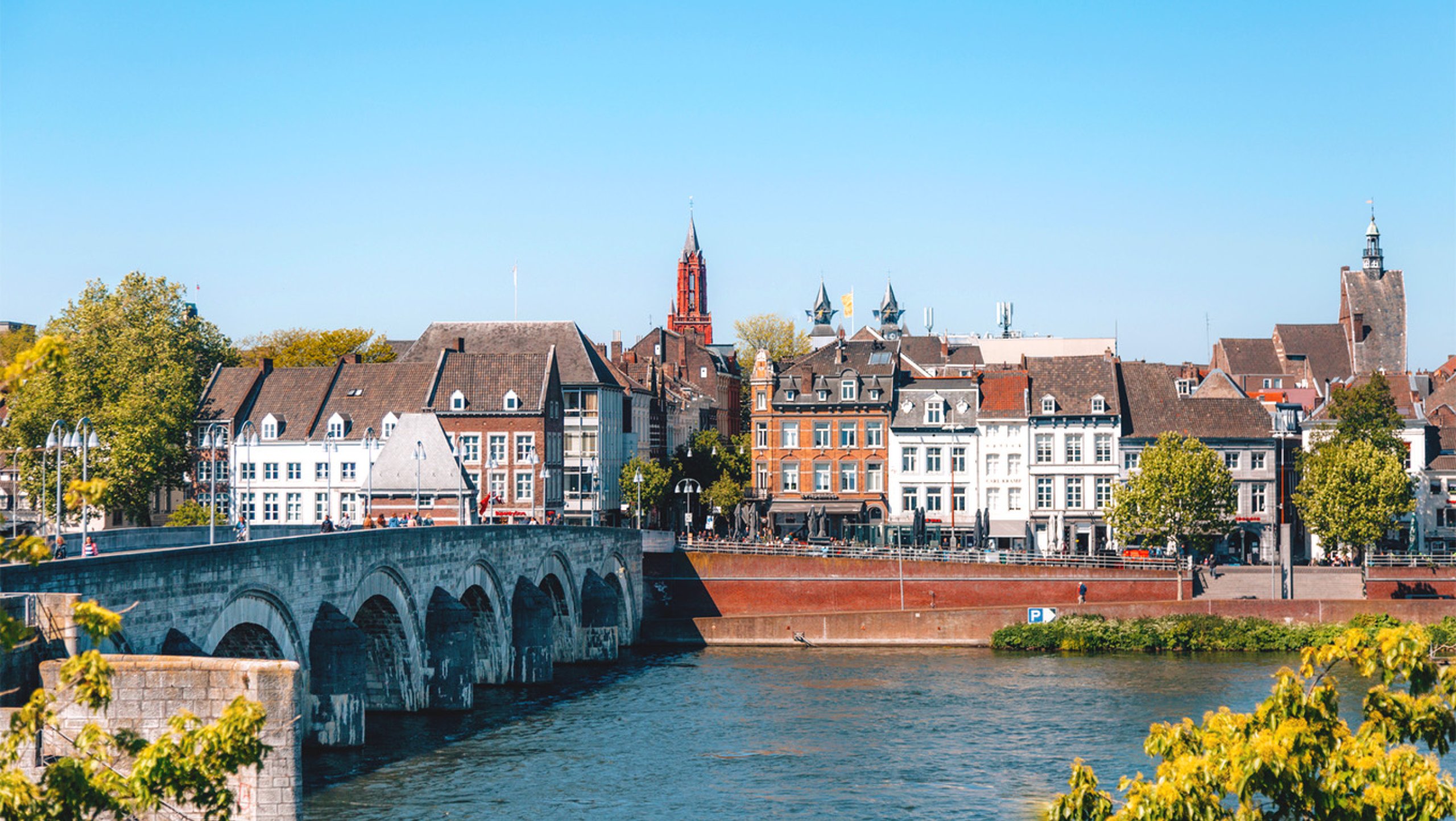
A bridge into Maastricht, with “lively squares, narrow streets, and historic buildings.”

*   *   *   *

The upper image is courtesy of In Flanders Fields – Wikipedia. Caption: “Illustrated page by Ernest Clegg. Note that the first line ends with ‘grow.'”

Re: Deadly wars. See Why wars are easy to start and hard to end.

Re: Sphinxcour. See Sphinxpassage | Maastricht: “The Sphinxpassage is a 120-metre-long covered tile passage between the Eiffel Building and Pathé. Almost 30,000 tiles bring Maastricht’s Sphinx past to life in words, images and objects.”

Re: The Cafe Karpershoek. See Amsterdam’s Oldest Pubs: Guide to Classic Brown Cafés.

The link “Beautiful Downtown” refers to the phrase “Beautiful Downtown Burbank” first used on the TV show, “Rowan and Martin’s Laugh-In,” which premiered in 1968. The full link name is Beautiful Downtown Burbank” – wesclark.com. Gary Owens played the announcer who coined the phrase, which “soon caught on and put Burbank on the map with television viewers all across the country.” (What can I say. I’m 75 years old and still remember such things from literally a century ago. Things like “it’s not fried, it’s Shake ‘n’ Bake, and Ah hay-uped.” Two syllables.)

The lower image is courtesy of “Maastricht Images.” With a page, “Welcome to the Netherlands A small country that’s big on culture and nature.”

*   *   *   *

Re:  The Israelite.  Harry Golden grew up in the Jewish ghetto of New York City, but eventually moved to Charlotte, North Carolina.  Thus the “Carolina Israelite.”  I on the other hand am a “classic 74-year-old “WASP” – White Anglo-Saxon Protestant – and live in north Georgia.  Thus the “Georgia Wasp.”    

Anyway, in North Carolina Harry wrote and published the “israelite” from the 1940s through the 1960s.  He was a “cigar-smoking, bourbon-loving raconteur.”  (He told good stories.) That also means if he was around today, the “Israelite would be done as a blog.”  But what made Harry special was his positive outlook on life.  As he got older but didn’t turn sour, like many do today.  He still got a kick out of life.  For more on the blog-name connection, see “Wasp” and/or The blog.

*   *   *   *
Hiking from Herkingen, Holland to Herselt, Belgium

*   *   *   *

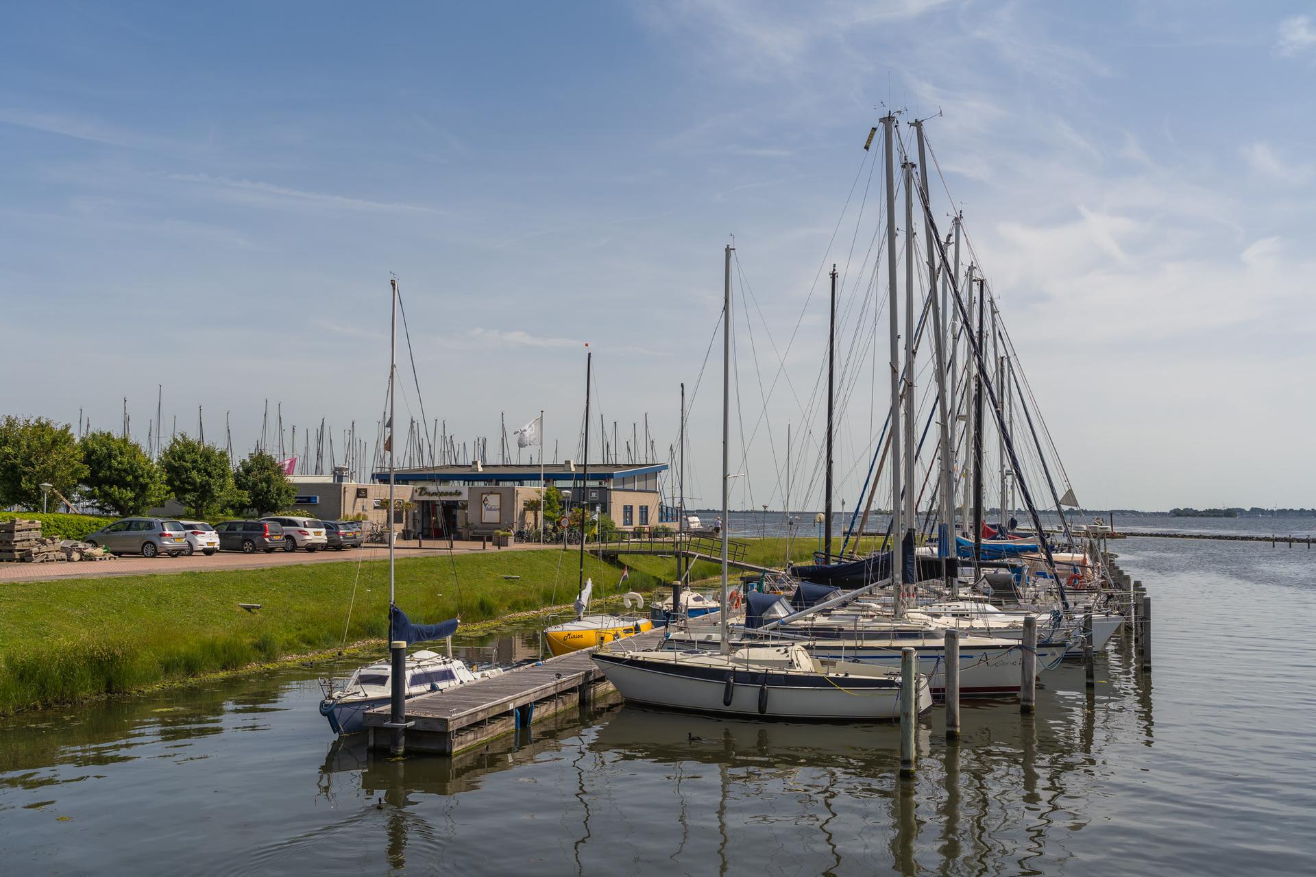
A scene from Herkingen, Holland, where three hikers will enjoy a first day off – from hiking…

*   *   *   *

Welcome to the “Georgia Wasp…”

This blog is modeled on the Carolina Israelite. That was an old-time newspaper – more like a personal newsletter – written and published by Harry Golden. Back in the 1950s, people called Harry a “voice of sanity amid the braying of jackals.” (For his work on the Israelite.)

That’s now my goal as well. To be a “voice of sanity amid the braying of jackals.”

For more on the blog-name connection, see the notes below.

In the meantime:

August 8, 2026 – The last post previewed my upcoming hike on the GR-5 in Holland. It started at Hook of Holland, and that post ended with our first day off in Herkingen. If things go like we’ve planned, we’ll have hiked some 51 miles in five days. (From “Hook” south and west to Herkingen.) After that first day off – sleeping two nights in the same bed – we’ll head the 13.3 miles south and east to Tholen. That is, it’s 13.3 miles according to our spreadsheet calculation, but Google Maps says its over 18 miles. (My brother just informed me that “the GR-5 wanders all over the place, rarely along Google’s shortest route.” Which I figured, writing this post, but I’m hoping for this hike down to Tholen the Google estimate is definitely the longer route.)

Either way, this day’s hike could present some challenges:

The municipality [ – of Tholen which takes its name from the town with the same name – ] consists of two peninsulas, formerly islands, the larger one on the south also called Tholen, the smaller one on the north called Sint Philipsland. The two are separated by the former strait, now bay, of Krabbenkreek. The municipality is bordered on the east by the Eendracht, once a Scheldt branch but now part of the Scheldt-Rhine Canal, crossed by three road bridges, by the Oosterschelde estuary to the south, the straits of KeetenMastgat to the west and the Krammer strait to the north.

In other words the place is surrounded by water, but a look at the Google Map route from Herkingen to Tholen shows some of the challenges a lot better. From Herkingen we may hike along the coast of South Holland Island with a wide body of water on our right. Then we may cross that wide body of water, via the N59 bridge until we reach the N257 and turn south(ish) and do a bunch of what looks like island-hopping.

Back on relative solid ground (according to Google) you reach Slikken van De Heen, “a beautiful nature reserve where land and sea meet. At low tide, mudflats and sandbanks emerge … a mosaic of creeks, grasslands and rugged nature.” And we may get to hear geese and ducks, plus “sometimes feel the salty wind blowing across the area from the Oosterschelde.”

But then there’s the site, GR®5 Segment 1.5: Herkingen – Nieuw Vossemeer, about that route from Herkingen to Tholen. It says the distance from Herkingen to Tholen is 15.3 miles, but shows Nieuw-Vossemeer as 6.3 miles short of Thoren. In other words, it’s in between the two ends of that one day’s hike. On the other hand, Google shows the walking distance from Herkingen to Nieuw-Vossemeer as 13.3 miles, so “something definitely doesn’t add up!”

The route leads hikers from Herkingen across the Grevelingendam onto the island of Tholen… Along the way, the path passes the Philips Dam and offers expansive views over the Krammer and Volkerak waters… In both Herkingen and Nieuw-Vossemeer, small-scale supermarkets and restaurants are available for necessary supplies.

That last is something to keep in mind, but assuming we do end up in Tholen – after however many miles – the next day we hike on to Bergen op Zoom. And by the way, for purposes of simplicity from here on I’ll refer to the Google Maps route. When I get home I’ll report back on the way we actually hiked. (Which is why I call these preview posts my pre-hike “recon.”)

Anyway, leaving town we’ll cross the Tholen bridge that connects North Holland and Zeeland. “This white arch bridge, which is part of the N286, crosses the Scheldt–Rhine Canal. South of the bridge you can find Tholen’s harbor. A marina with a historic shipyard sits near the old town center.” Bergen – our day’s destination – is in the province of North Brabant, with lots of hills formed by sandy soil pushing up against the marine clay, and locals “called those hills the Brabantse Wal, literally meaning ‘ramparts of Brabant.'” As for the town name, “Zoom refers to the border of these ramparts and bergen in Dutch means mountains or hills.”

That last is not something I’d look forward to, hiking over more mountains or hills. (After earlier hikes on the Chilkoot Trail, Pyrenees Mountains, the Way of St. Francis, and the Robert Louis Stevenson Trail over and through the rugged Cévennes Mountains in France?)

Google Maps says it’s 5.3 miles from Thoren to Bergen op Zoom, while our spreadsheet says it’s 9.1 miles. Which brings up one thing to note: In many if not most earlier Camino hikes – where, “at the end of each day you look forward to a warm bed, hot shower and cold beer” – we’ve had a guidebook available. But not so much, apparently, for just this first part of the GR-5. There are some guidebooks but they focus more on the more picturesque and challenging parts; the GR-5 going through France and especially over the Alps. (“Not this year!”)

And one more thing: Writing up this post I discovered two links – included in the Notes – that give a better idea of how the GR-5 in Holland and Belgium “wanders all over the place.”

Back to the hike. From Bergen op Zoom we hike 12.7 miles to Kalmthout, just inside Belgium. And for once the Google Map estimate isn’t that far off: The shortest estimate is 13.2 compared to our 12.7 miles. And Google seems to show that we’ll pass through the Kalmthoutse Heide, as in: “Discover the almost sacred silence of Grenspark Kalmthoutse Heide. This hike takes you past sand dunes, fens, grazing sheep and stunning panoramic views.”

Moving on through Belgium, we’ll hike 10.6 miles from Kalmthout to Brecht, a “charming town” in the Flanders region. Famous for picturesque streets, historic buildings and “cozy cafes serving delicious Belgian waffles.” For nature lovers, “lush forests and scenic countryside, making it an ideal destination for hiking, cycling, and exploring the great outdoors.” To get there we’ll head east to Wuustwezel, then southeast. (Per Google Maps, which says it’s 9.3 miles.)

From Brecht we hike the 8.6 miles to Zoersel, and our second day off. (Google Maps says it’s about seven miles, but our spreadsheet says it’s more like 8.6 miles.) Highlights include the Zoersel Town Hall, Saint Martin’s Church and the Park of Zoersel:

…nestled in the picturesque region of Flanders, Belgium, [the Park] is a tranquil oasis that offers visitors a serene environment to unwind and connect with nature. Located in the charming municipality of Zoersel, this park is renowned for its lush greenery, meandering pathways, and diverse wildlife. It serves as a perfect spot for both locals and tourists seeking respite from the hustle and bustle of everyday life.

Which sounds perfect for that second day off from hiking. But see also Surcele Oaked Pub – the name refers to the oldest name of Zoersel and literally means acidic (sur) soils (cele) – and also De Sjoks, Zoersel, known for it “great beer selection.” I may have to visit both places on the two-night-one-full-day, to compare and contrast.

From there we hike to Herentals and Herselt, where this post ends, with one preview post left to get to Maastricht. Google Maps says it’s 10.7 miles to Herentals from Zoersel, while our spreadsheet says it’s another 13.3 mile hike. Interestingly, the 10.7-mile Google route passes through a small village spelled “Einhoven,” remarkably similar to Eindhoven, Netherlands, of the Second World War’s Operation Market Garden fame. The Eindhoven in Netherlands is 37 miles east of Zoersel, but that’s the city I got when I tried to Google the “Einhoven” in Belgium. Which is something else I’ll have to report back on when I get home. along with the discrepancies between our spreadsheet and the Google Maps estimate of miles hiked in a day.

And Herselt offerss “expansive forests and rolling hills … a picturesque rural landscape:”

Herselt is situated in the Campine (Kempen) region of northeastern Belgium, characterized by predominantly flat terrain typical of this sandy plateau. The landscape features gentle slopes and low elevations, averaging around 16 meters above sea level, with local variations that facilitate surface runoff during heavy rainfall. This flat Campine topography, formed by sandy deposits from glacial and fluvial processes, influences local drainage patterns and limits relief to subtle undulations

Not to mention the statue below, “Wandeling dorpskern Herselt,” which may illustrate just how we three travelers will feeling limping into town after another 13.3 mile hike.

*   *   *   *

*   *   *   *

The upper image is courtesy of “Herkingen,” Images. It came with a page “Herkingen, eine Ortschaft am Grevelingenmeer,” which can be translated into English. (And incidentally, in Dutch the “Hoek” in Hoek of Holland can mean either “corner” or “cape.”) As for Herkingen itself:

Thanks to its beautiful location on the Grevelingenmeer, Herkingen is a popular holiday destination for water sports enthusiasts on Goeree-Overflakkee. Here you will find water, beach and the vast Dutch landscape that will make you forget the hustle and bustle of everyday life. The modern marina and good restaurants are other reasons for a relaxing holiday in Herkingen. Herkingen offers pure pleasure.

And about those earlier Camino hikes – and the Chilkoot Trail, where at the end of each day we definitely did not have a warm bed, hot shower and a cold beer: Use the search engine above right for links to past posts.

The site GR®5 the Netherlands, South Holland, Netherlands – Map, Guide shows the actual route, with different lodging sites different from ours. The site GR 5 Belgium: North Sea to Alps Hiking Guide gives some good information on this part of the hike.

Actually there is a GR5 walking guidebook – trek from Hoek van Holland, or “The GR5 Trail – Benelux and Lorraine,” but it’s 19 Euros and covers more than double what we need. (327 miles to our 140.) See also The GR5 in the Netherlands, Belgium, Luxembourg, Lorraine, etc.

A note. After our second day off in Zorsel, we hike on to Herentals, Herselt, Testelt and Diest, still in Belgium, where we’ll have our third day off. (Hey, I’m 75 and my brother is 81.) From there we hike to Huesden Zolder, Stokrooie, Vlaandern, Zutendaal, and finally Lanaken, our last day in Belgium. And since this post ends with Herselt, the next post will begin with the hike from there to Testelt. (And yes, lots of funny names.)

The full link: Zoersel Travel Guide: Top 10 Must-Visit Tourist Places.

The lower image is courtesy of “Herselt belgium Images.” See also “Wandeling dorpskern Herselt | Wandelroute | WandelWeb, which seems to show a hill 40 meters high at the start of that day’s hike?

*   *   *   *

Re:  The Israelite.  Harry Golden grew up in the Jewish ghetto of New York City, but eventually moved to Charlotte, North Carolina.  Thus the “Carolina Israelite.”  I on the other hand am a “classic 74-year-old “WASP” – White Anglo-Saxon Protestant – and live in north Georgia.  Thus the “Georgia Wasp.”    

Anyway, in North Carolina Harry wrote and published the “israelite” from the 1940s through the 1960s.  He was a “cigar-smoking, bourbon-loving raconteur.”  (He told good stories.) That also means if he was around today, the “Israelite would be done as a blog.”  But what made Harry special was his positive outlook on life.  As he got older but didn’t turn sour, like many do today.  He still got a kick out of life.  For more on the blog-name connection, see “Wasp” and/or The blog.

*   *   *   *

A preview of Holland’s GR-5 hike

*   *   *   *

Heineken experience, Amsterdam
“The large copper stills of the Heineken Experience,” in the middle of Amsterdam…

*   *   *   *

August 1, 2026 – I’m taking a break from doing posts about my two-week driving trip last May in Ireland. This post will preview an adventure that’s coming up later this month.

My brother, his wife and I will be hiking 140 miles on the GR-5. It starts at the Hook of Holland in the Netherlands and crosses Belgium and Luxembourg before moving into France. (The “GR” stands for a series of long-distance walking trails throughout Europe; the translations in various languages generally mean “‘long trail’ or more literally ‘great route.'”) The whole GR-5 runs over 700 miles and ends up in Nice, France, on the Mediterranean coast, but we’re only going as far as Maastricht. (And to get there we’ll hike through Belgium for not quite two weeks.)

For starters: I’ll fly over and spend four days in Amsterdam. Two of those days I’ll be on my own, then I’ll meet up with my brother and his wife. (Flying into Paris and taking the train over from there.) After those two family days we’ll take the train to “Hoek van Holland,” spend the night there and start the hike the next day. (BTW: For what to do those four days see The Ultimate 3-Day Amsterdam Itinerary (By A Local). One idea? Beers & Barrels on Rembrandtplein.)

Another idea? The Heineken Experience, close to the Albert Cuypmarket:

This tour gives you access to the old brewery and the first brew room, where the beer was produced before the company grew too big and moved elsewhere. You’ll learn everything about Heineken and end up on the roof terrace where you can enjoy two beers, included in the tour. With your I Amsterdam City Card you get a 25% discount, but tours must be booked with your card in advance.

By the way, according to the 3-Day itinerary site, a “72-hour I Amsterdam City Card costs €100 ($110) and fits perfectly with this three-day itinerary. It saves you money in the end. It includes public transport within the city, free entry to a lot of museums, a free canal cruise and a free one-day bicycle rental.” Plus you get a 25% discount to the Heineken Experience. (The City Card site says you can get a three day card for much less, though without the discounts?)

But enough about that; on to the hike itself. From Hook of Holland we’ll pass through Rozenburg, Brielle, Hellevoetsluis, Goedereed and Herkingen. There we’ll stay two nights – and enjoy a day off. After that first day off, we pass through Tholen, Bergen op Zoom, then on to Kalmthout in Belgium. Passing through Belgium, we’ll go through Brecht and Zorsel; there for two nights and a second day off. From there we hike to Herentals, Herselt, Testelt and Diest, still in Belgium, where we’ll have our third day off. (Hey, I’m 75 and my brother is 81.) From there we hike to Huesden Zolder, Stokrooie, Vlaandern, Zutendaal, and finally Lanaken, our last day in Belgium.

On our last day hiking we’ll get back into Holland and end up at Maastricht. After two days there – recuperating – we’ll part ways. My hiking partners will take the train to Paris and then fly home. I’ll take the train up to Arnhem and stay for one night, then head back to Amsterdam. I’ll spend one night there, then fly home to Atlanta. And now for some specifics.

The first 93 miles in Holland – down to the Belgian border near Bergen op Zoom – start off with a diverse landscape of expansive dunes and maritime forests along the Zeeland islands.

The first day’s hike ends in Rozenburg, after 13 miles. (One of our longest days?) It’s on Rozenburg Island, “formed centuries ago from several sand bars in the mouth of the river Maas.” (Aka the Meuse.) Our spreadsheet says it’s 13 miles, but Google Maps says it 13 kilometers or 8.3 miles. Either way it’s mostly flat along the river, plus there’s a ferry. (Says Google.)

I’ll report back on that when I get home, but here’s a note from experience. The Google-Map way usually follows highways, as I found out hiking the Canterbury Trail last year. (See Clackett Lane to Dunton Green: “That Google Map way led to series of near-death experiences, in the form of cars zipping by at high speeds with little or no room on the side of the road.”)

And all this for a total of 23 days on the trail; 20 hiking and three days off in between.

Now back to the specifics. After Rozenburg we’ll hike 6.5 miles to Brielle, a historic seaport “on the north side of the island of Voorne-Putten, at the mouth of the New Maas.” And again, our spreadsheet differs from the Google Maps, which says 4.8 miles. (One possible reason: Google tracks its maps from one center of a town to the center of another, while our spreadsheet is based on “lodging to lodging.”) Also, Brielle is on the far outskirts of Rotterdam.

From Brielle we hike to Hellevoetsluis, “with the sea, beach and dunes close by.” It features “2,000 mooring places, spread over five harbours. With such a broad expanse of water as the Haringvliet and the North Sea close by, it is popular with water sports lovers.” And yet again there’s a discrepancy in mileage, but we’ll end up north of town, close to where the N57 bridge crosses the Haringvliet. That’s a large inlet of the North Sea and “an important estuary of the Rhine-Meuse delta.” (Our spreadsheet says that day’s hike is 13.6 miles.)

From Hellevoetsluis it’s 6.2 miles to Goedereede. In the Middle Ages it was an important trading town with ramparts, and the name means “safe harbor” or safe anchorage. And to get there we’re apparently going to have to walk across that N57 bridge? (For quite a ways it looks like.) And for once Google Maps is close to our estimate.

That’s also true of the next day’s hike, to Herkingen, where for the first time we head south, instead of north or west. (Actually south-southeast.) Herkingen itself is a village in the Dutch province of South Holland, “on the south coast of the island Goeree-Overflakkee, in the municipality of Goeree-Overflakkee.” (And Goeree-Overflakkee is a delta island, the largest island by land area in the Netherlands after the man-made Flevopolder.”)

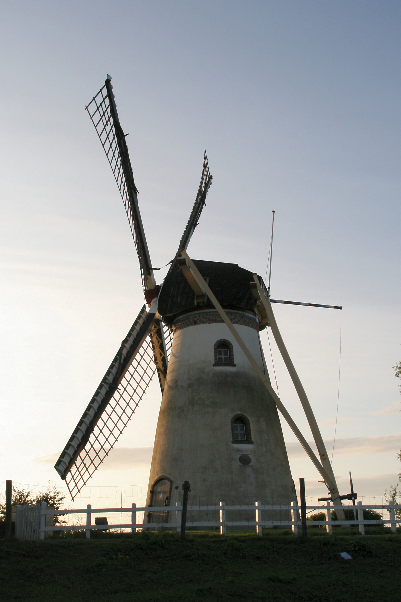
In Herkingen we stay two nights – and enjoy our first day off from hiking. One note: The town “currently hosts several of the largest modern windmills in the country.” Something to look forward to, exploring, along with “several pubs and cafés that provide a cozy atmosphere and local cuisine.” Next up, on to Tholen, Bergen op Zoom, and then Kalmthout in Belgium.

*   *   *   *

“Windmill De Dankbaarheid” – in Herkingen and our first day off…

*   *   *   *

The upper image is courtesy of the Ultimate 3-Day Amsterdam Itinerary.

The link GR®5 the Netherlands notes: “The GR®5 in the Netherlands covers approximately 93 miles (155km) from Hook of Holland to the Belgian border near Bergen op Zoom. This route traverses a diverse landscape of expansive dunes, maritime forests, and the impressive Delta Works along the Zeeland islands.” The link GR5: NL section – Into the hike adds:

This is the first section of GR5, beginning in Hoek van Holland, a town next to the North sea, and ending in Bergen op Zoom. As Caroll Dorgan describes in his guidebook, the altitude change is negligible, but if you think it’s a boring hike, well, think again. I was amazed by the beauty of the coastal Netherlands, the friendliness of people I’ve met and the variety of fauna on the trail. This was also my first multi-day hike alone, earning a special place in my heart. 

The lower image is courtesy of Herkingen – Wikipedia. Another note: The place “offers several pubs and cafés that provide a cozy atmosphere and local cuisine.”

*   *   *   *