Category Archives: Travelogs

“Hola! Buen Camino!”

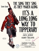
It's_a_Long_Way_to_Tipperary_-_cover_2

I’m now in Puente Villarente, about eight miles shy of Leon.  (In Spain, on the Camino de Santiago.) By the time we get there – tomorrow – we will have hiked 250 miles from Pamplona, in the 21 days since we left on September 13. (We took a day off in Burgos.) Unfortunately my tablet isn’t good for the usual high-quality posts, so for now I’ll try this more-primitive version.

The image above refers to one of the favorite songs on my iPod Shuffle. The one I sneak out every once in a while, “on the march.” But I’ve changed the words to “It’s a long way to Santiago!” (Santiago de Compostela that is.)

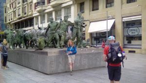
IMG_20170912_144540

Here’s a picture from Pamplona, showing two “turistas” in front of a statue commemorating the annual running of the bulls. It seems like an eternity ago.

The first 10 days after that – on the hike – were pretty miserable. My left foot constantly throbbed, until it blistered up and got tough. But the day off in Burgos helped a lot. And since then we’ve made good progress. Still, we had to implement a Plan B, which involves renting bikes in Leon and cycling the remaining 194 miles.

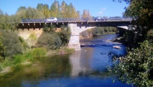
But for now we’re happily ensconced in Puente Villarente, a city named for the old Roman bridge shown below.

I’ll try to either update or add some such primitive posts, but if not, I’ll be back home on or about October 17.

IMG_20171003_142757


Going back “whence we came…”

I’m going east to explore Spain.  (That’s where Columbus – center – started west to explore us…)

*   *   *   *

Within 48 hours I’ll be winging my way from Atlanta to Madrid (As in Spain, and as indicated in Training for the Camino.)  From there I’ll be taking a train to Pamplonafrom whence my brother and I will hike 450 miles in 30 days, on the Camino de Santiago.  Which brings up the whole “whence we came” thing.  (As illustrated at right, and in the title of this post.)

That phrase is attributed – variously – to John F. KennedyJames Baldwin, and Jesus.

Jesus said – in the King James Version of John 8:14 – “I know whence I came, and whither I go; but ye cannot tell whence I come, and whither I go.”  John F. Kennedy put it this way:  “When we go back to the sea … we are going back from whence we came.”  And James Baldwin said, “If you know whence you came, there are absolutely no limitations to where you can go.”

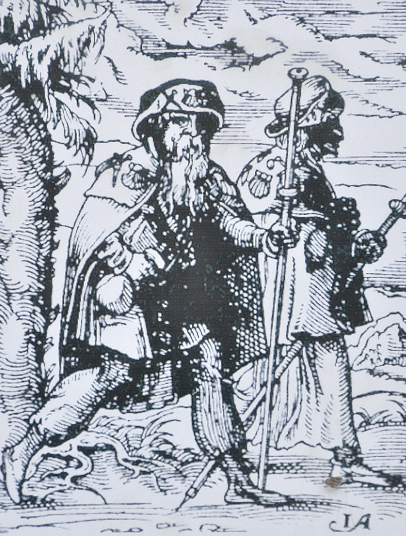
Which pretty much sums up the whole idea of going on a pilgrimage.  As in – for example – going for a 450-mile hike on the Camino de Santiago. (As shown at left, in an illustration from a far earlier time.)

Or, as Pope (Emeritus) Benedict XVI put it:

To go on pilgrimage is not simply to visit a place to admire its treasures of nature, art or history.  To go on pilgrimage really means to step out of ourselves in order to encounter God where he has revealed himself…  Above all, Christians go on pilgrimage [for example] to Compostela, which, associated with the memory of Saint James, has welcomed pilgrims from throughout the world who desire to strengthen their spirit with the Apostle’s witness of faith and love.

The point of all this being that – in going to Spain – I’ll be going back to the place where the whole American Saga really began.  (As illustrated in the painting at the top of the page.)  That saga – the American Journey – began when one Chris Columbus met “Isabella I of Castile and Ferdinand II of Aragon.”  I.e., back “whence we all came.”

Metaphorically or otherwise…

But there is one problem.  In preparing for the trip, I found out that I know very little about Spain as it is today.  For example, I didn’t know that Spain is now both a constitutional monarchy and a parliamentary democracy.  (One of “19 full democracies in the world.”)

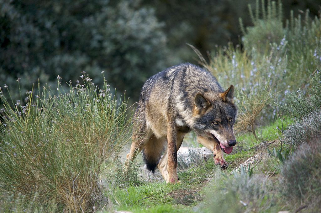
I also didn’t know about the Iberian Wolf – at right – but there’s more on that later.

More to the point, I didn’t have much of an idea of what kind of sections or provinces of Spain that I’d be hiking through.

But I know now – through the magic of Googling – that my portion of the 450-mile Camino-hike will go through the four most-northerly regions of Spain:  NavarraLa RiojaCastilla y Leon, and Galicia.

(My brother will be hiking further:  Over the Pyrenees – from Saint-Jean-Pied-de-Port in France – and meeting up with me in Pamplona.  So he’ll do 500 miles and I’ll do 450 miles.  But personally I had enough mountain hiking last August.  See On the Chilkoot &^%$# Trail! – Parts One  and Two.)

So anyway, the capital of the first province on our mutual journey – Navarra (Navarre) – is Pamplona.  This – it is said – is “a quiet and pleasant city … world-famous for the Running of Bulls which form part of its most famous festival, Sanfermines, in July.”  (And as immortalized in The Sun Also Rises, the 1926 novel by American author Ernest Hemingway.)

Wine with the La Rioja Designation of Origin © La Rioja TurismoThe La Rioja region also has one province, of the same name.   The “smallest of Spain’s Autonomous Communities,” the first thing that comes to mind for La Rioja is “probably the wine bearing the same name.”  (Memo to self:  Do more research on this topic.)  

Along the Way of Saint James there are monumental towns of great beauty lined up:  Calahorra, Arnedo, San Millan de la Cogolla,Santo Domingo de la Calzada, and Logroño, founded already by Romans and today the region’s capital.

The next region – Castilla y Leon – is not only the largest region of Spain, it’s also “the largest region of all the European Union.”  And it’s actually two regions in one:  “Castilla and Leon came together in 1983, when the regions of Castilla la Vieja and Leon were united.”

The 450-mile hike ends in Galicia, the region “known in Spain as the ‘land of the 1000 rivers.'”  It has four provinces:  Lugo, Ourense, Pontevedra and A Coruña.  The capital of the latter province is – as we well know by now  – Santiago de Compostela.  And that’s the “final destination of the famous pilgimage way” and “certainly among Spain’s most beautiful cities.”

In closing this post, I’m not sure when I’ll get to do another one before I get home  That is, I’m not sure how safe, secure and user-friendly are the “public” wi-fi connections in Spain.

But in the meantime, consider the following little tidbits of information:

*   *   *   *

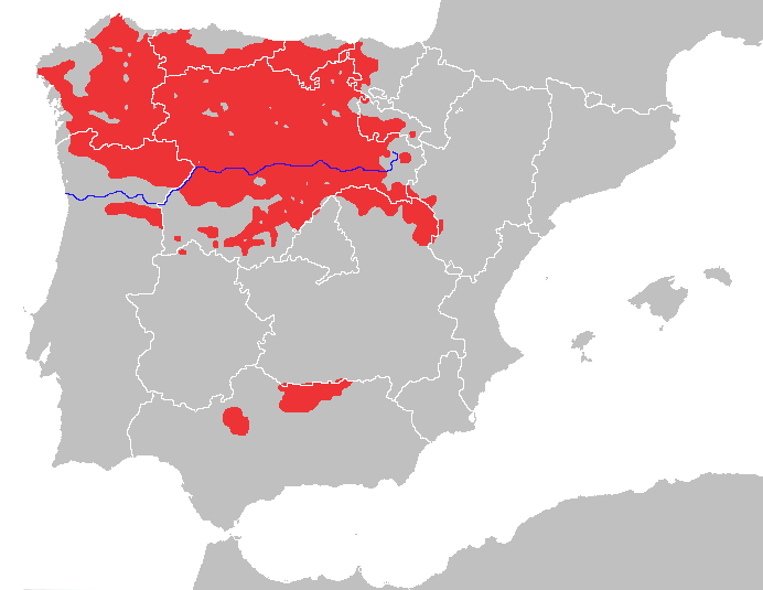
The region of Spain where my brother and I will be hiking…

The “approximate geographical range of the Iberian wolf…” 

IberianWolf-Map.png

And finally, an “Alpha male Iberian wolf with blood stains in its snout:”

Just Sayin’!

*   *   *   *

The upper image is courtesy of Spain – Wikipedia.  The caption:  “Christopher Columbus meets Isabella I of Castile and Ferdinand II of Aragon in the Alhambra.”

Re:  “Whence.”  The Kennedy-quote image is courtesy of To sail or to watch – we are going back from whence we camequotefancy.com.  Kennedy made the comments at the “Dinner for the America’s Cup Crews,” on September 14, 1962.  Here’s the full quote:

I really don’t know why it is that all of us are so committed to the sea, except I think it’s because in addition to the fact that the sea changes, and the light changes, and ships change, it’s because we all came from the sea.  And it is an interesting biological fact that all of us have in our veins the exact same percentage of salt in our blood that exists in the ocean, and, therefore, we have salt in our blood, in our sweat, in our tears.  We are tied to the ocean.  And when we go back to the sea – whether it is to sail or to watch it – we are going back from whence we came.

Re:  “American Journey.”  See also The American Journey: A History of the United States, the text book, not to be confused with American Journey, the “six-part orchestral composition” composed by John Williams and “commissioned by U.S. President Bill Clinton to accompany a multimedia presentation titled ‘The Unfinished Journey’ directed by Steven Spielberg for the 2000 ‘Millennium‘ celebrations.”

Re:  “Back ‘whence we all came.'”  Yeah, I know, the Vikings Beat Columbus to America, but they didn’t stick around very long.  See Norse colonization of North America – Wikipedia:  

The Norse colony in Greenland lasted for almost 500 years.  Continental North American settlements were small and did not develop into permanent colonies.  While voyages, for example to collect timber, are likely to have occurred for some time, there is no evidence of any lasting Norse settlements on mainland North America.

Information on the “northerly regions of Spain” was gleaned from Regions of SPAIN – All about Spain.

The “wolf” image is also courtesy of the Wikipedia article on Spain.  The caption, “Iberian Wolf.”  The caption for that link indicates that the Iberian Wolf is “a subspecies of grey wolf that inhabits the forest and plains of northern Portugal and northwestern Spain.  The 2003 census estimated the total Iberian population to be 2,000 wolves.”  The article further indicated that “Iberian wolf lives in small packs.  It is considered to be beneficial because it keeps the population of wild boar stable, thus allowing some respite to the endangered capercaillie populations which suffers greatly from boar predation.  It also eats rabbitsroe deerred deeribexes and even small carnivores and fish.  In some places it eats domestic animals such as sheep and dogs.”

The “La Rioja” image is courtesy of Tourism in La Rioja (Province) in Spain | Visit La Rioja.  The caption:  “Wine with the La Rioja Designation of Origin © La Rioja Turismo.”

Note again that the map above – showing the “Approximate geographical range of the Iberian wolf” – roughly coincides to where I’ll be hiking.  See e.g. the top map in Training for the Camino.

Also, note that the idea of Columbus starting “west to explore us” is a bit of Artistic License.

Training for the Camino

My projected route will start at Pamplona, at the lower right, for some 450 miles of hiking…

*   *   *   *

Three weeks from now I’ll be winging my way from Atlanta to Madrid.*  (As in Spain.)  I’ll arrive at 8:30 Saturday morning, after an all-night flight.  (And no doubt suffering from jet lag.)

Bad news? “Travelling east causes more problems than travelling west because the body clock has to be advanced, which is more difficult.” And if you cross six time zones – like me – “the body will typically adjust to this time change in three to five days.” By that time I’m supposed to be in Pamplona, getting ready to hike 450 miles, in 30 days, on the Camino de Santiago.

*   *   *   *

And now for some background:  Last year at this time I was training for a four-day “hike” on the Chilkoot Trail.  I was also training for a canoe trip.  That canoe trip came after the Chilkoot-Trail hike, and entailed my brother and I paddling 440 miles “down” the Yukon River,* in Canada.

I described those adventures in On the Chilkoot &^%$# Trail! – Part 1 and Part 2, and in “Naked lady on the Yukon.”  (As metaphorically illustrated at right.)

The “Chilkoot” was pretty much a nightmare.  For one thing, it’s not a trail at all.  It’s more like one big pile of &^%#$ rocks after another.  But I’m glad I did it.

I’m also glad my brother and I canoe-paddled 440 miles “down” the Yukon River, from Whitehorse  to Dawson City.  (For reasons including but not limited to the “naked lady” sighting described in my prior posts.)  So now I’m ready for a new adventure.

For one thing, between last summer and now we’ve had a contentious presidential election, and an even more contentious beginning-of-the-Trump Administration.  So my new adventure in Spain is a chance to get away from it all.  Then too, I’ve tried to keep pace with all the resulting mayhem since last August, but to no avail.  (For one thing I was going to do a post on a “Bizarro Trump.”  But that’s been impossible because it’s hard to tell the Bizarro version from the real thing.)  So I’ve decided to focus on some things I can actually have an impact on.

Things like my upcoming pilgrimage on the Camino de Santiago.  (Where I’ll meet up my brother in Pamplona, but not during the “running of the bulls, as seen at left.)

And incidentally, the map at the top of the page is courtesy of Camino de Santiago 800 PROJECT.  That post described a 14-day trip on the Camino, starting at Saint-Jean-Pied-de-Port.  But that guy and his travel-buddy covered the 500 miles on bicycles, not on foot.  (Though traveling on bikes could be a fallback position for us:  “an alternative course of action that may be taken if the original plan fails.”)

Other sites with good advice include Preparing for the Camino and Training for the Camino.

Then there’s Camino de Santiago – Helping pilgrims since 2004, and – for some “devil’s advocate” feedback – a post called 10 Reasons Why El Camino Santiago Sucks.

Among the reasons the Camino “sucks:” Car traffic within earshot 95% of the time, monotonous scenery and unfriendly commercialism.  But apparently the biggest reason:

It’s hard to take a piss.  There’s little privacy. Cars and pilgrims are constantly passing you by.  After 3 p.m. most pilgrims retire to their albergues (huts) and you’ll get more privacy to do your business.  Nevertheless, at 7 p.m. one jogger still managed to catch me with my pants down.  [Emphasis in original.]

13 Dead Horse GulchWhich could be a personal problem.  And for that matter there was also very little privacy on the Chilkoot Trail.

But as I described the situation in The Chilkoot – Part 1, that was more of a problem of “cursing my fate” rather than answering a call of nature.  (See the notes…)

Then too, I ran into a similar problem kayaking into the Okefenokee Swamp – twice – for overnight camping trips.  But in that case it was a matter of no solid ground – in the swamp – for you to get out and stand up.  (For whatever reason.)

But we were talking about “training for the Camino.”  For starters, there’s a boatload of paperwork:  Making sure your passport is up-to-date, and has at least three months left after your projected departure date.  (Departure back home from Spain that is.)  Getting your pilgrim’s “credencial.”  Booking your air line flight.  Getting travel insurance.  Getting your pack ready, and making sure it weighs no more than 10% of your body weight.  (For me, 16 pounds.)

You could get all the necessary prep-info from the websites noted above, or other informative sites. Or, you could have an ex-Marine Sgt. Rock-type older brother who’s done the research already.

And sent a number of informative emails, plus a 4-page single-spaced “to-do list” to check before you leave.  (Not to mention a note saying, “I hope you’re saving this information I’m passing on…”) 

As to getting ready to hit the trail itself, the hardest part is getting your feet ready.  (Like the hardest part of getting ready to paddle six hours a day for eight days is getting your wrists and hands in shape.)  To that end, I’ve been hiking 12 or more miles a day, once a week, for the last several months.  And making sure my feet are in good enough shape the next morning to hike another five or six hours.  And for the past several weeks I’ve been doing my weekly hikes on the Pine Mountain Trail, near F.D. Roosevelt State Park, near Warm Springs, GA.

But there’s a big difference.  The Pine Mountain Trail is – I hope – far more rugged than the Camino.  Lots of roots, boulders, sheer drop-offs and slippery-rock streams to cross.  On the other hand the Camino seems to be more smooth and level, or asphalt-paved.

Naturally I’ll be doing a post-mortem in this blog, once I get home.  So “we” will see if my hike-training preparations were adequate.  But in the meantime it pays to look ahead.  And looking ahead to some time on the weekend of October 14-15 – some seven and a half weeks from now – I hope to catch a glimpse of of our final destination, shown below.  That would be Santiago de Compostela, whether the “Pico Sacro*” is in the background or foreground.

*   *   *   *

“A partial view of Santiago de Compostela, with the Pico Sacro in the background…”

*   *   *   *

The upper image is courtesy of Camino de Santiago 800 PROJECT: Map of the Routesilverarrow18.blogspot.com.  

“Note” also that an asterisk in the main text indicates a statement supported by a reference detailed further in this “notes” section.  Thus as to the asterisk next to the passage “from Atlanta to Madrid:” The image is courtesy of the Wikipedia article on Spain, including a link to the Spanish Civil War (1936-39).  The caption indicated the words “No pasaran” translate to “They shall not pass.”  The caption further noted a sub-title on the banner, that “Madrid will be the graveyard of fascism.”  And finally, the caption noted that “Fascism was on rise in Europe during Spanish Civil War,” which somehow seemed appropriate…

Also, re:  “‘down’ the Yukon River.”  As explained in the “naked lady” post, the Yukon flows north, like the Nile River but unlike most other rivers in the world.  Thus the anomaly of saying you are paddling “down” a river, but also paddling northward, which most people refer to as “up.”  See The Straight Dope: On maps, why is north always up?

Re:  “Cursing my fate.”  See On the Chilkoot &^%$# Trail! – Part 1:

What with my lack of depth perception, going over “one big pile of *&$% rocks after another” was like negotiating a minefield.  I wore heavy hiking boots, but they felt like ballet slippers. Every step was sheer torture…  I had just taken one of many missteps – especially bad that day – and let loose a string of pungent epithets. Then I looked behind me and there – climbing “personfully” behind me – was [a] sweet young [lady hiker].  Sheepishly I apologized, noting that I had “no depth perception.”

Also re:  The Camino.  See also Camino de Santiago – Wikipedia.

The image to the right of the paragraph “But as I described the situation,” shows “Dead Horse Trail,” so named for the number of horses who died on White Pass, the only alternative route to the Klondike gold fields in the 1898 gold rush.  As to which route was better – White Pass or the Chilkoot Trail –  “a pioneer – Mont Hawthorne – said there really was no choice:  “One’s hell.  The other’s damnation.”  

The “Sgt. Rock” image is courtesy of Sgt Rock Wallpapernocturnals.com.

The lower image is courtesy of Santiago de Compostela – Wikipedia.  As to “Pico Sacro,” see Pico Sacro | Web Oficial de Turismo de Santiago de Compostela, which added these points:

The history of the municipality of Boqueixón is closely linked to its main geographic landmark and greatest natural and cultural resource:  Pico Sacro, one of Galicia’s most mythical and best-known mountains.

Pico Sacro’s silhouette is a scenic point of reference in a wide-ranging area.

Pico Sacro is the source of countless legends and traditional tales.  The region’s inhabitants venerated the mountain before and after the arrival of Christianity, and it plays an essential role in the myth regarding the transfer of the Apostle James’ body.  It has a peculiar shape formed by rocks of crystallized quartz and a height of 533 metres above sea level.

Canoeing 12 miles off the coast of Mississippi…

*   *   *   *

July 19, 2017 – In September I’m flying to Madrid, Spain.  From there I’ll take the train to Pamplona, to meet up with my adventurous brother, Tom.  From that point we’ll both be hiking the Camino de Santiago.  (At left.)  We plan to hike 450 miles in 30 days.

Which brings up the 8-day canoe trip that we two took back in November 2014, “12 miles offshore.”  (I.e., 12  miles off the coast of Mississippi.)  We started out on Lake Pontchartrain, then paddled through the Rigolets, then out into the Gulf of Mexico.

12 miles out into the Gulf of Mexico.

We paddled a whole lot during the day.  In one stretch we paddled 17 miles in 11 hours.  Then at night we “primitive camped.”  We primitive camped on places like Half Moon Island and East Ship Island.  (And from time to time we camped on an occasional salt marsh.)

Which naturally brings up the question, Why?   Why would two old geezers – 63 and 69, respectively and at the time – paddle so far out into the realm of sharks and drowning?

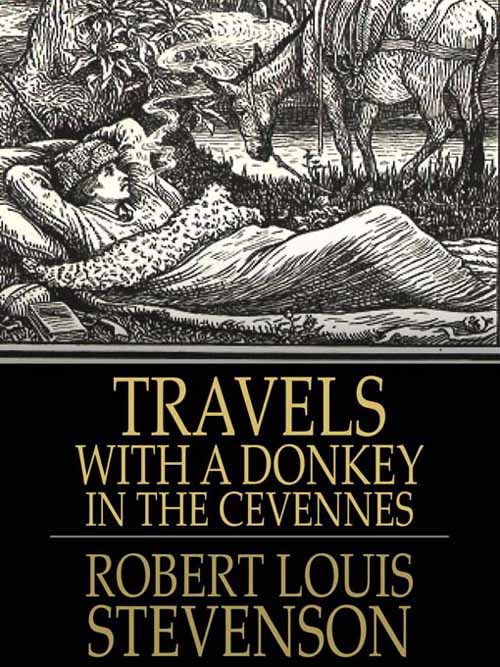
http://walkinginfrance.info/wp-content/uploads/2009/01/Travels1.jpgI still don’t know the full answer, except to say that such adventures are a whole lot of fun once they’re over.  But part of the appeal got spelled out by both John Steinbeck – in Travels with Charley – and Robert Louis Stevenson.  (His Travels with a Donkey in the Cévennes is at right.)

The sum and substance of it is that there’s something rewarding to doing the unexpected.  There’s something rewarding in paddling 12 miles offshore, at the mercy of the elements, with day’s end promising “naught but a lukewarm meal on a soggy beach,” or a more soggy salt marsh:

But as it turns out, that’s the nature of pilgrimages.   They give us a break from “real life,” from the rat race that consumes so many lives today…  [T]hrough the raw experience of hunger, cold and lack of sleep, “we can quite often find a sense of our fragility as mere human beings, especially when compared with ‘the majesty and permanence of God.’”   In short, such a pilgrimage can be “‘one of the most chastening, but also one of the most liberating’ of personal experiences.”

As Wikipedia noted, such journeys – pilgrimages – can be to a “shrine or other location of importance to a person’s beliefs,” or some other search “of moral or spiritual significance.”  (Wikipedia also noted that one “popular pilgrimage journey is along the Way of St. James to the Santiago de Compostela Cathedral, in Galicia, Spain,” but that’s a subject for future posts.)  

But perhaps the best answer – at least for people of a certain age – is simply to show that we can still do it.  Or as John Steinbeck said in Travels with Charley, too many men – as they get older – “hood their passions, and gradually retire from their manhood.”  But that wasn’t his way:

I did not want to surrender fierceness for a small gain in yardage…  If this projected journey should prove too much then it was time to go anyway.  I see too many men delay their exits with a sickly, slow reluctance to leave the stage.  It’s bad theater as well as bad living.

Or to put it simply:  I want to have these adventures before I get too old and decrepity.

*   *   *   *

And incidentally, the photo below is another one I took near dawn on November 10, 2014. (That’s the day we did 17 miles in 11 hours, which amounted to some six hours of actual canoeing.)  Also, given the age of the “intrepid canoeists” it behooved us to learn – through “OJT“ – the technique of “siesta at sea.”  Note the calm water that is a necessity for such a siesta when you’re 10 or 12 miles out in the Gulf.  In other words, it pays to pace yourself

In further words, we’ll likely be taking plenty of siestas on the Camino de Santiago.

*   *   *   *

For a longer version of this tale, see On canoeing 12 miles offshore, from May 2015.

The “pilgrim” image – to the left of the first paragraph in the main text – is courtesy of the Wikipedia article on the Camino de Santiago.  The caption:  “Way of St. James pilgrims (1568).”

Re:  “Calm water.”  The Gulf waters were so calm because we got up and broke camp at 3:00 in the morning.  Later on in the day – owing to increased wind and the heat of the sun – the waters in the Gulf of Mexico get way more roiled.

Re:  Siestas.  Wikipedia noted that such short naps include the “traditional daytime sleep of Spain,” while in America and other non-Mediterranean cultures the habit has caught on while being referred to as a “power nap.”  The article included the image at left, with the caption:  “A painting of a young woman taking a siesta,” or The hammockGustave Courbet (1844).

Some highlights from 2016…

Seeing a “naked lady on the Yukon” – symbolized here – was one of my highlights from 2016…

*   *   *   *

It’s New Year’s Day, and so a good time to recall some highlights from 2016.

Johnny Mercer, New York, N.Y., between 1946 and 1948 (William P. Gottlieb 06121).jpgThere was of course the Election From Hell, but the less said about that the better.  I prefer to “Accentuate the Positive.”  (Referring to the 1944 song with lyrics by Johnny Mercer, shown at left.)  And seeing a “naked lady on the Yukon” certainly qualifies as one of those positive 2016 highlights…

Back in August my brother, nephew and I met up in the town of Whitehorse, in the Yukon Territory.  From there we drove to Skagway, Alaska.  And from there we hiked the Chilkoot Trail in four days.  (The “meanest 33 miles in history.”)

And here’s a news flash:  There’s a good reason why they call it the “meanest 33 miles in history.”  Mostly it’s because “the Chilkoot” is not a trail at all, but just one big pile of rocks after another.  But it was a man-against-nature venture, and fortunately the “manly men” won. (Though not without some bruises and blisters that lasted for weeks…)  

After that my nephew had the good sense to head back east to begin classes at Penn State.  However, my brother and I proceeded on to a twelve-day canoe trip “down” the Yukon River.  We ended up in Dawson City, also in the Yukon Territory.  But the most “poetic” part of the journey involved two days paddling on Lake Laberge, at right.

Most people know it better as “Lake Labarge,” thanks to the famous poem,  “The Cremation of Sam McGee.”  But that’s only because “Laberge” doesn’t rhyme with “marge,” meaning “shore” or “edge.”  (As in “edge of a lake.”  And further as in the poem’s narrator hauling McGee’s body to the “marge of Lake Lebarge.”)

I figured there was an object lesson there, somewhere…

All in all my brother and I spent five weeks driving up to the Yukon – from Utah – then doing the two “man against nature” adventures, and finally driving back home from the Yukon.  But by far the more traumatic of the two was hiking the Chilkoot Trail.  It was so traumatic that I had to do two blogposts on the subject:  On the Chilkoot &^%$# Trail!, Parts 1 and Part 2.

One of the highlights hiking the trail came as we three were approaching the summit of the Chilkoot Pass.  (My brother and nephew were way out in front.  And at left is the good part.)  

And what with my lack of depth perception – from having only one good eye – going over “one big pile of *&$% rocks after another” was like negotiating a minefield.  I wore heavy hiking boots, but they felt like ballet slippers.  Every step was sheer torture, and brought new pain to each aching foot.

So anyway, I had just taken one of many missteps – causing severe pain – and thus let loose a string of pungent epithets.  Then I looked behind me and there – climbing behind me – was a sweet young lady hiker.  Sheepishly I apologized, noting that I had “no depth perception.”  But she went ahead and passed me.  (And probably rolled her eyes in the process…)  A short while later I had another misstep and loosed another string of epithets.

Again I looked behind me, and again there was a young couple, including another “sweet, innocent young thing.”  So I said to myself, “Hey, I may be on to something here!”

Unfortunately I tried it a few times later on the trail, but my magic formula didn’t work.  (On the other hand there I did see that “Naked lady on the Yukon,” 10 days later, on August 12…) 

You can see the full story at the “Naked lady” post, which brings up the strong current on the Yukon River.  Generally it’s pretty fast, ranging from over four miles an hour up to seven miles an hour in some places.  (Except on“Lake &^%$# Laberge,” where the paddling is very slow.)

That’s the kind of current that helps you paddle 440 miles in 12 days.  But it also means that when you see something totally unexpected, by the time you recognize it, the current is already moving you downriver…  Which meant that by the time I recognized the naked lady as a naked lady, the current was already pushing me farther down-river.

SwampWaterPoster.jpgWhich is enough – for now – about the naked lady on the Yukon.

Which brings up one of my other 2016 adventures, a return trip to the  Okefenokee Swamp, as detailed in “There he goes again.”  That post – from Monday, May 30 – looked ahead to the middle of the week.  I actually put in 11:00 a.m. on Wednesday morning, June 1, and counted 39 gators in the first hour of paddling.  (Then I stopped counting.)   I never did do a post on that little adventure, which is something I need to do in the next week or so.

As for an excuse, I had “another stinkin’ funeral.”  A close friend died unexpectedly the day before, but I didn’t find out about it until I was already in Valdosta.

Which makes this as good a place as any to end this particular post.  Except to note that there were way too many “stinkin’ funerals” to go to in 2016.  (As noted also in the December 19 post, A funeral and an NTE (Near-Ticket Experience).)

And to note that I didn’t see any naked ladies in the Okefenokee Swamp.

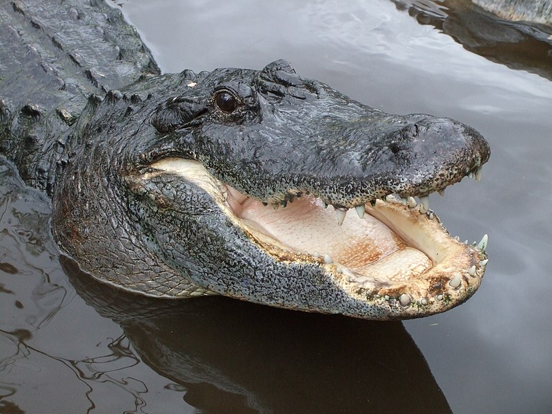
Just at lot of alligator[s] mississippienses…”

*   *   *   *

*   *   *   *

The upper image is courtesy of Sun tanning – Wikipedia, the free encyclopedia.  The caption:  “A woman sun tanning on a Portuguese beach.”  Further references are in the blog-posts cited in the text.  And a BTW: Googling “election from hell 2016” got me some 154,000,000 results.

A funeral and an NTE (Near-Ticket Experience)

Image may contain: night

*   *   *   *

It’s been a while since I’ve posted anything.  In fact it’s been since December 6, when I posted “I dreamed I saw Don Trump last night.”   But I have a good excuse:  I had to go to a funeral.

My aunt died on December 7.  She was a mere 80 years old, and so still fairly young by today’s standards.  (Especially as I myself get closer to that age.)  But she had a host of health problems, and so it wasn’t really surprising to get a text from my sister-in-law on December 3.  It said Joan was in the ICU, “critical but stable.”  But unfortunately she went downhill from there.

So I had to attend “another stinkin’ funeral!”  (As we say in our family, having gone through too many lately.)  I had to work up until 2:00 in the afternoon, last Saturday, the 10th.  Then I headed north, making Gastonia (NC) that night.

The following day I had an NTE.  (Near-Ticket Experience, an allusion to an NDE, as illustrated at right.)

I had crossed the line into Virginia about noon, on I-85, and about 20 minutes later some obnoxious guy in a brand-new BMW passed me.  (The BMW was so new it still had the paper-temporary license tag.)  To make matters worse, he did the old “thread the needle trick,” squeezing between two cars – one was mine – as we rocketed along about 76 mph.

At first I was a bit miffed, but then I figured I’d use him as a “rabbit car.”  A Rabbit Car is the mythical entity by which you can go well over the speed limit but not get caught.  The theory is that the police will stop the rabbit car first.

So, we were both barreling along about 85 mph.  I was slightly behind, and in the right-hand lane.

Right there on I-85 in Virginia the median is full of trees and woods, interspersed with service roads between the north-bound and south-bound sets of lanes.

And in one such service road I saw a police car.

Unfortunately the obnoxious guy in the new BMW saw him first, so he slowed down first.  Which meant that I actually passed him before I could slow down myself.

There were seven or eight cars fairly close behind us, so the trooper had to wait to pull out.  But sure enough, in my rear-view mirror I could see him get out on the road and start to follow us.  Then – quite soon after that – he turned on his “rollers” and sped up.

So I slowed down a whole lot, and also tried getting into the “rocking chair” position, nestled snugly between two other cars, one right in front of me and one right behind.

And for a moment or two I cursed my luck.  I didn’t need either an expensive ticket or an increase in insurance rates.  But fortunately the trooper passed me and commenced to pull over the obnoxious guy in the BMW.  (Who by then was about 10 car lengths ahead of me.)

After my heart-rate and breathing got back to near normal, I figured there was some kind of object lesson there…  I may write more about the funeral later, but speaking of object lessons, I got another one a day or two after I got back.

I made it back home from the funeral on Thursday, the 15th.  I worked all day Friday, and Friday night was busy unpacking and getting stuff sorted out.  Then this happened on Saturday…

I was at K-Mart, buying wrapping paper.  It came out to $4.76, so I handed the sweet young cashier a 5-dollar bill and a penny.  She said, “Sir, it’s four dollars and seventy-six cents.”  And I said, “Yes, it is.”  So she said again, real slow,  “Sir, the price is four dollars and seventy-six cents.” I said, “Yes, and I gave you a five and a penny.”

So once again she repeated – pointing to each individual number on the cash register, one number at a time – “Sir, it’s four dollars and seventy-six cents.”  (As noted, she said it really slow, like she was talking to a moron, or an old geezer.  As in, “OMG, this old guy came in today…”)

Naturally my mind HAD been racing with all kinds of thoughts, off in la-la land, your might say.

Part of it was the hectic travel involved in the funeral I’d just been to, and part of it was the upcoming Christmas season, with all the demands that go along with it.  But this little encounter slowed me down.  (“Grounded me,” you might say.)  

I had been on automatic pilot, but now I had to be “in the moment”

So finally I was able to “become the moment,” and explain.  I said to her, real slow, “If I had given you a five dollar bill, you would have had to hand me six coins back.  Two dimes and four pennies.  But by handing you a 5-dollar bill and a penny, all you have to do is give me ONE coin back, a quarter.”  So she said, “Oh…”

I figure that somewhere in this combination of experience there’s yet another object lesson.

But one thing is, one day her generation is going to be running the country.  Like when we’re in our nursing homes.  I mean, who knows? These young people today might end up electing some doofus who’s totally unqualified and untrained to run the country!

Oh, wait…

Or they might do things like rocket along an interstate highway at 85 miles an hour – or more – two cars at a time, on some delusional “rabbit car” theory.

In the meantime, the encounter with the cashier reminded of the cartoon below.

*   *   *   *

*   *   *   *

The upper image is courtesy of Police Car Lights Flashing …police led light bar …galleryhip.com.

The lower image is courtesy of http://lowres.cartoonstock.com/food-drink-koala-koala_bear.”

“No city for Grouchy Old White People”

Liberty Enlightening the World…”   (Before all the talk about “Building a Stinkin’ Wall!”)

*   *   *   *

No Country for Old Men poster.jpgThe title of this post is a take-off on the film, No Country for Old Men.

(Which was – by far – the worst movie I’ve ever had the displeasure of sitting through.  I waited – in vain and what seemed like hours – for the movie to show some glimpse of redeeming social value.”)

And incidentally, the title of that furshlugginer movie came from the opening line of William Butler Yeats‘ famous poem, “Sailing to Byzantium.”  In turn, one theme of the movie – according to Wikipedia – was that more and more, “things are out of alignment, that balance and harmony are gone from the land and from the people.”

Which certainly could describe the dynamics of today’s political scene.

But – Wikipedia added – the movie is also “a lament for the way the young neglect the wisdom of the past and, presumably, of the old.”  The wisdom of old people that is.

Of course it might help if more of “the old” weren’t so ^%#$ grouchy all the time!

Then too, what passes for wisdom – from way too many people my age – is simply a rehash of the cliche that’s been around for millenia:  That the world is going to hell in a handbasket.

Which is ironic.  That’s because people my age are Baby boomers, and once upon a time we told ourselves we were going to “change the world.”  And yet, here we are – way too many of us – mouthing the same old “negative vibes, man!”

(Which is itself a negative vibe, but that’s a whole ‘nother story.)

But we digress…  My point is this:  “New York City is a refreshing reminder that there’s more to this country than just the right-wing wackos so prevalent back home in ‘The Bubble.’”

That’s what I wrote on my Facebook page on September 22.  That entry also included this:

Ever since last Saturday, September 17, we’ve been taking the Staten Island ferry into and back from Manhattan Island. So that’s eight times – twice a day for four days now – that we’ve seen the Statute of Liberty, off in the distance…  And I don’t remember ONCE seeing a sign that said, “the heck with your tired, your poor,” those “wretched refuse … yearning to breathe free.”  WE’RE GONNA BUILD A FRIKKIN WALL!

Of course much of the time I did feel like I was surrounded by a bunch of “furriners” in the Big Apple.  (Not unlike the Willie-and-Joe cartoon at left.)  And they all seemed to be speaking every language but English.  But that brings up another – ongoing – theme of this blog:  That unless you step out of your comfort zone on a fairly regular basis, the chances are you’ll wind up as just another GROUCHY OLD PERSON!

And who wants to be just another cliché?

And by the way:  That September 22 Facebook post was also when I wrote that my next offering in this “Wasp” blog was going to be titled, “No City for Grumpy Old White People!”  (I changed it to “grouchy,” as more fitting.)

And finally – I noted back on Facebook on September 22 – it had been “a long day, but fun.  And I’ve had my usual one beer at the South Manhattan Terminal,* then another one on the Ferry itself, and I’m now finishing my third of the night, a ‘Corona Extra.’”

The point being that – while it’s healthy to step out of your comfort zone every once in a while – it’s also nice to have a routine to fall back on…

*   *   *   *

Which brings up the fact that we spent a lot of time on the subway, as well as the Ferry.  And traveling on either one can be an especially bad idea during rush hour.  That’s when it seems like everybody in New York City is on the subway (or the Ferry), and in a big rush.

And that’s not to mention being all crowded in – in to the subway especially – and hot, sweaty and disgusting.

But every once in a while you might catch a break and find one of those liminal moments.  For example, what caught my eye in the photo above right – aside from the obvious – was the separate train running parallel to ours, leading to “multiple images.”

I figured there was some kind of symbolic message there.

Then there was the Saturday night – September 17, our first night in the city – when we took a double-decker tour bus.  It was scheduled to head down Sixth Avenue toward downtown Manhattan, then over to Brooklyn.  But the bus was late, and so first one line of passengers and then a second – our line of passengers – had to wait patiently for our bus tour to start.

Sixth Avenue looking north.jpgThen we finally got on the bus, and as we rode down the  toward the  district, we heard a lot of sirens.    Then we passed a street or two that had been blocked off – as seen at left – and all kinds of murmuring crowds.Then we finally got on the bus, and as we rode down the Avenue of the Americas – seen at left – toward the Chelsea district, we heard a whole lot of sirens.  (I mean, even more sirens and louder than usual in the City.)  Then we passed a street or two that had been blocked off – as seen at left – and all kinds of murmuring crowds.

At the time I was texting my on-and-off-again Dulceback home.  I was describing to her our progress through town,  when she texted back, “Explosion reported in New York..  be safe.”  Which made me one of the first on the bus to find out about the story, “New York City explosion rocks Chelsea neighborhood.”

The thing is, when the bombing happened – apparently – we were still back in that long line to get on the tour bus.  And at the time we were kind of disgruntled about the long delay.  But as it turned out, the delay meant that we DIDN’T drive by right as the explosion happened.

From which an object lesson or two might be gleaned…

I’ll continue this travelogue in Part II.  But I’ll close out this Part I with an example of why – it seems to me – the Big Apple is “No city for Grouchy Old White People:”

*   *   *   *

Back home this would come under the heading TMI!

*   *   *   *

I took the photo at the top of the page on our first trip into NYC, via the Staten Island Ferry.  You can tell it’s Saturday (9/17) because of all the pleasure boats clogging the harbor.  For more on the Statue see Statue of Liberty – Wikipedia, the free encyclopedia

Re:  “Change the world.”  The song – written by Graham Nash – was originally titled “Chicago.”  It referred in part to the riots at the 1968 Democratic National Convention in Chicago.  The “chorus contains the lines: ‘We can change the world./ Rearrange the World.’” (See Wikipedia.)  Which begs the question:  “If we were going to ‘change the world,’ what the hell have we been doing all these years?”

The “Willie and Joe” image is courtesy of Willie & Joe: Summary-1 – amyatishkin.  (And of course, Bill Mauldin.)  For a larger image, see Re: “So many dang furriners,” from August 1, 2016.

Re:  The “South Manhattan Terminal.”  As Wikipedia noted, the formal name is “Whitehall:”

The ferry departs Manhattan from the Staten Island Ferry Whitehall Terminal at South Ferry, at the southernmost tip of Manhattan near Battery Park.  On Staten Island, the ferry arrives and departs from the St. George Ferry Terminal on Richmond Terrace, near Richmond County’s Borough Hall and Supreme Court.

Re:  “Liminal moments.”  My first thought was to describe the timing of the subway photo as a “subliminal moment,” but further research led me to Liminality – Wikipedia.  One definition therein described such a moment as a “fluid, malleable situation that enables new institutions and customs to become established.”  Wikipedia added that the term has “passed into popular usage, where it is applied much more broadly, undermining its significance to some extent.”   I would define the term – used here – as when you see a photo worth taking, with lots of hidden meanings…

I took the lower-image photo at the “Staten Island Ferry Whitehall Terminal at South Ferry,” the afternoon of Wednesday, September 21, our last day in the City.  We left earlier than usual, both to avoid the usual rush-hour hubbub, and because the hubbub that day was going to be worse than usual.  See Obama, traffic woes arrive in New York for United Nations General Assembly:

[H]ello actual gridlock.  President Barack Obama left Washington, the city where nobody gets along, and arrived Monday in New York, the city where – for the next two weeks – nobody will be able to get around midtown.  Obama is the headliner at the 68th United Nations General Assembly, an annual gathering that means world-class traffic woes in Manhattan.

“No city for Grouchy Old White People” – Part II

An 1886 view of “Liberty Enlightening the World” – before the talk about building a wall

*   *   *   *

We left Part I with an example of why – it seems – the Big Apple is “No City for Grouchy Old White People.”  But that’s just another way of saying a visit to New York City is a refreshing change of pace.  And a lot of that refreshment comes from seeing the Statue of Liberty. (Every morning and evening for four of five days on a mini-vacation…)

But not everyone agrees that “Liberty Enlightening the World” has a special meaning for real Americans.  For example, one knucklehead wrote, in 2014:

[The inscription on the Statue of Liberty] is just a poem.  It’s not one of our founding documents, nor is it a law, nor is it anything more than what it is:  a poem.  A nice poem, with stirring, emotion-driven rhetoric, yes, but a poem nonetheless.

See Words on Statue of Liberty merely a poem – azcentral.com.  But that – it seems to me – is like saying the Bible is “just a nice set of old-time stories.”

Be that as it may, that just a poem guy was responding to a suggestion that “Congress read the inscription on the base of the Statue of Liberty in order to make a more informed decision regarding immigration.”  (Which sounded like a pretty good idea to me.)

And by the way, about 75% of the Old Testament is also “just a bunch of poems.*”

Which brings up the fact that way too many people interpret both the Bible and the Constitution in the same narrow-minded way.

“Strictly,” narrowly and fundamentally.  It also seems they’re usually the ones who already have it made – and are deathly afraid other people might take what they have.  (Like the “just a poem” guy.  But see my response to that narrow approach – On “originalism” – in a companion blog.) 

But we digress!

We were discussing the “mere poem” inscribed on the Statue of Liberty.  (The statue I passed by “eight times – twice a day for four days now,” on my recent visit.)  It spoke of a “mighty woman with a torch,” whose name is “Mother of Exiles.”  (Get that?  Mother of Exiles.)   The poet then told the “ancient lands” to keep “your storied pomp!”  Then came the famous words:

“Give me your tired, your poor, Your huddled masses yearning to breathe free,
The wretched refuse of your teeming shore.  Send these, the homeless, tempest-tost to me,
I lift my lamp beside the golden door!”*

Which seems to speak volumes about the American Dream.  The Wikipedia article on that “national ethos of the United States” featured a picture of the Statue of Liberty, with these words:  “For many immigrants, the Statue of Liberty was their first view of the United States, signifying new opportunities in life.  The statue is an iconic symbol of the American Dream.”

And that – I assume – includes the inscription written on the Statue of Liberty.

 that's all i have to say about that - that's all i have to say about that Forrest GumpFinally – on this topic – It also seems to me that the “just a poem” guy probably bears a passing resemblance to the man shown at the bottom of the page.  (At least metaphorically…)

So now, like Mr. Gump, “That’s all i have to say about that.”

*   *   *   *

Meaning I’m done with the soapbox part of this post.

Turning to the true travelogue part:

Five of our six various group-members met up on Friday afternoon and evening, September 16, at the home base near the north end of Staten Island.  (From which we were to commute by ferry to Manhattan, and which itself was home to a number of strange-speaking “furriners…”)

At its fullest, the ever-shifting “Gang of Six” consisted of the brother and the nephew with whom I recently hiked the Chilkoot &^%$# Trail!  Along with my sister-in-law and her daughter – my niece – and her relatively-new beau.  (Of over a year now, and he arrived late Saturday night.)

On Saturday morning, September 17, the five of us took our first ride on the Staten Island Ferry, and visited the One World Trade Center.  In the evening we all – still just five of us – took an tour by double-decker bus, of lower Manhattan and Brooklyn.  (Punctuated by the bomb going off in the Chelsea district shortly before we passed by, as noted in Part i.)  But other than that the tour was nice. At the end of this long day, I got three “Stellas” at the Whitehall (Manhattan) Terminal.  One for me, one for my brother and one for my nephew.  (We had beer in the car near the Staten Island terminal, but that would have taken a while to chill.  Which is why I got another beer on the ferry ride back to Staten Island.  $6.00, cash only.)  We got home about 12:39, much past my bedtime.

On Sunday, September 18 we got up late, and we elder-folk  finally met “the beau.”  (Who had arrived late the night before.)  After that we mostly relaxed and stayed on Staten Island.  I did some laundry.  The six of us took a walk on the Franklin D. Roosevelt Boardwalk and Beach.

On Monday, September 19, a new set of five took the ferry to Manhattan.  (After my nephew headed back to classes at Penn State.)  We visited the Museum of Natural History – uptown – after a long, crowded ride on the subway.  And the line to get in – shown at right – was also very long and very crowded.

That night we had dinner at the Hard Rock Cafe New York (Theater District), after which we wandered around Times Square awhile.

Somehow we lucked into some $30 tickets to see “The Fantasticks” at the Jerry Orbach Theater, at 210 West 50th Street.  (“The show’s original off-Broadway production ran a total of 42 years and 17,162 performances, making it the world’s longest-running musical.”)  

Which made for another late night trip on the ferry.  (Fortified by one beer from the Whitehall Terminal, one beer on the ferry itself – I remembered to bring cash – and one back home.)

Tuesday we five headed over to the City on the noon ferry.  While we were waiting in the terminal, there was an old guy wandering around talking to himself, saying something about wanting to get married.  It looked like he was wearing something like adult diapers…

Pedestrians admiring plants along a walkway, which is surrounded by several low-rise buildingsOnce we got over to the city, we took another subway ride up to the start of the “High Line.”  That’s the mile-and-a-half “New York City linear park built in Manhattan on an elevated section of a disused New York Central Railroad spur.”  Then we had lunch at the Artichoke Basille’s Pizza, in Chelsea.  (The same neighborhood where the bomb(s) went off Saturday night.)

Then my niece and her beau left to head back to home-and-work places in the Washington D.C. area.  That left three of us – the three “elders,” two of whom are retired – to head uptown.  We headed uptown – by another crowded subway – to a museum I had chosen, the Frick Collection (and/or Museum).  (“I picked the Frick!”)  

And through the magic of internet, you may see the galleries “through our Virtual Tour.”

We had a light supper at some swanky place uptown.  (I had a brioche au fromage sandwich – with tomato – and we sat outside and watched rushing New Yorkers passing by.)  Then we took a walk along the Hudson river-front, and still got home fairly early.  I bought a draft Bud Light at the terminal – again – and a Corona for my brother.  (He has expensive tastes in beer, at least outside Utah. Where he lives they can only buy 3.2 beer.)  

Wednesday, September 21, was pretty much an “anti-climax day.” We visited the South Street Seaport Museum | Where New York Begins.  But then we ended up taking the 3:30 afternoon ferry back home.  That’s because we found out – after the museum visit and lunch – that Ellis and Liberty islands were at least partially closed, because of a visit by “the Prez.”  But back on Staten Island my brother and I visited the National Lighthouse Museum.

Then we started packing, to head back home the next day.

On Thursday, September 22, I kayaked across the Verrazano Narrows.  (Mostly following the Bridge of the same name.)  

Here’s a photo from about half-way back to Staten Island.  You may notice that the waters are fairly choppy.  And I can tell you that those waters got WAY choppier than when I started.  In other words, I seem to have started out – that fine Thursday morning – on pretty much of a neap tide.  It only took me 20 minutes to get from Staten Island to Brooklyn, and I like to do a full two hours of kayaking a week.  So on the way over I toyed with the idea of cruising along the Atlantic side of Brooklyn for awhile.

But I decided not to, mostly because I figured it would be better to get back on the put-in side while I was still fresh.  And it’s a good thing I did.  As I was paddling back the tide started coming in.  Which wasn’t so bad, since at worst it would have swept me in toward Hoboken.

I ended up having 13 minutes left of my two-hours-of-kayaking-a-week quota, when I finally got back to where I put in, at Roosevelt Beach.  (And got dunked “coming in for a landing.”)  But it could have been worse. The tide could have been going out.  (As in, “out to sea…”)

And that was pretty much it for my visit to New York City.  I drove home via the Cape May Ferry and the Chesapeake Bay Bridge–Tunnel, and got home Saturday, September 24.

Except to note that the visit sounds a lot shorter than it was in real-time.  That’s because in real time we did a lot of walking, through the streets of Manhattan.  And we did a lot of people-watching, of the “passing panoply.”  And we spent a lot of time on crowded subways, listening to all kinds of languages spoken by all kinds of different people.

But that’s what made the visit so refreshing…

And except to note one more thing.  The photo below is one I took at the Museum of Natural History, on September 19.  With all the talk of politics lately, I figured this would be a good one size fits all insult, for whatever political opponent you may have in mind.

So here’s my gift to you, a souvenir from my recent visit to New York City:

Here’s a typical [- fill in the blank – ] voter!”

*   *   *   *

The upper image is courtesy of Statue of Liberty – Wikipedia.  The caption:  “‘Unveiling of the Statue of Liberty Enlightening the World’ (1886) by Edward Moran. Oil on canvas. The J. Clarence Davies Collection, Museum of the City of New York.”

Re:  Much of the Old Testament as “a bunch of poems:”  See Poetry in the Hebrew Bible:

Approximately 75% of the Hebrew Bible is poetry.  All of Psalms and Proverbs are Hebrew poetry and many other books, such as the book of Genesis, are filled with poetry.  The reason much of the Bible was written in poetry is that it was originally sung and stories that are sung are much easier to memorize that when simply spoken.  There is much more poetry in the Bible than most realize because most people do not understand it.*

See also Biblical poetry – Wikipedia. Which brings up the fact that the just a poem statement also implies that liberty is a finite commodity; that there’s only so much to go around.    

Meaning in turn that – to way too many people these days – “liberty” must be preserved for only those who “already have it.” (See Nativism – Wikipedia.) But apparently the swarms of “furriners” – surrounding me in NYC – hadn’t seen the poster at right, from Colorado… Which may be another way of saying that liberty is only a finite commodity to those who are afraid to share it.

On a related note, of the United States Constitution as “the nation’s scripture:”

During the Constitution’s 150th anniversary in 1937, President Franklin Roosevelt likened [the Constitution] to the Bible, saying it should be read over and over again.  It was an apt simile. The Constitution had always served as the nation’s scripture…*

Battle for Justice: How the Bork Nomination Shook America, by Ethan Bronner. (Anchor Books, published by Doubleday, at page 21.) On that note, scripture is alternately defined as “anything written” – from the “Classical Latin scriptura, a writing” – or any statement “regarded as authoritative.”  (In addition to the usual definition: “the sacred writings of the Jews, identical with the Old Testament of the Christians,” and/or “Christian Bible; Old and New Testaments.”)  See Scripture – definition of scripture by The Free Dictionary, and Scripture dictionary definition

Re:  Words on the Statue of Liberty. See The New Colossus- Wikipedia. Here are all the words:

Not like the brazen giant of Greek fame,
With conquering limbs astride from land to land;
Here at our sea-washed, sunset gates shall stand
A mighty woman with a torch, whose flame
Is the imprisoned lightning, and her name
Mother of Exiles. From her beacon-hand
Glows world-wide welcome; her mild eyes command
The air-bridged harbor that twin cities frame.

“Keep, ancient lands, your storied pomp!” cries she
With silent lips. “Give me your tired, your poor,
Your huddled masses yearning to breathe free,
The wretched refuse of your teeming shore.
Send these, the homeless, tempest-tost to me,
I lift my lamp beside the golden door!”

On the Chilkoot &^%$# Trail! – Part 1


As noted in my last post, I just got back – last August 29 – from a trip that began on July 26.

That’s when my brother and I started the drive from Utah to Whitehorse, Yukon Territory.  Four days later – on Friday, July 29 – we met up with my nephew, fresh out of the Army.

In due course, my brother and I – alone and aged 70 and just-turned-65 – paddled our canoes “‘up’ the Yukon River.”  (440 miles in 12 days.)

But first, we two brothers – joined by our nephew-son – hiked the Chilkoot Trail (See Naked lady on the Yukon.)  And to hike the Trail you have to start in Skagway, Alaska.  (Above left, the day we arrived.)  I also noted that people call the Chilkoot Trail the “meanest 33 miles in history.”

http://www.dralionkennels.com/images/newsflash.jpgAlso in Naked lady on the Yukon, I posted this news flash:*

There’s a reason [why] they call it the “meanest 33 miles in history.”  I’ll be detailing that little jaunt in a later post.  (To be titled, “On the Chilkoot &$%# Trail!”)  

And so, here it is – drum roll please – my blog-post on the Chilkoot &$%# Trail!

First of all, note the picture at the top of the page.  It includes an easy-to-miss orange pole.  (You see them marking the “trail.”  The one in the photo above is to the hiker’s right – the viewer’s left – and “up the trail” a bit.)  Note also:  There doesn’t seem to be a “trail” anywhere around, either in the top photo or the ones below.  Just one big pile of &$%# rocks after another.

So now you’re getting a feel for “hiking the Chilkoot.”

More background:  Before doing the hike I learned that the trail actually started in Dyea, Alaska. (It ends in Bennett, British Columbia.)  I also learned that Dyea is actually pronounced “DIe-eeee,” perhaps prophetically.  (As in, “that’s what you feel like doing once you get on the &$%# Trail!”)

Further, the Chilkoot was a major access route – from “DIe-eeee” to the Yukon goldfields – in the Klondike Gold Rush of 1896–99.  That gold rush “transformed the Chilkoot Trail into a mainstream transportation route to Canada’s interior.”

And I learned that the only other route to the gold fields was through White Pass.  (Up to 1899, when a railroad was built from Skagway to the Yukon.)   As to which route was better, a pioneer – Mont Hawthorne – said there really was no choice:  “One’s hell.  The other’s damnation.”

13 Dead Horse GulchA side note:  White Pass was also called “Dead Horse Trail,” apparently renamed by Jack London:  “Nearly 3,000 pack animals died.  Drivers rushing over the pass had little concern for beasts.  Exhausted horses starved, were hurt on rough ground, became mired in mud and fell over cliffs.”

Which also gives you a feel for “hiking the Chilkoot.”

And finally – after the fact and back at the Westmark Hotel, Whitehorse – I saw a plaque about the Trail.  It noted that every Klondike “stampeder” had to haul a year’s supply of food – 2,000 pounds – up and over the Chilkoot Pass.  “This often took 35 to 40 trips up and back down.” Further, the last 1,000 feet of the climb “took an average of 6 hours with a loaded pack.”

Which made me feel better about my performance – detailed below – but only after the fact. (On Tuesday – August 2, the day we climbed over the pass itself – we averaged a little over half a mile an hour.  Which turned out to be not too bad, historically speaking.)

By then I’d already developed a host of blisters, one of which – a blister-on-a-blister on my right heel – got infected.  It was still throbbing – from time to time – and didn’t fully heal until well after two weeks of canoeing and then six days driving back home from Dawson City.  (I’m sure the 12 days of feet being wet and cold 11 or 12 hours a day canoeing on the Yukon didn’t help.)

But we digress… 

I packed a notebook for the hike – which lasted four days – and duly made an entry at 8:32 p.m., August 1.  (Day 1 of the hike.)  But then I didn’t make any more entries until August 4, when we finally got to the railroad station at Bennett.  There I noted:  “I wrote no more until we reached Bennett, on the 4th day. Too [&$%#] tired and late arriving on the 2d day.  And the 3d.”

There’s more on those second and third days below.

But on the first day we made Sheep Camp: “13 miles or so – nobody seems sure of the miles – by 7:30 p.m.”  That included crossing the swaying footbridge, à la Indiana Jones and the Temple of Doom.  (There’s a picture from the movie in the notes below.)  There’s more on that in Part 2, but unfortunately, I’m now approaching the limit of the ideal length for a blog-post.  (No more than 1,200 words.*)  So, I’ll wrap up “Part 1” with a story relating to the photo below.

I took the photo on Day 4, when we finally reached the railroad station at Bennett.  But it relates back to an incident that occurred on the second – the worst – day of the “Trail.”

We were approaching the summit of the Chilkoot Pass.  (Slowly in general and especially slowly for me.)  What with my lack of depth perception, going over “one big pile of *&$% rocks after another” was like negotiating a minefield.  I wore heavy hiking boots, but they felt like ballet slippers.  Every step was sheer torture, and brought new pain to each aching foot.

I had just taken one of many missteps – especially bad that day – and let loose a string of pungent epithets. Then I looked behind me and there – climbing “personfully” behind me – was this sweet young thing.  Sheepishly I apologized, noting that I had “no depth perception.”

She went ahead and passed me.  (And probably rolled her eyes in the process…)

A short while later I had another misstep – again, the “Trail” is sheer torture for someone with only one good eye – and let loose another string of pungent epithets.  I looked behind me again, and there was a young couple, including another “sweet, innocent young thing.”

So I said to myself, “Hey, I may be on to something here!”

Unfortunately I tried it a few times later on the trail, but my magic formula didn’t work.  (On the other hand there I did see that “Naked lady on the Yukon,” 10 days later, on August 12…) 

The point being that on the forth day of the ordeal, most of the people who’d been hiking the Trail met up on again at the railroad station in Bennett.  There was only one train, at 3:15, so all us hikers had a chance to sit on something besides rocks, and pitch our tents to dry out.  (It had rained the night before.)  Including the young lady I’d insulted on Day 2…

But before we got to the end of the trail, I had to experience the phantom pack phenomenon – weaving and rolling like a drunken sailor – and slip and slide down a glacier or two.  Then I got to the point where “if I could have cried I would.”  (Hey, I’m secure in my masculinity.)  

And finally, we got to take part in a little parade.  (See On the Chilkoot &^%$# Trail! – Part 2.)

*   *   *   *

One of many happy hikers who finished the Chilkoot Trail at Bennett, B.C.

*   *   *   *

Unless otherwise noted, the images in this post – including the photos at the bottom and top of the page – are ones I took during the aforementioned “hike.”  (More like sheer torture…)  Also, an asterisk (“*”) in the main text indicates that a word or two of explanation will be made in these notes.

For example, the “news flash” image is courtesy of www.dralionkennels.com/newsflash.

Re:  “One’s hell.  The other’s damnation.”  The quote is from The horror of the White Pass Trail | Yukon News.  Also, “Dead Horse Trail” was also known as Dead Horse Gulch.  The photo accompanying the paragraph is courtesy of the Yukon News.

Re:  Indiana Jones and the Temple of Doom.  See also happyotter666.blogspot.com, which included the image at left, of a bridge like the one we crossed on the Chilkoot’s second day of hiking.

Re:  Ideal length of a blog-post.  See How Long Should My Blog Posts Be?  (Suggested length, 800-1,200 words.)  But see also The Ideal Length for All Online Content – Buffer Blog, indicating a preferred post-length of 1,600 words.

Re:  “The end of the trail.”  The link-quotation notes that the “trail is the thing, not the end of the trail. Travel too fast and you miss all you are traveling for.”  I could have used that quote both on the Chilkoot Trail and again on the Yukon River, when I was always “slow ship in the convoy.”  See e.g. The Pacific War Online Encyclopedia: Convoys:  “The convoy can only advance at the speed of the slowest merchant ship in the convoy, which negates the speed advantage of the faster ships.”

I could have used that little quote too, if only to ease my own own mind…

On the Chilkoot &^%$# Trail! – Part 2

*   *   *   *

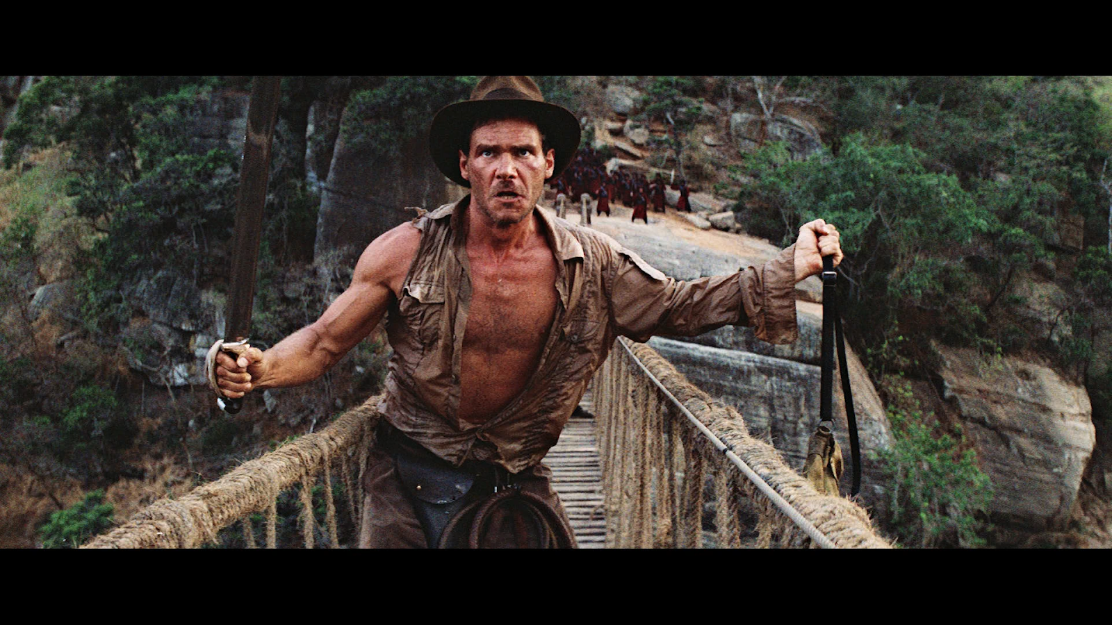
Okay, it wasn’t quite as bad – crossing that “swinging bridge” the first day on the Chilkoot Trail – as it was for Indiana Jones in the photo above.  (For example, we hadn’t been “cornered by Mola Ram and his henchmen on a rope bridge high above a crocodile-infested river.”)

But that second day on the Trail was pretty &^%$ bad…  In case you hadn’t noticed, this continues Part 1 of “On the Chilkoot &^%$# Trail!”  We left Part 1 with we three – brother, nephew and I – all having made Sheep Camp by 7:30 p.m. on the first day of the hike.

13 miles or so – nobody seems sure how many – by 7:30 p.m…  That included crossing the swaying footbridge … à la Indiana Jones and the Temple of Doom.

(Reprised in the photo above right.)  Part 1 also included the tale of a “young thing” I managed to insult on the second day of the hike – approaching the summit of Chilkoot Pass – and how most or all us hikers met up again – on the fourth day – waiting for the 3:15 train back to Skagway.

But I had to cut it short – and make this a two-parter – because I was “approaching the limit of the ideal length for a blog-post.”  (About 1,200 words.)  So now, back to Day 1 of the hike.

On Monday August 1, we left the trailhead – near “Die-eee” – at 9:00 a.m.  We made Sheep Camp by 7:30 that night, and after getting situated I managed to write a little something in the notebook I’d packed.  I wrote:  “I’m shivering as I’m writing.  I’ve been sweating all day despite the cool 68-degree temps.  And now it’s turning cool, so I’m shivering.”  I then added:

There were many times – many times – today when I wondered what the hell I was doing here.  And that this was just too far to go in one day.  And I like hiking at my own pace.  Rather than always bringing up the rear…  So today was the tough one, as far as miles traveled.  “Only” eight miles, but we’ll be climbing the Pass [tomorrow].  BTW:  I just had my fifth swallow of “O be joyful.”

So here’s another side note:  “O Be Joyful” was our code-word for ardent spirits.  We started packing them – in past canoe trips, like down the Missouri River from Fort Benton, MT – as a way of following in the footsteps of Lewis and Clark, and other American pioneers.

You see, back in the old days of our country, whiskey – for example – was used instead of hard currency:

One of the first media of exchange in the United States was classic whiskey.  For men and women of the day, the alcohol did more than put “song in their hearts and laughter on their lips.”  Whiskey was currency.  Most forms of money were extremely scarce in our country after the Revolutionary War, making monetary innovation the key to success.

See Why Whiskey Was Money, and Bitcoins Might Be.  So it was in that spirit – primarily – that I took a flask of “O be joyful” along on the Chilkoot.  Be that as it may, after I wrote, “I just had my fifth swallow of ‘Oh be joyful,’” I then added, “Which helps a lot.”

(I wasn’t so sure about the “song in my heart and laughter on my lips…”)

Also on the evening of August 1st, I wrote that the campground was more crowded than I expected.  And that in the audience – listening to a lecture by a ranger when we arrived – there were some cute women, but “romance is the last thing on my mind tonight.”

(Which itself was telling…)  I concluded,Altogether a good day.  I had my doubts, which were justified in a way, but ‘we’ came through.  Albeit with me bringing up the rear the whole day.”

On that note, I “brought up the rear” the next day as well, and for pretty much the rest of the hike.

Which brings up the fact that hiking the Chilkoot Trail is sheer torture for someone – like me – with only one good eye and and thus no depth perception.*  And that applied even on the relatively smooth parts of the trail, like the section shown at right.

Also – as mentioned in the notes – anyone hiking the trail is advised that if they have to get airlifted out, the cost will be a cool $28,000.00.  Which brings up another point rangers make in the process of getting your permit to hike the trail:  Watch out for the bears!

For one thing, the general rule is “no chow in your tent.”  Each camp has a tented-in dining facility,* and there – and only there – are you supposed to eat.  Eating on the trail can be messy, and the usual solution for crumbs or spills is to wipe the stuff off on your pants.  But bears have an extremely keen sense of smell, and so some crumbs in your pocket or syrup from a snack-cup on your pants could lead to an extremely unpleasant midnight visit.

But for me the message distilled down to this:  You don’t have to be faster than the bear.  You only have to be faster than the others in your party.  (Which of course spelled trouble for me…) 

But once again we digress…  The point is that eventually – in our case, the second day – we got  past the smooth parts of the trail and began approaching the summit.  It got so bad for me – after we got up and over the summit – that first my brother and then my nephew left their packs ahead and came back and carried my pack for a while.  Which led to its own problems.  Much like the phantom limb phenomenon, the “phantom pack” syndrome leaves you disoriented.  Especially when negotiating “one big pile of *&^% rocks after another,” you end up walking like the proverbial drunken sailor, weaving to and fro.

Finally – after much anguish – you get to and over the summit.  But as noted, things don’t get any easier.  There – on the other side of the summit of Chilkoot Pass – were at least three “glaciers,” or ice-fields.  (Like the one at right.)  My first reaction was:  “Great!  Nice smooth snow to walk on!”

But these glacier-slash-ice-fields were just as treacherous, though in a different way.  My fellow hikers hadn’t relieved me of my pack yet, so walking on the slippery snow led to several falls.

It got so bad that finally I stayed down – on the snow-slash-glacier – and slip-slid to the end.  That got my pants and boots thoroughly wet in the process, but at least – for a moment or two – I wasn’t struggling over “one big pile of &^%$ rocks after another.”

Somewhere in there I slipped and fell on some rocks, banging my right knee enough that by Thursday, at Bennett, that area of my jeans was covered with crusted blood.

Which leads to my confession – I “do not deny, but confess” – that there were times on the Trail when if I could have cried I would.  (But that wouldn’t have helped the pain in my feet, or made the journey any shorter.)  Which brings us to the late afternoon and evening of the second day.

Along with the usual “one big pile of &^%$ rocks after another” – and the three “glaciers” noted above – the other side of the pass featured a seemingly-endless series of streams and/or rivulets like the one at left.  They too were beautiful, but treacherous.  (I was going to say “like some women I know,” but decided against that.)

I know my brother took a spill or two – and got an infected elbow as a result – but mostly because he told me so later.

And as far as I know my nephew did okay crossing the many “beautiful but treacherous” streams, but not from any personal observation.  He – and my brother as well – were usually so far out in front of me that I often lost sight of them.

Then it started getting dark.

Back at the hotel in Skagway – before we left – it was still light as late as 10:00 p.m.  Therefore – I deduced – we should have plenty of hours to hike on the Trail.  But for some reason it got darker earlier on the Trail, which meant that by 7:00 p.m. or so my brother started getting worried.  The result was that in the fullness of time – just in time – we had a little parade.

To make a long story short, my brother went ahead the couple of miles to Happy Camp, dropped his pack and hiked back to where I was.  He carried my pack for a bit, then some strapping  young lad showed up.  He – the strapping young lad – had heard someone at Happy Camp talk about my struggles, and decided to come back and help.  (Apparently we – or at least I – became quite a conversation piece around Happy Camp that night…)

So the strapping young lad carried my pack a while – “jabbering all the way,” my brother said – and finally my nephew came back.  He had also dropped his pack at Happy Camp and then he carried my pack the final mile and a half.  That was my brother’s recollection.
David Allan Coe.jpgAll I remember is that along about 7:30, I could see some people on the Trail ahead of me.  Eventually I limped up to where my brother and nephew were.  Also there were the aforementioned “strapping young lad,” along with a nice white-haired Canadian ranger lady who called me by my name.  (They keep tabs on all hikers on the Trail.)

From that point, we all set off toward Happy Camp.  The nice ranger-lady followed behind me, engaging me in conversation.  (Probably trying to keep my mind off my aching feet.)  So, eventually we all made it to Happy Camp, and that’s how we “had a little parade.”  But this time I wasn’t bringing up the rear.  (For once.)

On that note – and as described in Campgrounds of the Chilkoot Trail:

Happy Camp is the only campground on the Chilkoot Trail in the alpine…  Happy Camp owes its name to the relief prospectors (and hikers) experienced from arriving at the first outpost after the pass. The camp is situated in a true alpine ecosystem and receives heavy use because of its location.

Personally, I can vouch for the “relief” part.  And it got better.  (At least for that night.)  
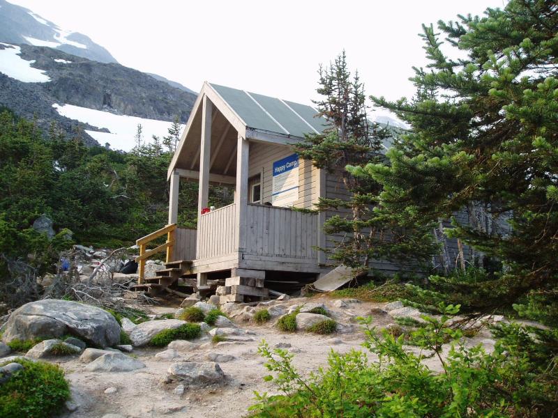
Happy Camp shelterApparently the nice white-haired Canadian ranger lady felt sorry for us.  (Or at least for me.)  So she let the three of us use her personal shelter tent.  That is, she said she had to get up early the next morning for some meeting elsewhere on the Trail, so she’d stay in main – wooden – shelter at Happy Camp, shown at left.

That meant the three of us didn’t have to set up our tents in the waning light of that second day on the Trail.

It also meant that two of us got to sleep on cots.  (My nephew slept on his air mattress on the floor, despite my saying I’d sleep on the floor.  But I made it up to him – for carrying my pack – by splitting two six-packs of beer once we got back to Skagway, as described elsewhere.)   And finally, the nice white-haired Canadian ranger lady brought us each a juice-box.

And a sweeter nectar I’ve never tasted.  
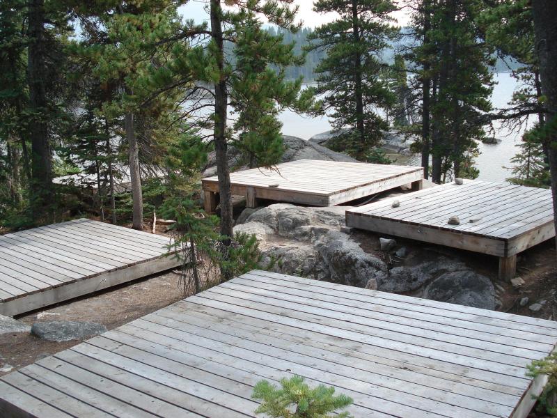
Wooden tent platforms among trees in front of a lakeFrom that point the rest of the hike is a blur.  I know we made it next day to the campground at Bare Loon Lake. (Which included numerous tent platforms like the ones at right.)  

And I know that that left only four miles to do the next day, Thursday, to get to the railroad station at Bennett.  And that rangers and other hikers kept saying the Trail would get easier and smoother “a mile or so further along.”

But it never happened.  At least not until a mile or so from the station, when the Trail got wide and sandy.  In fact the Trail at that point was pretty much like walking on the beach.  Which of course presented its own different challenges, but at that point I wasn’t complaining.  (Much.) 

Thursday, August 4, 1:20 Alaska Time.  We’re at the Bennett railroad station.  Got here at 12:05 AT.  I’ve set up my tent to dry it off – it rained last night – and heated up some water…   Spilled some walking back across the tracks.  (“No open fires.”)  But there was enough left over to make hot coffee.  For the first time since Monday morning.  The right knee of my jeans is covered with blood.  The ankle areas are dried mud.  I have two or three large blisters, one each inner heel, that have already popped.  And one large blister on the right big toe that looks about to pop.  Huge!  But right now the world looks great!

That’s what I wrote in the notebook I’d packed, writing in it for the first time since Monday.  So there – at the railroad station that would remain unmanned until the 3:15 arrived – the right knee of my jeans was crusted with dry blood.  And my feet were blistered and beyond sore.

Which is another way of saying they don’t call the Chilkoot Trail “the meanest 33 miles in history” for nothing.  Meanwhile, I had one final point to be made.  I made it via email – to the folks back home – once the three of us got back to Skagway:  “I used up my quota of expletives for the next couple of years, so any prayers in my direction would help immensely.”

So now, to paraphrase that great philosopher, Forrest Gump:

“That’s all I have to say about the Chilkoot &$%# Trail!”

 that's all i have to say about that - that's all i have to say about that Forrest Gump

*   *   *   *

Unless otherwise noted, the images in this post – including the photos at the bottom and top of the page – are ones I took during the aforementioned “hike.”  (More like sheer torture…)

For example, the image at the top of the page is courtesy of happyotter666.blogspot.com.  See also Indiana Jones and the Temple of Doom – Wikipedia, which provided the “cornered” quote.

Re:  “O be joyful.”  See also Definition of oh be joyful – Online Slang Dictionary, and/or O-be-joyful – 17 of the Finest Words for Drinking.

Re:  Whiskey and other “ardent spirits” used as currency.  See also TTB.gov Alexander Hamilton And The Whiskey Tax:  “small farmers on the young Nation’s western frontier in the Appalachian Mountains, often distilled whisky from their surplus corn crop.  This whisky was then often used as a form of currency on the cash-strapped frontier.”

Re:  “No depth perception.”  As illustrated by the image at right – courtesy of lookfordiagnosis.com – imagine trying to negotiate “one big pile of &^%$ rocks after another,” with no depth perception.  And while trying maintain enough speed to keep up with your brother and nephew, while seeing the “piles of &^%$ rocks” as a blur.  (As in the background at right.)  And with the full knowledge that one bad move – one twisted knee or ankle – will cost you a cool $28,000 to get airlifted out.  (That’s what they told us in Skagway when we got our permits.  Meaning it’s happened often enough that they have the figures down pat.)    

Re: “No chow in your tent.”  The photo at left – courtesy of Campgrounds of the Chilkoot Trail – Wikipedia – shows both a “dining shelter” in the background, and in the foreground a ranger at Sheep Camp giving a lecture like the one in the main text.  Also, “Rangers recommend 7.5 to 10 hours for a group to travel from Sheep Camp to Happy Camp.”  We took longer than that… 

Re:  “Called Me by My Name.”  The allusion is to a song by David Allan Coe.  (Which – incidentally – is one of my signature karaoke songs.)  The photo shows Coe on stage in 2009.  It is not intended to refer in any way to the “nice white-haired Canadian ranger lady.”  That nice white-haired Canadian ranger lady should – in my estimation – be elevated to sainthood, along with Mother Teresa.

Re:  The juice boxes and “sweeter nectar.”  My brother said his was grape juice, but I could have sworn that mine was “raisin.”  I remember thinking that it was such an odd flavor for a juice box, but I couldn’t find any such flavor on the internet.  (Or maybe I was in a state of delirium.)  One thing I do know:  No matter what the flavor, that juice box – at that point in time – was delicious!

The lower image is courtesy of that’s all i have to say about that – Forrest Gump – quickmeme.